Directions to Pergotec (Ocoyucan) with public transportation
The following transit lines have routes that pass near Pergotec
How to get to Pergotec by bus?
Click on the bus route to see step by step directions with maps, line arrival times and updated time schedules.
From San Antonio Abad, Puebla
53 minFrom Villa Ávila Camacho o La Ceiba, Ocoyucan
35 minFrom La Guadalupana, Puebla
41 minFrom Plaza Solé Zavaleta, San Gregorio Atzompa
34 minFrom Colonia Flor del Bosque, Puebla
63 minFrom Telmex, Puebla
38 minFrom Oficinas Administrativas Pemex Logistica, Puebla
64 minFrom La Carcaña, San Pedro Cholula
43 minFrom Altar Niño Doctor, Puebla
56 minFrom Auditorio Gnp, Puebla
51 min
Bus stops near Pergotec in Ocoyucan
Bus lines to Pergotec in Ocoyucan
- RUTA SANTA LUCÍA, Ramal 1, Santa Lucía - Las Cuartillas,VIEW
- RUTA VILLA FRONTERA, Ramal 1, Jorge Murad - San José Xilotzingo (Ida),VIEW
- RUTA 8, Ramal 2, San José Chapulco - Barrio De Santiago,VIEW
- RUTA 4, Ramal 2, Infonavit Agua Santa - Centro,VIEW
- CORREDOR 16 DE SEPTIEMBRE, Balcones del sur - Retornando por la 23 Poniente (Circular),VIEW
- RUTA 63, Ramal 1, Inf. Amalucan - Guadalupe Hidalgo (Regreso),VIEW
- RUTA NGA, Ramal 3, Santa Clara - Santa María,VIEW
- TRANSPORTE NOCTURNO, Paseo Bravo - Hospital General (Circular),VIEW
- RUTA 54A, Ramal 2, 3 Cerritos - Universidad Politécnica Metropolitana De Puebla,VIEW
- RUTA 45, Ramal 1, Bugambilias - Azcárate,VIEW
What are the closest stations to Pergotec?
The closest stations to Pergotec are:
- Cedros, 104 is 51 meters away, 1 min walk.
- Acacias, 6 is 60 meters away, 2 min walk.
- 16 De Septiembre, 1 is 63 meters away, 2 min walk.
- Acacias is 155 meters away, 3 min walk.
Which bus lines stop near Pergotec?
These bus lines stop near Pergotec: CORREDOR 16 DE SEPTIEMBRE, RUTA 54A, RUTA 8, RUTA NGA, RUTA VILLA FRONTERA.
What’s the nearest bus station to Pergotec in Ocoyucan?
The nearest bus station to Pergotec in Ocoyucan is Cedros, 104. It’s a 1 min walk away.
What time is the first bus to Pergotec in Ocoyucan?
The TRANSPORTE NOCTURNO is the first bus that goes to Pergotec in Ocoyucan. It stops nearby at 3:35 AM.
What time is the last bus to Pergotec in Ocoyucan?
The TRANSPORTE NOCTURNO is the last bus that goes to Pergotec in Ocoyucan. It stops nearby at 2:35 AM.
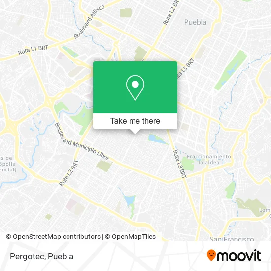
See Pergotec, Ocoyucan, on the map
Public Transit to Pergotec in Ocoyucan
Wondering how to get to Pergotec in Ocoyucan? Moovit helps you find the best way to get to Pergotec with step-by-step directions from the nearest public transit station.
Moovit provides free maps and live directions to help you navigate through your city. View schedules, routes, timetables, and find out how long does it take to get to Pergotec in real time.
Looking for the nearest stop or station to Pergotec? Check out this list of stops closest to your destination: Cedros; Acacias; 16 De Septiembre; Acacias.
Bus: CORREDOR 16 DE SEPTIEMBRE, RUTA 54A, RUTA 8, RUTA NGA, RUTA VILLA FRONTERA, RUTA SANTA LUCÍA, RUTA 4, RUTA 63, TRANSPORTE NOCTURNO, RUTA 45.
Want to see if there’s another route that gets you there at an earlier time? Moovit helps you find alternative routes or times. Get directions from and directions to Pergotec easily from the Moovit App or Website.
We make riding to Pergotec easy, which is why over 1.5 million users, including users in Ocoyucan, trust Moovit as the best app for public transit. You don’t need to download an individual bus app or train app, Moovit is your all-in-one transit app that helps you find the best bus time or train time available.
For information on prices of bus, costs and ride fares to Pergotec, please check the Moovit app.
Use the app to navigate to popular places including to the airport, hospital, stadium, grocery store, mall, coffee shop, school, college, and university.
Pergotec Address: Avenida 16 de Septiembre 6308, Bugambilias, 72100 Puebla, Puebla street in Ocoyucan
- Tociburguer,
- Panaderia La Artesa,
- Fábrica del Disfraz,
- WESTERN UNION,
- YOGA MUSICA,
- Clases de Vallet,
- Eva Control de Peso,
- Banorte,
- Telemerketin,
- Grupo Akron de Alcohólicos Anónimos, área Puebla Uno,
- Central Mexicana de Alcolicos Anonimos,
- Invermat Desarrollos Inmobiliarios,
- Casa de Asis,
- Ortodoncia & Estética Dental,
- Quiropráctico Ulises a Ruiz,
- Analisis Clinico del Dr Simi,
- Salon Arcadia,
- Estética Nail & Hair Design,
- LA CANTERA,
- Salon jardin el colibri
Places Near Pergotec (Ocoyucan)
- Ciudad Judicial del Estado de Puebla, San Andrés Cholula,
- Tres Cruces, Puebla,
- 25 Zona Militar, Puebla,
- Complejo Cultural Universitario, Ocoyucan,
- Hospital Traumatología y Ortopedia de Puebla, San Pedro Cholula,
- Parque Puebla, Puebla,
- Galerías Serdán, San Pedro Cholula,
- Hospital General Regional 36 IMSS San Alejandro, San Andrés Cholula,
- Centro de Desarrollo Comunitario Tres Cruces, Puebla,
- Estadio Cuauhtémoc, Puebla,
- Parque Ecologico, Pue., San Andrés Cholula,
- Centro Comercial Angelópolis, San Andrés Cholula,
- Ciudad Universitaria, Puebla,
- Zona de los Fuertes, Puebla,
- Centro Integral de Servicios CIS, San Andrés Cholula,
- Plaza Las Animas, Puebla,
- Secretaria de Finanzas, Puebla,
- Plaza Dorada Centro Comercial, Puebla,
- Hospital Imss La Margarita, Puebla,
- SAT, San Andrés Cholula
How to get to popular places in Puebla with public transit
Get around Ocoyucan by public transit!
Traveling around Ocoyucan has never been so easy. See step by step directions as you travel to any attraction, street or major public transit station. View bus and train schedules, arrival times, service alerts and detailed routes on a map, so you know exactly how to get to anywhere in Ocoyucan.
When traveling to any destination around Ocoyucan use Moovit's Live Directions with Get Off Notifications to know exactly where and how far to walk, how long to wait for your line, and how many stops are left. Moovit will alert you when it's time to get off — no need to constantly re-check whether yours is the next stop.
Wondering how to use public transit in Ocoyucan or how to pay for public transit in Ocoyucan? Moovit public transit app can help you navigate your way with public transit easily, and at minimum cost. It includes public transit fees, ticket prices, and costs. Looking for a map of Ocoyucan public transit lines? Moovit public transit app shows all public transit maps in Ocoyucan with all bus routes and stops on an interactive map.
Puebla has 1 transit type(s), including: bus, operated by several transit agencies, including RUTA, RUTA Alimentadoras, Rutas Convencionales and Líneas temporales