Directions to Perrott Realty (Bennington) with public transportation
The following transit lines have routes that pass near Perrott Realty
 Bus: ORANGE LINE, PURPLE LINE, BLUE LINE, GREEN LINE, RED LINE.
How to get to Perrott Realty by bus?
Click on the bus route to see step by step directions with maps, line arrival times and updated time schedules.
Bus stops near Perrott Realty in Bennington
Bus lines to Perrott Realty in Bennington
- BLUE LINE, Community Rehab. & Treatment,VIEW
- GREEN LINE, Southwestern Vt Medical Center,VIEW
- RED LINE, Bus Terminal at 215 Pleasant St.,VIEW
- BROWN LINE, Bus Terminal at 215 Pleasant St.,VIEW
- LIGHT GREEN LINE, Light Green Line,VIEW
- ORANGE LINE, Orange Line,VIEW
- PURPLE LINE, Purple Line,VIEW
- 7, Colchester, Vt,VIEW
What are the closest stations to Perrott Realty?
The closest stations to Perrott Realty are:
- Silver Street Apartments is 14 yards away, 1 min walk.
- Walloomsac Apartments is 579 yards away, 7 min walk.
- Willie's Variety is 1007 yards away, 12 min walk.
- Pleasant Street 215 is 1346 yards away, 16 min walk.
- Green Mountain Community Bus Terminal is 1363 yards away, 16 min walk.
Which bus lines stop near Perrott Realty?
These bus lines stop near Perrott Realty: ORANGE LINE, PURPLE LINE.
What’s the nearest bus station to Perrott Realty in Bennington?
The nearest bus station to Perrott Realty in Bennington is Silver Street Apartments. It’s a 1 min walk away.
What time is the first bus to Perrott Realty in Bennington?
The ORANGE LINE is the first bus that goes to Perrott Realty in Bennington. It stops nearby at 6:15 AM.
What time is the last bus to Perrott Realty in Bennington?
The 7 is the last bus that goes to Perrott Realty in Bennington. It stops nearby at 9:00 PM.
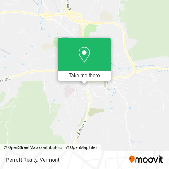
See Perrott Realty, Bennington, on the map
Public Transit to Perrott Realty in Bennington
Wondering how to get to Perrott Realty in Bennington? Moovit helps you find the best way to get to Perrott Realty with step-by-step directions from the nearest public transit station.
Moovit provides free maps and live directions to help you navigate through your city. View schedules, routes, timetables, and find out how long does it take to get to Perrott Realty in real time.
Looking for the nearest stop or station to Perrott Realty? Check out this list of stops closest to your destination: Silver Street Apartments; Walloomsac Apartments; Willie's Variety; Pleasant Street 215; Green Mountain Community Bus Terminal.
Bus: ORANGE LINE, PURPLE LINE, BLUE LINE, GREEN LINE, RED LINE, BROWN LINE, LIGHT GREEN LINE, 7.
Want to see if there’s another route that gets you there at an earlier time? Moovit helps you find alternative routes or times. Get directions from and directions to Perrott Realty easily from the Moovit App or Website.
We make riding to Perrott Realty easy, which is why over 1.5 million users, including users in Bennington, trust Moovit as the best app for public transit. You don’t need to download an individual bus app or train app, Moovit is your all-in-one transit app that helps you find the best bus time or train time available.
For information on prices of bus, costs and ride fares to Perrott Realty, please check the Moovit app.
Use the app to navigate to popular places including to the airport, hospital, stadium, grocery store, mall, coffee shop, school, college, and university.
Perrott Realty Address: 120 Elm St street in Bennington
- Circle of Life,
- South Shire,
- Niramit,
- Bennington, Vermont,
- Catamount Rotary Charities,
- Edward Jones Investments,
- Bennington County Choral Society,
- Salem Dentistry,
- Small Business Administration,
- Roofer If for Cheap,
- South St Gas,
- Paula's Rock Shop & Weaving Workshop,
- BCRC,
- Adecco,
- CRM- Community Resource Management,
- Coffee Bar,
- South Street Group Home,
- Union South,
- Navy Federal Credit Union,
- Putnam Block
Places Near Perrott Realty (Bennington)
- Castleton, VT, Rutland,
- Dartmouth-Hitchcock Medical Center, Clinical Systems, Grafton,
- WXXX, Chittenden,
- Derby Line Stanstead Border Crossing,
- Castleton University, Rutland,
- Springfield, VT, Windsor,
- GLOBALFOUNDRIES, Chittenden,
- Waterbury, VT,
- Rutland, VT, Rutland,
- Hannaford, Rutland,
- Xxxxxxxxxxxxx, Chittenden,
- Sugarbush Resort,
- Barre, VT,
- Missisquoi River Basin Association,
- Richford Auto,
- University of Vermont Medical Center - Fanny Allen Campus, Chittenden,
- Spring Step,
- Ecco,
- MVU,
- Champlain Valley Exposition, Chittenden
How to get to popular places in Vermont with public transit
Get around Bennington by public transit!
Traveling around Bennington has never been so easy. See step by step directions as you travel to any attraction, street or major public transit station. View bus and train schedules, arrival times, service alerts and detailed routes on a map, so you know exactly how to get to anywhere in Bennington.
When traveling to any destination around Bennington use Moovit's Live Directions with Get Off Notifications to know exactly where and how far to walk, how long to wait for your line, and how many stops are left. Moovit will alert you when it's time to get off — no need to constantly re-check whether yours is the next stop.
Wondering how to use public transit in Bennington or how to pay for public transit in Bennington? Moovit public transit app can help you navigate your way with public transit easily, and at minimum cost. It includes public transit fees, ticket prices, and costs. Looking for a map of Bennington public transit lines? Moovit public transit app shows all public transit maps in Bennington with all Bus, Train and Ferry routes and stops on an interactive map.
Vermont has 3 transit type(s), including: Bus, Train and Ferry, operated by several transit agencies, including Green Mountain Transit, Wilmington MOOver, Advance Transit, Vermont Translines, Rockingham MOOver, The Bus (Marble Valley Regional Transit District), Green Mountain Express, Rural Community Transportation, Addison County Transit Resources, Stagecoach Transportation Services, Amtrak, Greyhound-us, Dartmouth Campus Connector and Lake Champlain Ferries