How to get to Perry Ellis by bus?
Click on the bus route to see step by step directions with maps, line arrival times and updated time schedules.
From South Florida Fairgrounds, Royal Palm Beach-West Jupiter
53 minFrom Lake Worth Tri Rail Station, Lake Worth
80 minFrom Suncoast High School, Riviera Beach
25 minFrom Mar a Lago, West Palm Beach
69 minFrom John I. Leonard High School, Lake Worth
72 minFrom Lake Worth, FL, Lake Worth
62 minFrom Singer Island, West Palm Beach
57 minFrom Forest Hill Blvd / US-1, West Palm Beach
50 minFrom Keiser University-West Palm Beach, Royal Palm Beach-West Jupiter
42 minFrom Greenacres, FL, Lake Worth
62 min
How to get to Perry Ellis by train?
Click on the train route to see step by step directions with maps, line arrival times and updated time schedules.
Bus stops near Perry Ellis in West Palm Beach
Train stations near Perry Ellis in West Palm Beach
Bus lines to Perry Ellis in West Palm Beach
What are the closest stations to Perry Ellis?
The closest stations to Perry Ellis are:
- PBOM at BERTH 4 is 199 yards away, 3 min walk.
- PBOM at BERTH 3 is 230 yards away, 3 min walk.
- West Palm Beach Station is 3513 yards away, 41 min walk.
- West Palm Beach Amtrak Station is 3525 yards away, 41 min walk.
- West Palm Beach is 4161 yards away, 49 min walk.
Which bus lines stop near Perry Ellis?
These bus lines stop near Perry Ellis: 20, 33.
Which train line stops near Perry Ellis?
TRIRAIL (Northbound To Mangonia Park)
What’s the nearest bus station to Perry Ellis in West Palm Beach?
The nearest bus stations to Perry Ellis in West Palm Beach are PBOM at BERTH 4 and PBOM at BERTH 3. The closest one is a 3 min walk away.
What time is the first train to Perry Ellis in West Palm Beach?
The TRIRAIL is the first train that goes to Perry Ellis in West Palm Beach. It stops nearby at 3:56 AM.
What time is the last train to Perry Ellis in West Palm Beach?
The FLORIDIAN is the last train that goes to Perry Ellis in West Palm Beach. It stops nearby at 4:16 PM.
What time is the first bus to Perry Ellis in West Palm Beach?
The 20 is the first bus that goes to Perry Ellis in West Palm Beach. It stops nearby at 5:24 AM.
What time is the last bus to Perry Ellis in West Palm Beach?
The 33 is the last bus that goes to Perry Ellis in West Palm Beach. It stops nearby at 10:14 PM.
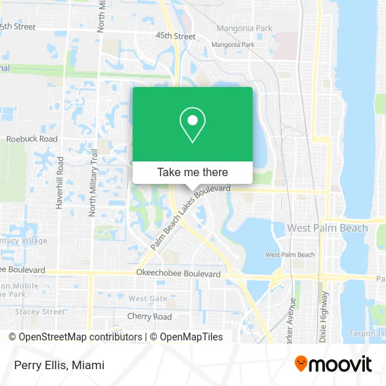
See Perry Ellis, West Palm Beach, on the map
Public Transit to Perry Ellis in West Palm Beach
Wondering how to get to Perry Ellis in West Palm Beach? Moovit helps you find the best way to get to Perry Ellis with step-by-step directions from the nearest public transit station.
Moovit provides free maps and live directions to help you navigate through your city. View schedules, routes, timetables, and find out how long does it take to get to Perry Ellis in real time.
Looking for the nearest stop or station to Perry Ellis? Check out this list of stops closest to your destination: PBOM at BERTH 4; PBOM at BERTH 3; West Palm Beach Station; West Palm Beach Amtrak Station; West Palm Beach.
Bus: 20, 33.Train: TRIRAIL, FLORIDIAN, SILVER METEOR, BLFM.
Want to see if there’s another route that gets you there at an earlier time? Moovit helps you find alternative routes or times. Get directions from and directions to Perry Ellis easily from the Moovit App or Website.
We make riding to Perry Ellis easy, which is why over 1.5 million users, including users in West Palm Beach, trust Moovit as the best app for public transit. You don’t need to download an individual bus app or train app, Moovit is your all-in-one transit app that helps you find the best bus time or train time available.
For information on prices of bus and train, costs and ride fares to Perry Ellis, please check the Moovit app.
Use the app to navigate to popular places including to the airport, hospital, stadium, grocery store, mall, coffee shop, school, college, and university.
Perry Ellis Address: 1791 Palm Beach Lakes Blvd West Palm Beach, FL 33401 street in West Palm Beach
- The North Face,
- Brahmin Outlet,
- Pandora,
- Flip Flop Shops,
- Eyemaze,
- Grilled Cheese Gallery,
- Jarden smart Market,
- J.Crew Factory,
- Cole Haan Outlet,
- Nike Factory Outlet Palm Beach,
- Motherhood Maternity,
- Palm Beach Outlets,
- Pal Beach Mall,
- Tanger Outlets Palm Beach,
- Ifixandrepair PB Outle,
- BED BATH & BEYOND,
- Original Penguin,
- Rawlings Brand Store: West Palm Beach,
- Tumi Outlet Store - Palm Beach Outlets,
- West Palm Outlets
Places Near Perry Ellis (West Palm Beach)
- Dolphin Mall, Miami,
- Little Havana, Miami,
- Richard E. Gerstein Justice Building, Miami,
- Wynwood, Miami,
- Miami Freedom Park, Miami,
- Zoo Miami, Miami,
- Dolphin Mall Bus, Miami,
- Port of Miami Cruise Terminal, Miami,
- 1351 NW 12th St, Miami,
- Miami-Dade County Courthouse, Miami,
- Sawgrass Mall, Miami,
- Aventura Mall, Miami Beach,
- Aventura Mall, Miami,
- Marlins Park, Miami,
- Miami Design District, Miami,
- Sawgrass mall ( FL ), Miami Beach,
- Hard Rock Stadium, Miami Gardens,
- Bayside Marketplace, Miami,
- Keiser University Flagship Campus, West Palm Beach,
- Brickell City Centre, Miami
How to get to popular places in Miami with public transit
Get around West Palm Beach by public transit!
Traveling around West Palm Beach has never been so easy. See step by step directions as you travel to any attraction, street or major public transit station. View bus and train schedules, arrival times, service alerts and detailed routes on a map, so you know exactly how to get to anywhere in West Palm Beach.
When traveling to any destination around West Palm Beach use Moovit's Live Directions with Get Off Notifications to know exactly where and how far to walk, how long to wait for your line, and how many stops are left. Moovit will alert you when it's time to get off — no need to constantly re-check whether yours is the next stop.
Wondering how to use public transit in West Palm Beach or how to pay for public transit in West Palm Beach? Moovit public transit app can help you navigate your way with public transit easily, and at minimum cost. It includes public transit fees, ticket prices, and costs. Looking for a map of West Palm Beach public transit lines? Moovit public transit app shows all public transit maps in West Palm Beach with all Bus, Train, Light Rail and Ferry routes and stops on an interactive map.
Miami has 4 transit type(s), including: Bus, Train, Light Rail and Ferry, operated by several transit agencies, including Broward County Transit, Miami-Dade Transit, Metrorail, Palm Tran, Tri-Rail, Brightline, MARTY, City of Homestead Trolley, Key West Transit, Treasure Coast Connector, GoLine IRT, Amtrak, Greyhound-us, FlixBus-us and Aventura Express Shuttle Bus