How to get to Personal Help by bus?
Click on the bus route to see step by step directions with maps, line arrival times and updated time schedules.
Bus stops near Personal Help in Vero Beach
Bus lines to Personal Help in Vero Beach
- RT 1, Main Transfer Center,VIEW
- RT 11, Main Transfer Center,VIEW
- RT 3, Main Transfer Center,VIEW
- RT 2, 02 - Indian River Mall to Main Transit Hub,VIEW
- RT 8, 08 - Gifford Health Center to Main Transit Hub,VIEW
- RT 4, 04 -IG Center to Main Transit Hub,VIEW
- RT 6, 06 - Intergeneral Recreation Center to Main Trans,VIEW
What are the closest stations to Personal Help?
The closest stations to Personal Help are:
- US 1 & 20th St. (OB) is 209 yards away, 3 min walk.
- 10TH Ave. & 20th PL is 284 yards away, 4 min walk.
- US 1 & 11th Ave. EB is 634 yards away, 8 min walk.
- 14th Ave. & 19th St. Nb is 1239 yards away, 15 min walk.
- Main Transfer Center is 1404 yards away, 17 min walk.
Which bus lines stop near Personal Help?
These bus lines stop near Personal Help: RT 11, RT 4.
What’s the nearest bus station to Personal Help in Vero Beach?
The nearest bus station to Personal Help in Vero Beach is US 1 & 20th St. (OB). It’s a 3 min walk away.
What time is the first bus to Personal Help in Vero Beach?
The RT 1 is the first bus that goes to Personal Help in Vero Beach. It stops nearby at 6:21 AM.
What time is the last bus to Personal Help in Vero Beach?
The RT 1 is the last bus that goes to Personal Help in Vero Beach. It stops nearby at 6:41 PM.
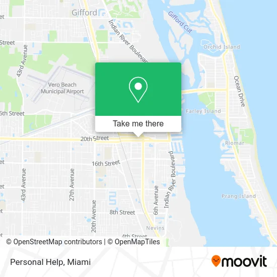
See Personal Help, Vero Beach, on the map
Public Transit to Personal Help in Vero Beach
Wondering how to get to Personal Help in Vero Beach? Moovit helps you find the best way to get to Personal Help with step-by-step directions from the nearest public transit station.
Moovit provides free maps and live directions to help you navigate through your city. View schedules, routes, timetables, and find out how long does it take to get to Personal Help in real time.
Looking for the nearest stop or station to Personal Help? Check out this list of stops closest to your destination: US 1 & 20th St. (OB); 10TH Ave. & 20th PL; US 1 & 11th Ave. EB; 14th Ave. & 19th St. Nb; Main Transfer Center.
Bus: RT 11, RT 4, RT 1, RT 3, RT 2, RT 8, RT 6.
Want to see if there’s another route that gets you there at an earlier time? Moovit helps you find alternative routes or times. Get directions from and directions to Personal Help easily from the Moovit App or Website.
We make riding to Personal Help easy, which is why over 1.5 million users, including users in Vero Beach, trust Moovit as the best app for public transit. You don’t need to download an individual bus app or train app, Moovit is your all-in-one transit app that helps you find the best bus time or train time available.
For information on prices of bus, costs and ride fares to Personal Help, please check the Moovit app.
Use the app to navigate to popular places including to the airport, hospital, stadium, grocery store, mall, coffee shop, school, college, and university.
Personal Help Address: 847 20th Pl Vero Beach, FL 32960 street in Vero Beach
- Indian River Gop,
- Government Official Guide English,
- ADT 24 7 Alarm & Security,
- The Mens Room Barber Shop Spa,
- Salon Aura,
- WTBS Blazin FM,
- Spectors,
- The UPS Store,
- Vero Beach Financial Group,
- Two Fish and Five Loaves,
- Biran C Herndon Pa,
- Mr T's Chophouse,
- El Rey Mexican Restaurant,
- Indian River Finance,
- Low Locksmith Prices,
- Irtc,
- Indian River National Bank,
- US Bank,
- CubeSmart,
- Ocean Village Sales
Places Near Personal Help (Vero Beach)
- Zoo Miami, Miami,
- Richard E. Gerstein Justice Building, Miami,
- Aventura Mall, Miami Beach,
- Marlins Park, Miami,
- Dolphin Mall, Miami,
- Miami Freedom Park, Miami,
- Miami-Dade County Courthouse, Miami,
- Hard Rock Stadium, Miami Gardens,
- Brickell City Centre, Miami,
- Dolphin Mall Bus, Miami,
- Sawgrass mall ( FL ), Miami Beach,
- Keiser University Flagship Campus, West Palm Beach,
- Wynwood, Miami,
- Miami VA Hospital, Miami,
- Sawgrass Mall, Miami,
- Miami Design District, Miami,
- Little Havana, Miami,
- Bayside Marketplace, Miami,
- Aventura Mall, Miami,
- Port of Miami Cruise Terminal, Miami
How to get to popular places in Miami with public transit
Get around Vero Beach by public transit!
Traveling around Vero Beach has never been so easy. See step by step directions as you travel to any attraction, street or major public transit station. View bus and train schedules, arrival times, service alerts and detailed routes on a map, so you know exactly how to get to anywhere in Vero Beach.
When traveling to any destination around Vero Beach use Moovit's Live Directions with Get Off Notifications to know exactly where and how far to walk, how long to wait for your line, and how many stops are left. Moovit will alert you when it's time to get off — no need to constantly re-check whether yours is the next stop.
Wondering how to use public transit in Vero Beach or how to pay for public transit in Vero Beach? Moovit public transit app can help you navigate your way with public transit easily, and at minimum cost. It includes public transit fees, ticket prices, and costs. Looking for a map of Vero Beach public transit lines? Moovit public transit app shows all public transit maps in Vero Beach with all Bus, Train, Light Rail and Ferry routes and stops on an interactive map.
Miami has 4 transit type(s), including: Bus, Train, Light Rail and Ferry, operated by several transit agencies, including Broward County Transit, Miami-Dade Transit, Metrorail, Palm Tran, Tri-Rail, Brightline, MARTY, City of Homestead Trolley, Key West Transit, Treasure Coast Connector, GoLine IRT, Amtrak, Greyhound-us, FlixBus-us and Aventura Express Shuttle Bus