How to get to Personalizzi by bus?
Click on the bus route to see step by step directions with maps, line arrival times and updated time schedules.
From Santa Cruz Da Serra, Duque De Caxias
77 minFrom Hospital Estadual Adão Pereira Nunes, Duque De Caxias
74 minFrom Taquara, Duque De Caxias
93 minFrom Jardim Anhangá, Duque De Caxias
86 minFrom Outlet Premium Caxias, Duque De Caxias
71 minFrom Chácaras Rio-Petrópolis, Duque De Caxias
67 minFrom Xerém, Duque De Caxias
89 minFrom SESC Nogueira, Petrópolis
82 minFrom Itaipava, Petrópolis
93 minFrom Monte do Azeite, Duque De Caxias
78 min
Bus stops near Personalizzi in Petrópolis
Bus lines to Personalizzi in Petrópolis
- 192, Centro,VIEW
- 193, Olga Castrioto (Via Alto Da Serra),VIEW
- 184, Vital Brasil (Via Coronel Veiga),VIEW
- 186, Vital Brasil (Via Castelânea),VIEW
- 187, Tancredo Neves,VIEW
- 188, Capitão Paladini (Via Castelânea),VIEW
- 189, Capitão Paladini (Via Coronel Veiga),VIEW
- 163, Sargento Boening ↔ Centro (Via Santos Dumont),VIEW
- 164, Sargento Boening / Paula Aguiar (Via Duas Pontes),VIEW
- 161, Sargento Boening (Via Rua Teresa),VIEW
- 162, Sargento Boening (Via Duas Pontes),VIEW
What are the closest stations to Personalizzi?
The closest stations to Personalizzi are:
- Rua Indaiá, 254-414 is 151 meters away, 2 min walk.
- Praça João Augusto Borba, 9 is 232 meters away, 4 min walk.
- Estrada Do Paraíso, 730 is 4647 meters away, 60 min walk.
- Ponto Final - Sargento Boening is 4651 meters away, 60 min walk.
Which bus lines stop near Personalizzi?
These bus lines stop near Personalizzi: 184, 186, 193, 411, 650, 662.
What’s the nearest bus station to Personalizzi in Petrópolis?
The nearest bus station to Personalizzi in Petrópolis is Rua Indaiá, 254-414. It’s a 2 min walk away.
What time is the first bus to Personalizzi in Petrópolis?
The 161 is the first bus that goes to Personalizzi in Petrópolis. It stops nearby at 5:00 AM.
What time is the last bus to Personalizzi in Petrópolis?
The 161 is the last bus that goes to Personalizzi in Petrópolis. It stops nearby at 12:01 AM.
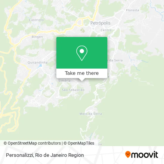
See Personalizzi, Petrópolis, on the map
Public Transit to Personalizzi in Petrópolis
Wondering how to get to Personalizzi in Petrópolis? Moovit helps you find the best way to get to Personalizzi with step-by-step directions from the nearest public transit station.
Moovit provides free maps and live directions to help you navigate through your city. View schedules, routes, timetables, and find out how long does it take to get to Personalizzi in real time.
Looking for the nearest stop or station to Personalizzi? Check out this list of stops closest to your destination: Rua Indaiá; Praça João Augusto Borba; Estrada Do Paraíso; Ponto Final - Sargento Boening.
Bus: 184, 186, 193, 411, 650, 662, 192, 187, 188, 189, 161, 162, 163, 164.
Want to see if there’s another route that gets you there at an earlier time? Moovit helps you find alternative routes or times. Get directions from and directions to Personalizzi easily from the Moovit App or Website.
We make riding to Personalizzi easy, which is why over 1.5 million users, including users in Petrópolis, trust Moovit as the best app for public transit. You don’t need to download an individual bus app or train app, Moovit is your all-in-one transit app that helps you find the best bus time or train time available.
For information on prices of bus, costs and ride fares to Personalizzi, please check the Moovit app.
Use the app to navigate to popular places including to the airport, hospital, stadium, grocery store, mall, coffee shop, school, college, and university.
Personalizzi Address: Rua Capitão Danilo Paladini, 225 Petrópolis Petrópolis-RJ 25645-111 street in Petrópolis
- Basilio e Gomes,
- Bar da Mabel,
- J Santos Conservadora de Elevadores,
- Tusco - Templo de Umbanda Sete Caminhos de Ogum,
- Rua Capitão Danilo Paladini,
- Jlm,
- Diego Palma Serviços Em Telefonia,
- Beatriz Nogueira Estética Avancada,
- Marcelo Peyroton,
- Somos Todos Protetores,
- Serralheria Léo do China,
- Pescados Irmaos Sabia,
- Comando 24h Seguranca e Tecnologia,
- Chaveiro Sao Sebastiao,
- Rua Franklin Roosevelt, 1,
- Sana Soldas,
- Facille Digital,
- Padaria Santiago,
- Rua São Sebastião / Rua Vital Brasil,
- Farmacia Sao Sebastiao
Places Near Personalizzi (Petrópolis)
- Hospital Federal Cardoso Fontes, Jacarepaguá,
- Rio De Janeiro,
- Shopping Rio Sul, Botafogo,
- Shopping RioSul, Botafogo,
- Hospital Pedro Ernesto, Vila Isabel,
- Avenida Venezuela 134, Saúde,
- Niterói, Niterói,
- Norte Shopping, Cachambi,
- Rua Ulysses Guimarães 16, Cidade Nova,
- Shopping Nova América, Del Castilho,
- Praia do Arpoador, Ipanema,
- Hospital Federal Do Andaraí, Andaraí,
- Rodoviária Novo Rio (Rodoviária do Rio de Janeiro), Santo Cristo,
- Shopping Downtown, Barra Da Tijuca,
- Museu Do Amanhã, Centro,
- Feirão De Malhas, Duque De Caxias,
- Avenida Rio Branco, Centro,
- Hospital Municipal Ronaldo Gazolla, Acari,
- Feira Livre da Gloria, Glória,
- Rua Licínio Cardoso, São Francisco Xavier
How to get to popular places in Rio de Janeiro Region with public transit
Get around Petrópolis by public transit!
Traveling around Petrópolis has never been so easy. See step by step directions as you travel to any attraction, street or major public transit station. View bus and train schedules, arrival times, service alerts and detailed routes on a map, so you know exactly how to get to anywhere in Petrópolis.
When traveling to any destination around Petrópolis use Moovit's Live Directions with Get Off Notifications to know exactly where and how far to walk, how long to wait for your line, and how many stops are left. Moovit will alert you when it's time to get off — no need to constantly re-check whether yours is the next stop.
Wondering how to use public transit in Petrópolis or how to pay for public transit in Petrópolis? Moovit public transit app can help you navigate your way with public transit easily, and at minimum cost. It includes public transit fees, ticket prices, and costs. Looking for a map of Petrópolis public transit lines? Moovit public transit app shows all public transit maps in Petrópolis with all Bus, Train, Metro, Light Rail, Ferry, Cable Car, Gondola and Funicular routes and stops on an interactive map.
Rio de Janeiro Region has 8 transit type(s), including: Bus, Train, Metro, Light Rail, Ferry, Cable Car, Gondola and Funicular, operated by several transit agencies, including TrensRJ, Metrô Rio, VLT Carioca, Barcas Rio, BRT MOBI-Rio, Auto Viação Alpha, Auto Viação Tijuca, Gire Transportes, Transurb, Viação Nossa Senhora das Graças, Consórcio INTERSUL, Braso Lisboa (Municipal), Caprichosa Auto Ônibus, Auto Viação Três Amigos and Rodoviária Âncora Matias