Directions to Pet Exercise Area (Richmond) with public transportation
The following transit lines have routes that pass near Pet Exercise Area
 Bus: 1A, 2C, 3B, FLIXBUS N2601, 2A.
- Train: NORTHEAST REGIONAL.
How to get to Pet Exercise Area by bus?
Click on the bus route to see step by step directions with maps, line arrival times and updated time schedules.
From Lorton, VA - Amtrak Auto Train Station (LOR), Fairfax County
223 minFrom Potomac Mills Mall, Prince William County
208 minFrom Busch Gardens Williamsburg (Employee Parking Lot), James City County
149 minFrom Rose Gaming Resort, Prince William County
233 minFrom Lorton, VA, Fairfax County
217 minFrom Hampton University, Hampton
309 minFrom Woodbridge, VA, Prince William County
150 minFrom UVA Hospital Medical Center, Charlottesville
297 minFrom Amazon Fulfillment Center-Ric3, Richmond
52 min
How to get to Pet Exercise Area by train?
Click on the train route to see step by step directions with maps, line arrival times and updated time schedules.
Bus stops near Pet Exercise Area in Richmond
Train station near Pet Exercise Area in Richmond
- Pathrichmond Main Street Amtrak Station, 14 min walk,VIEW
Bus lines to Pet Exercise Area in Richmond
What are the closest stations to Pet Exercise Area?
The closest stations to Pet Exercise Area are:
- Semmes + 10th is 215 yards away, 3 min walk.
- Hull + 9th is 570 yards away, 8 min walk.
- Commerce + Hull is 653 yards away, 8 min walk.
- Pathrichmond Main Street Amtrak Station is 1097 yards away, 14 min walk.
Which bus lines stop near Pet Exercise Area?
These bus lines stop near Pet Exercise Area: 1A, 2C, 3B, FLIXBUS N2601.
Which train line stops near Pet Exercise Area?
NORTHEAST REGIONAL (Newport News)
What’s the nearest train station to Pet Exercise Area in Richmond?
The nearest train station to Pet Exercise Area in Richmond is Pathrichmond Main Street Amtrak Station. It’s a 14 min walk away.
What’s the nearest bus station to Pet Exercise Area in Richmond?
The nearest bus station to Pet Exercise Area in Richmond is Semmes + 10th. It’s a 3 min walk away.
What time is the first train to Pet Exercise Area in Richmond?
The NORTHEAST REGIONAL is the first train that goes to Pet Exercise Area in Richmond. It stops nearby at 5:19 AM.
What time is the last train to Pet Exercise Area in Richmond?
The NORTHEAST REGIONAL is the last train that goes to Pet Exercise Area in Richmond. It stops nearby at 6:52 PM.
What time is the first bus to Pet Exercise Area in Richmond?
The 1A is the first bus that goes to Pet Exercise Area in Richmond. It stops nearby at 5:20 AM.
What time is the last bus to Pet Exercise Area in Richmond?
The 2C is the last bus that goes to Pet Exercise Area in Richmond. It stops nearby at 1:23 AM.
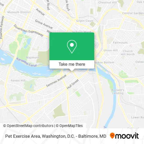
See Pet Exercise Area, Richmond, on the map
Public Transit to Pet Exercise Area in Richmond
Wondering how to get to Pet Exercise Area in Richmond? Moovit helps you find the best way to get to Pet Exercise Area with step-by-step directions from the nearest public transit station.
Moovit provides free maps and live directions to help you navigate through your city. View schedules, routes, timetables, and find out how long does it take to get to Pet Exercise Area in real time.
Looking for the nearest stop or station to Pet Exercise Area? Check out this list of stops closest to your destination: Semmes + 10th; Hull + 9th; Commerce + Hull; Pathrichmond Main Street Amtrak Station.
Bus: 1A, 2C, 3B, FLIXBUS N2601, 2A, 2B, 1B, 1C, 87.Train: NORTHEAST REGIONAL.
Want to see if there’s another route that gets you there at an earlier time? Moovit helps you find alternative routes or times. Get directions from and directions to Pet Exercise Area easily from the Moovit App or Website.
We make riding to Pet Exercise Area easy, which is why over 1.5 million users, including users in Richmond, trust Moovit as the best app for public transit. You don’t need to download an individual bus app or train app, Moovit is your all-in-one transit app that helps you find the best bus time or train time available.
For information on prices of bus and train, costs and ride fares to Pet Exercise Area, please check the Moovit app.
Use the app to navigate to popular places including to the airport, hospital, stadium, grocery store, mall, coffee shop, school, college, and university.
Pet Exercise Area Address: 800 Semmes Ave Richmond, VA 23224 street in Richmond
- The Terraces,
- Cafe Beignet,
- The Leasing Office,
- Atlantic Coast Exteriors,
- High-Rise Living on the James,
- Terraces at Manchester,
- Link Apartments Manchester,
- Ryan Leach,
- Rich Legacy Apparel,
- Carol Adams Foundation,
- Bass Crane Service,
- Pope Carpet and Floor Center,
- Eddy on the James,
- Bay Diesel,
- Mill at Manchester Lofts,
- LAX Natural,
- Brandon Boswell Photography,
- Perry Place,
- Perry Place Apartments,
- Ironclad Pizza Grill
Places Near Pet Exercise Area (Richmond)
- National Museum of African American History and Culture, Washington,
- Sibley Memorial Hospital, Washington,
- Amazon Hq2, Arlington County,
- Washington National Cathedral, Washington,
- Basilica of the National Shrine, Washington,
- M&T Bank Stadium, Baltimore,
- Pennsylvania Ave NW (3rd st and pennsylvania), Washington,
- Rock Creek Tennis Center, Washington,
- National Theatre, Washington,
- Warner Theatre, Washington,
- Marriott Marquis Washington, DC, Washington,
- Georgetown, Washington,
- PG Mall, Prince George's County,
- National Zoo, Washington,
- The Anthem, Washington,
- Washington DC VA Medical Center, Washington,
- Museum Of The Bible, Washington,
- Westfield Montgomery Mall, Montgomery County,
- Camden Yards, Baltimore,
- Capital One Arena, Washington
How to get to popular places in Washington, D.C. - Baltimore, MD with public transit
Get around Richmond by public transit!
Traveling around Richmond has never been so easy. See step by step directions as you travel to any attraction, street or major public transit station. View bus and train schedules, arrival times, service alerts and detailed routes on a map, so you know exactly how to get to anywhere in Richmond.
When traveling to any destination around Richmond use Moovit's Live Directions with Get Off Notifications to know exactly where and how far to walk, how long to wait for your line, and how many stops are left. Moovit will alert you when it's time to get off — no need to constantly re-check whether yours is the next stop.
Wondering how to use public transit in Richmond or how to pay for public transit in Richmond? Moovit public transit app can help you navigate your way with public transit easily, and at minimum cost. It includes public transit fees, ticket prices, and costs. Looking for a map of Richmond public transit lines? Moovit public transit app shows all public transit maps in Richmond with all Bus, Train, Metro, Light Rail and Ferry routes and stops on an interactive map.
Washington, D.C. - Baltimore, MD has 5 transit type(s), including: Bus, Train, Metro, Light Rail and Ferry, operated by several transit agencies, including WMATA, Montgomery County Ride On, Fairfax Connector, TheBus, PRTC, DASH - Alexandria, Arlington Transit (ART), RTA of Central Maryland, MDOT MTA, MDOT MTA Light RailLink, MDOT MTA Commuter Bus, MDOT MTA Local Bus, FXBGO!, Virginia Railway Express (VRE) and MARC