Directions to Pet Treks (Baltimore County) with public transportation
The following transit lines have routes that pass near Pet Treks
 Bus: 62.
How to get to Pet Treks by bus?
Click on the bus route to see step by step directions with maps, line arrival times and updated time schedules.
From Walmart, Baltimore County
47 minFrom Johns Hopkins Bayview Medical Center, Baltimore
59 minFrom Medstar Franklin Square Medical Center, Baltimore County
92 minFrom Bwi2 Employee Shuttles, Baltimore
78 minFrom Franklin Square Dr (franklin hospital), Baltimore County
92 minFrom Canton, Baltimore
96 minFrom Patterson Park, Baltimore
75 minFrom Dundalk, Maryland, Baltimore County
57 minFrom Patterson Park, Baltimore
77 minFrom Middle River, Maryland, Baltimore County
77 min
Bus stop near Pet Treks in Baltimore County
- Wise & North Point Mid Eb, 6 min walk,VIEW
Bus lines to Pet Treks in Baltimore County
- 62, Ccbc Essex,VIEW
What are the closest stations to Pet Treks?
The closest stations to Pet Treks are:
- Wise & North Point Mid Eb is 424 yards away, 6 min walk.
Which bus line stops near Pet Treks?
62 (Turner Station)
What’s the nearest bus station to Pet Treks in Baltimore County?
The nearest bus station to Pet Treks in Baltimore County is Wise & North Point Mid Eb. It’s a 6 min walk away.
What time is the first bus to Pet Treks in Baltimore County?
The 62 is the first bus that goes to Pet Treks in Baltimore County. It stops nearby at 4:47 AM.
What time is the last bus to Pet Treks in Baltimore County?
The 62 is the last bus that goes to Pet Treks in Baltimore County. It stops nearby at 12:21 AM.
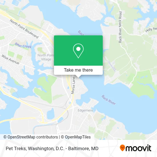
See Pet Treks, Baltimore County, on the map
Public Transit to Pet Treks in Baltimore County
Wondering how to get to Pet Treks in Baltimore County? Moovit helps you find the best way to get to Pet Treks with step-by-step directions from the nearest public transit station.
Moovit provides free maps and live directions to help you navigate through your city. View schedules, routes, timetables, and find out how long does it take to get to Pet Treks in real time.
Looking for the nearest stop or station to Pet Treks? Check out this list of stops closest to your destination: Wise & North Point Mid Eb.
Bus: 62.
Want to see if there’s another route that gets you there at an earlier time? Moovit helps you find alternative routes or times. Get directions from and directions to Pet Treks easily from the Moovit App or Website.
We make riding to Pet Treks easy, which is why over 1.7 million users, including users in Baltimore County, trust Moovit as the best app for public transit. You don’t need to download an individual bus app or train app, Moovit is your all-in-one transit app that helps you find the best bus time or train time available.
For information on prices of bus, costs and ride fares to Pet Treks, please check the Moovit app.
Use the app to navigate to popular places including to the airport, hospital, stadium, grocery store, mall, coffee shop, school, college, and university.
Pet Treks Address: 4500 Todd Point Ln street in Baltimore County
- Patapsco High School and Center for the Arts,
- Eastern Yth,
- Ekids,
- Advantage Homes, Inc.,
- Our Lady Of Hope Elementary,
- Agape Praise Fellowship,
- Corsets Queen,
- Gray-Charles Stricker Field,
- UPS Access Point,
- Regional Management,
- Cvs Photo,
- We Buy Your Home Quick,
- Mike Booz Real Estate Team,
- Under Armour- Omni Distribution House,
- Amazon Fulfillment Center-DCA1,
- Blue Rhino Propane Exchange,
- Western Union,
- Bmore Aquaponics,
- Zam Zam Mosque,
- Fresenius Kidney Care Dundalk
Places Near Pet Treks (Baltimore County)
- Basilica of the National Shrine, Washington,
- PG Mall, Prince George's County,
- M&T Bank Stadium, Baltimore,
- Washington DC VA Medical Center, Washington,
- Washington National Cathedral, Washington,
- Marriott Marquis Washington, DC, Washington,
- National Museum of African American History and Culture, Washington,
- Capital One Arena, Washington,
- National Theatre, Washington,
- Warner Theatre, Washington,
- Camden Yards, Baltimore,
- Georgetown, Washington,
- Sibley Memorial Hospital, Washington,
- Rock Creek Tennis Center, Washington,
- Westfield Montgomery Mall, Montgomery County,
- Museum Of The Bible, Washington,
- Amazon Hq2, Arlington County,
- National Zoo, Washington,
- Pennsylvania Ave NW (3rd st and pennsylvania), Washington,
- The Anthem, Washington
How to get to popular places in Washington, D.C. - Baltimore, MD with public transit
Get around Baltimore County by public transit!
Traveling around Baltimore County has never been so easy. See step by step directions as you travel to any attraction, street or major public transit station. View bus and train schedules, arrival times, service alerts and detailed routes on a map, so you know exactly how to get to anywhere in Baltimore County.
When traveling to any destination around Baltimore County use Moovit's Live Directions with Get Off Notifications to know exactly where and how far to walk, how long to wait for your line, and how many stops are left. Moovit will alert you when it's time to get off — no need to constantly re-check whether yours is the next stop.
Wondering how to use public transit in Baltimore County or how to pay for public transit in Baltimore County? Moovit public transit app can help you navigate your way with public transit easily, and at minimum cost. It includes public transit fees, ticket prices, and costs. Looking for a map of Baltimore County public transit lines? Moovit public transit app shows all public transit maps in Baltimore County with all Bus, Train, Metro, Light Rail and Ferry routes and stops on an interactive map.
Washington, D.C. - Baltimore, MD has 5 transit type(s), including: Bus, Train, Metro, Light Rail and Ferry, operated by several transit agencies, including WMATA, Montgomery County Ride On, Fairfax Connector, TheBus, PRTC, DASH - Alexandria, Arlington Transit (ART), RTA of Central Maryland, MDOT MTA, MDOT MTA Light RailLink, MDOT MTA Commuter Bus, MDOT MTA Local Bus, FXBGO!, Virginia Railway Express (VRE) and MARC