Directions to Peter Cook (Bridgehampton) with public transportation
The following transit lines have routes that pass near Peter Cook
 Bus: 92, HAMPTON JITNEY MONTAUK, 2, 1.
- Train: MONTAUK BRANCH.
How to get to Peter Cook by bus?
Click on the bus route to see step by step directions with maps, line arrival times and updated time schedules.
How to get to Peter Cook by train?
Click on the train route to see step by step directions with maps, line arrival times and updated time schedules.
Bus stops near Peter Cook in Bridgehampton
Train station near Peter Cook in Bridgehampton
- Bridgehampton, 9 min walk,VIEW
Bus lines to Peter Cook in Bridgehampton
What are the closest stations to Peter Cook?
The closest stations to Peter Cook are:
- Bridgehampton Eastbound is 222 yards away, 3 min walk.
- Montauk Hwy/Corwith Ave is 254 yards away, 4 min walk.
- Montauk Hwy/School St is 262 yards away, 4 min walk.
- Bridgehampton is 761 yards away, 10 min walk.
Which bus lines stop near Peter Cook?
These bus lines stop near Peter Cook: 92, HAMPTON JITNEY MONTAUK.
Which train line stops near Peter Cook?
MONTAUK BRANCH (Montauk)
What’s the nearest train station to Peter Cook in Bridgehampton?
The nearest train station to Peter Cook in Bridgehampton is Bridgehampton. It’s a 9 min walk away.
What’s the nearest bus station to Peter Cook in Bridgehampton?
The nearest bus station to Peter Cook in Bridgehampton is Bridgehampton Eastbound. It’s a 3 min walk away.
What time is the first train to Peter Cook in Bridgehampton?
The MONTAUK BRANCH is the first train that goes to Peter Cook in Bridgehampton. It stops nearby at 3:12 AM.
What time is the last train to Peter Cook in Bridgehampton?
The MONTAUK BRANCH is the last train that goes to Peter Cook in Bridgehampton. It stops nearby at 3:12 AM.
What time is the first bus to Peter Cook in Bridgehampton?
The 92 is the first bus that goes to Peter Cook in Bridgehampton. It stops nearby at 4:50 AM.
What time is the last bus to Peter Cook in Bridgehampton?
The HAMPTON JITNEY MONTAUK is the last bus that goes to Peter Cook in Bridgehampton. It stops nearby at 12:35 AM.
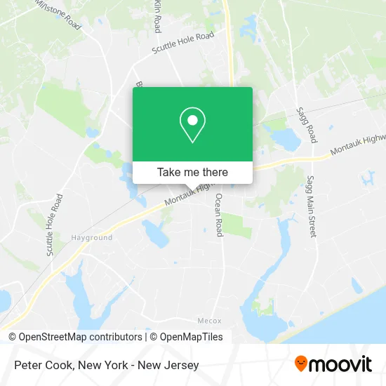
See Peter Cook, Bridgehampton, on the map
Public Transit to Peter Cook in Bridgehampton
Wondering how to get to Peter Cook in Bridgehampton? Moovit helps you find the best way to get to Peter Cook with step-by-step directions from the nearest public transit station.
Moovit provides free maps and live directions to help you navigate through your city. View schedules, routes, timetables, and find out how long does it take to get to Peter Cook in real time.
Looking for the nearest stop or station to Peter Cook? Check out this list of stops closest to your destination: Bridgehampton Eastbound; Montauk Hwy/Corwith Ave; Montauk Hwy/School St; Bridgehampton.
Bus: 92, HAMPTON JITNEY MONTAUK, 2, 1.Train: MONTAUK BRANCH.
Want to see if there’s another route that gets you there at an earlier time? Moovit helps you find alternative routes or times. Get directions from and directions to Peter Cook easily from the Moovit App or Website.
We make riding to Peter Cook easy, which is why over 1.5 million users, including users in Bridgehampton, trust Moovit as the best app for public transit. You don’t need to download an individual bus app or train app, Moovit is your all-in-one transit app that helps you find the best bus time or train time available.
For information on prices of bus and train, costs and ride fares to Peter Cook, please check the Moovit app.
Use the app to navigate to popular places including to the airport, hospital, stadium, grocery store, mall, coffee shop, school, college, and university.
Peter Cook Address: 2287 Montauk Hwy street in Bridgehampton
- David Lineweaver,
- Anne Riordan,
- Edward C. Brisotti,
- Carol Moyse,
- Donna D'Amiano,
- Theresa Quigley,
- Sunhe Sherwood-Dudley,
- Kimber Eaton,
- Joel Spiegel,
- Charles Conigliaro,
- Sarah Doud,
- Eric White,
- Lynda Ludeman,
- Krae Van Sickle,
- Jeffrey D. Levine,
- Roxane Mosleh,
- Susan Penzner,
- Jim Gallo,
- Peter Korelis,
- Dennis Page
Places Near Peter Cook (Bridgehampton)
- Queens Center Mall, Queens,
- 3 Stone St, Manhattan,
- Chinatown, Manhattan,
- SoHo, Manhattan,
- San Gennaro Feast, Manhattan,
- 111 Centre New York City Supreme Court, Manhattan,
- qqqq, Manhattan,
- Times Square, Manhattan,
- Bellevue Hospital, Manhattan,
- Wall Street, Manhattan,
- Pier 83, Manhattan,
- Mountainside Hospital, Glen Ridge,
- Katz's Deli, Manhattan,
- Hudson Yards, Manhattan,
- 376 Hudson Street, Manhattan,
- 66 John Street, Manhattan,
- 911 Memorial, Manhattan,
- 26 Federal Plaza, Manhattan,
- 1 Police Plaza, Manhattan,
- Rockefeller Center, Manhattan
How to get to popular places in New York - New Jersey with public transit
Get around Bridgehampton by public transit!
Traveling around Bridgehampton has never been so easy. See step by step directions as you travel to any attraction, street or major public transit station. View bus and train schedules, arrival times, service alerts and detailed routes on a map, so you know exactly how to get to anywhere in Bridgehampton.
When traveling to any destination around Bridgehampton use Moovit's Live Directions with Get Off Notifications to know exactly where and how far to walk, how long to wait for your line, and how many stops are left. Moovit will alert you when it's time to get off — no need to constantly re-check whether yours is the next stop.
Wondering how to use public transit in Bridgehampton or how to pay for public transit in Bridgehampton? Moovit public transit app can help you navigate your way with public transit easily, and at minimum cost. It includes public transit fees, ticket prices, and costs. Looking for a map of Bridgehampton public transit lines? Moovit public transit app shows all public transit maps in Bridgehampton with all Bus, Train, Subway, Light Rail, Ferry and Cable Car routes and stops on an interactive map.
New York - New Jersey has 6 transit type(s), including: Bus, Train, Subway, Light Rail, Ferry and Cable Car, operated by several transit agencies, including MTA Subway, Metro-North Railroad, LIRR, PATH, MTA New York City Transit - Express routes, MTA Bus, NJ Transit, NYC Ferry, NICE bus, Bee-Line Bus, NJ Transit Rail, Norwalk Transit District, Hartford Line, River Valley Transit and HART