How to get to Petite Chérie by bus?
Click on the bus route to see step by step directions with maps, line arrival times and updated time schedules.
From Orange Stadium, Saint-Denis
62 minFrom Crématorium du Mont-Valérien, Arrondissement de Nanterre
70 minFrom Hôpital Foch, Arrondissement de Nanterre
66 minFrom Paris La Défense Arena, Nanterre
61 minFrom Fondation Ophtalmologique Adolphe de Rothschild, Paris
40 minFrom Espace Jean Monnet, Rungis
64 minFrom Mairie du 19e arrondissement, Paris
43 minFrom Batignolles, Paris
39 minFrom Flixbus France, Levallois-Perret
54 minFrom Crematorium du Mont Valérien, Nanterre
70 min
How to get to Petite Chérie by train?
Click on the train route to see step by step directions with maps, line arrival times and updated time schedules.
How to get to Petite Chérie by metro?
Click on the metro route to see step by step directions with maps, line arrival times and updated time schedules.
From Orange Stadium, Saint-Denis
52 minFrom Paris La Défense Arena, Nanterre
48 minFrom Fondation Ophtalmologique Adolphe de Rothschild, Paris
40 minFrom Espace Jean Monnet, Rungis
65 minFrom Mairie du 19e arrondissement, Paris
37 minFrom Batignolles, Paris
37 minFrom Flixbus France, Levallois-Perret
48 min
Bus stops near Petite Chérie in Paris
Metro stations near Petite Chérie in Paris
Bus lines to Petite Chérie in Paris
What are the closest stations to Petite Chérie?
The closest stations to Petite Chérie are:
- Mouton - Duvernet is 46 meters away, 1 min walk.
- Mouton-Duvernet is 66 meters away, 1 min walk.
- Denfert-Rochereau is 284 meters away, 4 min walk.
- Mairie du 14ème is 377 meters away, 5 min walk.
- Dareau - René Coty is 418 meters away, 6 min walk.
- Pernety is 923 meters away, 12 min walk.
Which train line stops near Petite Chérie?
N (Paris-Montparnasse)
Which RER line stops near Petite Chérie?
B (Aéroport Charles-de-Gaulle 2 TGV / Mitry - Claye)
Which metro line stops near Petite Chérie?
4 (Porte de Clignancourt)
Which bus lines stop near Petite Chérie?
These bus lines stop near Petite Chérie: 38, 62, 68, 92.
What’s the nearest metro station to Petite Chérie in Paris?
The nearest metro station to Petite Chérie in Paris is Mouton-Duvernet. It’s a 1 min walk away.
What’s the nearest bus station to Petite Chérie in Paris?
The nearest bus station to Petite Chérie in Paris is Mouton - Duvernet. It’s a 1 min walk away.
What time is the first metro to Petite Chérie in Paris?
The 4 is the first metro that goes to Petite Chérie in Paris. It stops nearby at 5:36 AM.
What time is the last metro to Petite Chérie in Paris?
The 4 is the last metro that goes to Petite Chérie in Paris. It stops nearby at 1:08 AM.
What time is the first bus to Petite Chérie in Paris?
The N21 is the first bus that goes to Petite Chérie in Paris. It stops nearby at 3:00 AM.
What time is the last bus to Petite Chérie in Paris?
The N21 is the last bus that goes to Petite Chérie in Paris. It stops nearby at 3:41 AM.
What time is the first RER to Petite Chérie in Paris?
The B is the first RER that goes to Petite Chérie in Paris. It stops nearby at 5:18 AM.
What time is the last RER to Petite Chérie in Paris?
The B is the last RER that goes to Petite Chérie in Paris. It stops nearby at 12:58 AM.
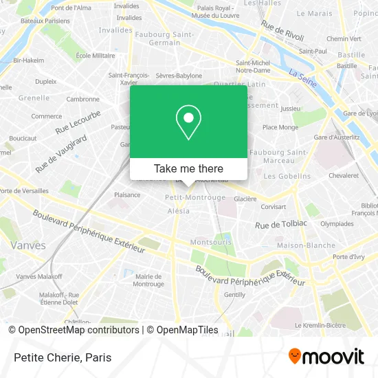
See Petite Chérie, Paris, on the map
Public Transit to Petite Chérie in Paris
Wondering how to get to Petite Chérie in Paris? Moovit helps you find the best way to get to Petite Chérie with step-by-step directions from the nearest public transit station.
Moovit provides free maps and live directions to help you navigate through your city. View schedules, routes, timetables, and find out how long does it take to get to Petite Chérie in real time.
Looking for the nearest stop or station to Petite Chérie? Check out this list of stops closest to your destination: Mouton - Duvernet; Mouton-Duvernet; Denfert-Rochereau; Mairie du 14ème; Dareau - René Coty; Pernety.
Train: N.RER: B.Metro: 4, B, 6, 13.Bus: 38, 62, 68, 92, N14, N21, 59, 88, N66.
Want to see if there’s another route that gets you there at an earlier time? Moovit helps you find alternative routes or times. Get directions from and directions to Petite Chérie easily from the Moovit App or Website.
We make riding to Petite Chérie easy, which is why over 1.5 million users, including users in Paris, trust Moovit as the best app for public transit. You don’t need to download an individual bus app or train app, Moovit is your all-in-one transit app that helps you find the best bus time or train time available.
For information on prices of metro, bus, train, RER and light rail, costs and ride fares to Petite Chérie, please check the Moovit app.
Use the app to navigate to popular places including to the airport, hospital, stadium, grocery store, mall, coffee shop, school, college, and university.
Petite Chérie Address: 4 Rue Mouton-Duvernet 75014 Paris street in Paris
- Claire's,
- La Voie Verte,
- Arrêt Mouton Duvernet [38,68],
- Hôtel Best Western Nouvel Orléans Montparnasse,
- Elisabeth Chaintron Drusch,
- Métro-Mouton Duvernet,
- Boulevard Voltaire,
- 19 Avenue du Général Leclerc,
- Parade,
- Giwood,
- Taskin,
- La Mercerie,
- Picard,
- Linvosges,
- Hotel Aviatic,
- Rêves d'Acier,
- Clinique Vétérinaire,
- 75014,
- Breteuil,
- Le temple du scrap
Places Near Petite Chérie (Paris)
- Hôpital Cochin, Paris,
- Institut Curie, Paris,
- Hôpital Necker, Paris,
- Hôpital Saint-Joseph, Paris,
- Fondation Louis Vuitton, Paris,
- Hopital Lariboisière, Paris,
- Hôpital Beaujon, Clichy,
- Galeries Lafayette Haussmann, Paris,
- Théâtre Mogador, Paris,
- Créteil Soleil, Creteil,
- Marché Saint-Pierre, Paris,
- 29 Rue Manin, Paris,
- Hopital Foch, Suresnes,
- Atelier Des Lumieres, Paris,
- Centre Hospitalier des 15/20, Paris,
- Hôpital Henri Mondor, Creteil,
- Galeries Lafayette, Paris,
- Hôpital de la Pitié-Salpêtrière, Paris,
- Gare Routière Flixbus, Paris,
- Hôpital Pitié Salpêtrière, Paris
How to get to popular places in Paris with public transit
Get around Paris by public transit!
Traveling around Paris has never been so easy. See step by step directions as you travel to any attraction, street or major public transit station. View bus and train schedules, arrival times, service alerts and detailed routes on a map, so you know exactly how to get to anywhere in Paris.
When traveling to any destination around Paris use Moovit's Live Directions with Get Off Notifications to know exactly where and how far to walk, how long to wait for your line, and how many stops are left. Moovit will alert you when it's time to get off — no need to constantly re-check whether yours is the next stop.
Wondering how to use public transit in Paris or how to pay for public transit in Paris? Moovit public transit app can help you navigate your way with public transit easily, and at minimum cost. It includes public transit fees, ticket prices, and costs. Looking for a map of Paris public transit lines? Moovit public transit app shows all public transit maps in Paris with all Bus, Train, Metro, Light Rail, RER, Funicular and Gondola routes and stops on an interactive map.
Paris has 7 transit type(s), including: Bus, Train, Metro, Light Rail, RER, Funicular and Gondola, operated by several transit agencies, including RATP, RER, RER Bus de remplacement, Train, Train Bus de remplacement, Tramway Bus de remplacement, TER, ADP, Magical Shuttle, Argenteuil - Boucles de Seine, Autocars Dominique, Bièvre, Brie et 2 Morin, Le Bus - C.C. du Clermontois and Cœur d’Essonne