How to get to Petrobras by bus?
Click on the bus route to see step by step directions with maps, line arrival times and updated time schedules.
From Hospital Estadual Melchiades Calazans, Nilópolis
60 minFrom Rua São Luiz Gonzaga, Benfica
51 minFrom Centro, Duque De Caxias
28 minFrom SENAC Riachuelo, Sampaio
63 minFrom Cemitério Jardim Da Saudade, Jardim Sulacap
50 minFrom Hospital Estadual Anchieta, Caju
59 minFrom Quintino, RJ, Quintino Bocaiúva
32 minFrom Barreira Do Vasco, Vasco Da Gama
46 minFrom Rio Minho (Niterói x Duque De Caxias), Duque De Caxias
26 minFrom Avenida Governador Leonel de Moura Brizola, Duque De Caxias
43 min
How to get to Petrobras by train?
Click on the train route to see step by step directions with maps, line arrival times and updated time schedules.
From Hospital Estadual Melchiades Calazans, Nilópolis
114 minFrom Rua São Luiz Gonzaga, Benfica
64 minFrom Centro, Duque De Caxias
43 minFrom SENAC Riachuelo, Sampaio
64 minFrom Quintino, RJ, Quintino Bocaiúva
80 minFrom Rio Minho (Niterói x Duque De Caxias), Duque De Caxias
48 minFrom Avenida Governador Leonel de Moura Brizola, Duque De Caxias
51 min
How to get to Petrobras by metro?
Click on the metro route to see step by step directions with maps, line arrival times and updated time schedules.
Bus stops near Petrobras in Brás De Pina
Metro station near Petrobras in Brás De Pina
- Vicente De Carvalho, 13 min walk,VIEW
Train station near Petrobras in Brás De Pina
- Parada De Lucas, 35 min walk,VIEW
Bus lines to Petrobras in Brás De Pina
- 560L, Méier (Via Norte Shopping),VIEW
- 564, Carrefour (Vicente De Carvalho),VIEW
- 775, Jardim América ↔ Madureira,VIEW
- 940, Ramos,VIEW
- 951, Vicente De Carvalho ↔ Terminal Margaridas (via Vista Alegre - Circular),VIEW
- 350, Castelo,VIEW
- 428L, Nova Aurora,VIEW
- 910, Bananal,VIEW
- 918, Bangu (Jardim Violeta),VIEW
- 919, Maré (via Bonsucesso),VIEW
- SN 919, Pavuna (via Saída 7),VIEW
- 920, Bonsucesso,VIEW
- 926, Penha,VIEW
- 928, Marechal Hermes,VIEW
- 629, Saens Peña,VIEW
- SN 629, Saens Peña,VIEW
- 950, Vicente De Carvalho ↔ Vista Alegre,VIEW
What are the closest stations to Petrobras?
The closest stations to Petrobras are:
- Avenida Merití, 2634 is 70 meters away, 2 min walk.
- Largo Do Bicão (Sentido Irajá) is 316 meters away, 5 min walk.
- Avenida Brás De Pina, 106 is 321 meters away, 5 min walk.
- Vicente De Carvalho is 977 meters away, 13 min walk.
- Parada De Lucas is 2766 meters away, 35 min walk.
Which bus lines stop near Petrobras?
These bus lines stop near Petrobras: 428L, 560L, 564, 775, 918, 951, VAN.
Which metro line stops near Petrobras?
L2 (Pavuna)
Which train line stops near Petrobras?
RAMAL SARACURUNA (Gramacho)
What’s the nearest metro station to Petrobras in Brás De Pina?
The nearest metro station to Petrobras in Brás De Pina is Vicente De Carvalho. It’s a 13 min walk away.
What’s the nearest bus station to Petrobras in Brás De Pina?
The nearest bus station to Petrobras in Brás De Pina is Avenida Merití, 2634. It’s a 2 min walk away.
What time is the first metro to Petrobras in Brás De Pina?
The L2 is the first metro that goes to Petrobras in Brás De Pina. It stops nearby at 5:10 AM.
What time is the last metro to Petrobras in Brás De Pina?
The L2 is the last metro that goes to Petrobras in Brás De Pina. It stops nearby at 12:41 AM.
What time is the first train to Petrobras in Brás De Pina?
The RAMAL SARACURUNA is the first train that goes to Petrobras in Brás De Pina. It stops nearby at 4:39 AM.
What time is the last train to Petrobras in Brás De Pina?
The RAMAL SARACURUNA is the last train that goes to Petrobras in Brás De Pina. It stops nearby at 11:06 PM.
What time is the first bus to Petrobras in Brás De Pina?
The SN 629 is the first bus that goes to Petrobras in Brás De Pina. It stops nearby at 3:11 AM.
What time is the last bus to Petrobras in Brás De Pina?
The SN 629 is the last bus that goes to Petrobras in Brás De Pina. It stops nearby at 2:47 AM.
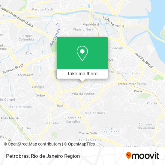
See Petrobras, Brás De Pina, on the map
Public Transit to Petrobras in Brás De Pina
Wondering how to get to Petrobras in Brás De Pina? Moovit helps you find the best way to get to Petrobras with step-by-step directions from the nearest public transit station.
Moovit provides free maps and live directions to help you navigate through your city. View schedules, routes, timetables, and find out how long does it take to get to Petrobras in real time.
Looking for the nearest stop or station to Petrobras? Check out this list of stops closest to your destination: Avenida Merití; Largo Do Bicão (Sentido Irajá); Avenida Brás De Pina; Vicente De Carvalho; Parada De Lucas.
Bus: 428L, 560L, 564, 775, 918, 951, VAN, 940, 629, SN 629, 950, 350, 910, 919.Metro: L2.Train: RAMAL SARACURUNA.
Want to see if there’s another route that gets you there at an earlier time? Moovit helps you find alternative routes or times. Get directions from and directions to Petrobras easily from the Moovit App or Website.
We make riding to Petrobras easy, which is why over 1.5 million users, including users in Brás De Pina, trust Moovit as the best app for public transit. You don’t need to download an individual bus app or train app, Moovit is your all-in-one transit app that helps you find the best bus time or train time available.
For information on prices of bus, train and metro, costs and ride fares to Petrobras, please check the Moovit app.
Use the app to navigate to popular places including to the airport, hospital, stadium, grocery store, mall, coffee shop, school, college, and university.
Petrobras Address: Rua Engenheiro Oscar Weinschenk Brás de Pina Rio de Janeiro-RJ 21211-780 street in Brás De Pina
- Avenida Meriti,
- Clinica De Olhos Vila Da Penha,
- Consultório Odontológico Dr. Ivan Magro,
- Rua Engenheiro Oscar Weinschenk,
- Bicão Point Super Lanches (Habib's Largo do Bicão),
- Linha 563L - Duque de Caxias / Carrefour,
- Habib's (Habib's Bicão),
- Dermatologia Dra Gabriele Perrotta,
- Cunsultório Odontológico - Dentista Sônia Salle,
- IBOL Vila da Penha,
- Clínica Médica PALAZZO,
- Avenida Meriti 2567,
- Habib's,
- Previdência Social - Vila Da Penha,
- CCAA (CCAA Largo do Bicão),
- Promed Medicina Diagnóstica,
- Rua Padre Manuel Viegas,
- 1a Igreja Batista da Vila da Penha,
- Progressão Vila da Penha,
- Brás de Pina
Places Near Petrobras (Brás De Pina)
- Museu Do Amanhã, Centro,
- Feira Livre da Gloria, Glória,
- Shopping Rio Sul, Botafogo,
- Shopping Nova América, Del Castilho,
- Hospital Federal Do Andaraí, Andaraí,
- Hospital Federal Cardoso Fontes, Jacarepaguá,
- Niterói, Niterói,
- Rua Licínio Cardoso, São Francisco Xavier,
- Shopping RioSul, Botafogo,
- Hospital Municipal Ronaldo Gazolla, Acari,
- Rodoviária Novo Rio (Rodoviária do Rio de Janeiro), Santo Cristo,
- Rio De Janeiro,
- Rua Ulysses Guimarães 16, Cidade Nova,
- Avenida Rio Branco, Centro,
- Shopping Downtown, Barra Da Tijuca,
- Hospital Pedro Ernesto, Vila Isabel,
- Praia do Arpoador, Ipanema,
- Avenida Venezuela 134, Saúde,
- Feirão De Malhas, Duque De Caxias,
- Norte Shopping, Cachambi
How to get to popular places in Rio de Janeiro Region with public transit
Get around Brás De Pina by public transit!
Traveling around Brás De Pina has never been so easy. See step by step directions as you travel to any attraction, street or major public transit station. View bus and train schedules, arrival times, service alerts and detailed routes on a map, so you know exactly how to get to anywhere in Brás De Pina.
When traveling to any destination around Brás De Pina use Moovit's Live Directions with Get Off Notifications to know exactly where and how far to walk, how long to wait for your line, and how many stops are left. Moovit will alert you when it's time to get off — no need to constantly re-check whether yours is the next stop.
Wondering how to use public transit in Brás De Pina or how to pay for public transit in Brás De Pina? Moovit public transit app can help you navigate your way with public transit easily, and at minimum cost. It includes public transit fees, ticket prices, and costs. Looking for a map of Brás De Pina public transit lines? Moovit public transit app shows all public transit maps in Brás De Pina with all Bus, Train, Metro, Light Rail, Ferry, Cable Car, Gondola and Funicular routes and stops on an interactive map.
Rio de Janeiro Region has 8 transit type(s), including: Bus, Train, Metro, Light Rail, Ferry, Cable Car, Gondola and Funicular, operated by several transit agencies, including TrensRJ, Metrô Rio, VLT Carioca, Barcas Rio, BRT MOBI-Rio, Auto Viação Alpha, Auto Viação Tijuca, Gire Transportes, Transurb, Viação Nossa Senhora das Graças, Consórcio INTERSUL, Braso Lisboa (Municipal), Caprichosa Auto Ônibus, Auto Viação Três Amigos and Rodoviária Âncora Matias