How to get to Petrodis by bus?
Click on the bus route to see step by step directions with maps, line arrival times and updated time schedules.
From Chácaras Rio-Petrópolis, Duque De Caxias
55 minFrom Hospital Estadual Adão Pereira Nunes, Duque De Caxias
62 minFrom Santa Cruz Da Serra, Duque De Caxias
55 minFrom SESC Nogueira, Petrópolis
77 minFrom Itaipava, Petrópolis
80 minFrom Outlet Premium Caxias, Duque De Caxias
62 minFrom Xerém, Duque De Caxias
80 minFrom Taquara, Duque De Caxias
87 minFrom Jardim Anhangá, Duque De Caxias
61 minFrom Monte do Azeite, Duque De Caxias
65 min
Bus stops near Petrodis in Petrópolis
Bus lines to Petrodis in Petrópolis
- 154N, Petrópolis - Xerém,VIEW
- 155, Vila Felipe (Via Duas Pontes),VIEW
- 162, Sargento Boening (Via Duas Pontes),VIEW
- 164, Sargento Boening / Paula Aguiar (Via Duas Pontes),VIEW
- 168, Campinho,VIEW
- 172, Alto Independência,VIEW
- 174, Independência / Cacilda Becker (via Coronel Veiga),VIEW
- 176, Independência / José Chaves (via Coronel Veiga),VIEW
- 177, Independência / Siméria / São Sebastião (Noturno),VIEW
- 178, Taquara,VIEW
- 179, Bairro Mauá (Via Quarteirão Italiano),VIEW
- 183, Siméria (Via Coronel Veiga),VIEW
- 184, Vital Brasil (Via Coronel Veiga),VIEW
- 186, Vital Brasil (Via Castelânea),VIEW
- 187, Tancredo Neves,VIEW
- 188, Capitão Paladini (Via Castelânea),VIEW
- 189, Capitão Paladini (Via Coronel Veiga),VIEW
- 192, Olga Castrioto (Via Coronel Veiga),VIEW
- 335, Valparaíso (Comunidade Oswaldo Cruz) - Emergencial,VIEW
- 645, Honduras (via Gulf),VIEW
What are the closest stations to Petrodis?
The closest stations to Petrodis are:
- Rua Washington Luís, 911 is 54 meters away, 2 min walk.
- Rua Rocha Cardoso, 31 is 274 meters away, 4 min walk.
- Rua Washington Luís, 487 is 342 meters away, 5 min walk.
- Rua Monsenhor Bacelar, 492 is 585 meters away, 8 min walk.
Which bus lines stop near Petrodis?
These bus lines stop near Petrodis: 154N, 180, 184, 186, 650, 662.
What’s the nearest bus station to Petrodis in Petrópolis?
The nearest bus station to Petrodis in Petrópolis is Rua Washington Luís, 911. It’s a 2 min walk away.
What time is the first bus to Petrodis in Petrópolis?
The 177 is the first bus that goes to Petrodis in Petrópolis. It stops nearby at 3:17 AM.
What time is the last bus to Petrodis in Petrópolis?
The 720 is the last bus that goes to Petrodis in Petrópolis. It stops nearby at 3:30 AM.
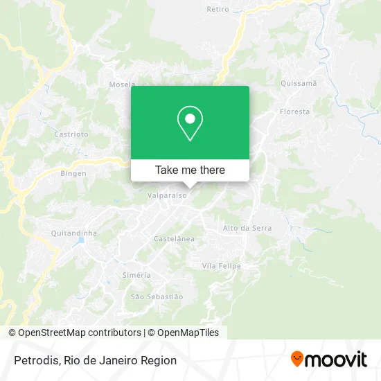
See Petrodis, Petrópolis, on the map
Public Transit to Petrodis in Petrópolis
Wondering how to get to Petrodis in Petrópolis? Moovit helps you find the best way to get to Petrodis with step-by-step directions from the nearest public transit station.
Moovit provides free maps and live directions to help you navigate through your city. View schedules, routes, timetables, and find out how long does it take to get to Petrodis in real time.
Looking for the nearest stop or station to Petrodis? Check out this list of stops closest to your destination: Rua Washington Luís; Rua Rocha Cardoso; Rua Washington Luís; Rua Monsenhor Bacelar.
Bus: 154N, 180, 184, 186, 650, 662, 155, 162, 164, 168, 010 (EXECUTIVO), 019 (EXECUTIVO), 100, 103, 104, 642, 165.
Want to see if there’s another route that gets you there at an earlier time? Moovit helps you find alternative routes or times. Get directions from and directions to Petrodis easily from the Moovit App or Website.
We make riding to Petrodis easy, which is why over 1.5 million users, including users in Petrópolis, trust Moovit as the best app for public transit. You don’t need to download an individual bus app or train app, Moovit is your all-in-one transit app that helps you find the best bus time or train time available.
For information on prices of bus, costs and ride fares to Petrodis, please check the Moovit app.
Use the app to navigate to popular places including to the airport, hospital, stadium, grocery store, mall, coffee shop, school, college, and university.
Petrodis Address: Rua Washington Luiz, Petrópolis Petrópolis-RJ 25655-006 street in Petrópolis
- Rua Washington Luiz,
- Master Petropolis Servicos,
- Soul Rope Access,
- Águas Do Imperador - Ete Quitandinha,
- Igreja Apostolica Filhos do Leao - Iafl,
- Cervejaria Buda Beer,
- 99condo.Com,
- Bom D+ Salgados,
- Ideias Design,
- Celebrare,
- Rua Edmundo de Lacerda,
- Maria Aparecida de Oli,
- Instituto Gruparj,
- Centro de Físioterapia Petrópolis,
- Rua Monsenhor Bacelar Próximo ao 589,
- Oca Permacultura Aplicada,
- Vidro e Esquadria de Aluminio Vibox,
- Igreja Santa Teresa,
- Templo Evangélico do Amor Divino,
- Educandario Terra Santa
Places Near Petrodis (Petrópolis)
- Rodoviária Novo Rio (Rodoviária do Rio de Janeiro), Santo Cristo,
- Hospital Municipal Ronaldo Gazolla, Acari,
- Avenida Venezuela 134, Saúde,
- Shopping Downtown, Barra Da Tijuca,
- Niterói, Niterói,
- Norte Shopping, Cachambi,
- Shopping RioSul, Botafogo,
- Rua Ulysses Guimarães 16, Cidade Nova,
- Rua Licínio Cardoso, São Francisco Xavier,
- Rio De Janeiro,
- Hospital Pedro Ernesto, Vila Isabel,
- Avenida Rio Branco, Centro,
- Museu Do Amanhã, Centro,
- Shopping Rio Sul, Botafogo,
- Shopping Nova América, Del Castilho,
- Hospital Federal Cardoso Fontes, Jacarepaguá,
- Feirão De Malhas, Duque De Caxias,
- Feira Livre da Gloria, Glória,
- Hospital Federal Do Andaraí, Andaraí,
- Praia do Arpoador, Ipanema
How to get to popular places in Rio de Janeiro Region with public transit
Get around Petrópolis by public transit!
Traveling around Petrópolis has never been so easy. See step by step directions as you travel to any attraction, street or major public transit station. View bus and train schedules, arrival times, service alerts and detailed routes on a map, so you know exactly how to get to anywhere in Petrópolis.
When traveling to any destination around Petrópolis use Moovit's Live Directions with Get Off Notifications to know exactly where and how far to walk, how long to wait for your line, and how many stops are left. Moovit will alert you when it's time to get off — no need to constantly re-check whether yours is the next stop.
Wondering how to use public transit in Petrópolis or how to pay for public transit in Petrópolis? Moovit public transit app can help you navigate your way with public transit easily, and at minimum cost. It includes public transit fees, ticket prices, and costs. Looking for a map of Petrópolis public transit lines? Moovit public transit app shows all public transit maps in Petrópolis with all Bus, Train, Metro, Light Rail, Ferry, Cable Car, Gondola and Funicular routes and stops on an interactive map.
Rio de Janeiro Region has 8 transit type(s), including: Bus, Train, Metro, Light Rail, Ferry, Cable Car, Gondola and Funicular, operated by several transit agencies, including TrensRJ, Metrô Rio, VLT Carioca, Barcas Rio, BRT MOBI-Rio, Auto Viação Alpha, Auto Viação Tijuca, Gire Transportes, Transurb, Viação Nossa Senhora das Graças, Consórcio INTERSUL, Braso Lisboa (Municipal), Caprichosa Auto Ônibus, Auto Viação Três Amigos and Rodoviária Âncora Matias