How to get to Pfarramt by bus?
Click on the bus route to see step by step directions with maps, line arrival times and updated time schedules.
From SAP Campus, Walldorf
28 minFrom Hauptfeuerwache, Berufsfeuerwehr Mannheim, Neckarau
109 minFrom Thermen & Badewelt Sinsheim, Sinsheim
118 minFrom Möbel Höffner, Schwetzingen
60 minFrom Neuenheimer Feld, Neuenheim
39 minFrom Marie-Baum-Schule Heidelberg, Wieblingen
48 minFrom Agaplesion Bethanien Krankenhaus Heidelberg, Südstadt
36 minFrom Globus Restaurant Waghäusel, Waghäusel
133 minFrom Luxor Filmpalast, Bahnstadt
34 min
How to get to Pfarramt by train?
Click on the train route to see step by step directions with maps, line arrival times and updated time schedules.
From Hauptfeuerwache, Berufsfeuerwehr Mannheim, Neckarau
84 minFrom Thermen & Badewelt Sinsheim, Sinsheim
78 minFrom Möbel Höffner, Schwetzingen
89 minFrom Neuenheimer Feld, Neuenheim
40 minFrom MVV Energie Ladestation, Käfertal
86 minFrom Marie-Baum-Schule Heidelberg, Wieblingen
46 minFrom Agaplesion Bethanien Krankenhaus Heidelberg, Südstadt
41 minFrom Luxor Filmpalast, Bahnstadt
29 min
Bus stops near Pfarramt in Sandhausen
Light Rail stations near Pfarramt in Sandhausen
Train station near Pfarramt in Sandhausen
- St. Ilgen, Bahnhof, 13 min walk,VIEW
Bus lines to Pfarramt in Sandhausen
- 720, St. Leon-Rot, See,VIEW
- 721, Heidelberg, Hauptbahnhof,VIEW
- 722, Sandhausen, Schulzentrum Ost,VIEW
- 758, Leimen, Steige,VIEW
- 725, Sandhausen, Lebenshilfe - St. Ilgen, Bahnhof West,VIEW
- 7923, Sandhausen, Ecke Leimbachring - St. Ilgen, Bahnhof West,VIEW
- 759, St. Ilgen, Bahnhof West,VIEW
- 726, St. Ilgen, Weberstraße,VIEW
What are the closest stations to Pfarramt?
The closest stations to Pfarramt are:
- Sandhausen, Altes Rathaus is 189 meters away, 3 min walk.
- Sandhausen, Neues Rathaus is 215 meters away, 3 min walk.
- Sandhausen, Büchertstraße is 573 meters away, 8 min walk.
- Sandhausen, Schulzentrum West is 627 meters away, 9 min walk.
- St. Ilgen-Sandhausen Bahnhof is 933 meters away, 13 min walk.
- St. Ilgen, Bahnhof is 933 meters away, 13 min walk.
- Georgi-Marktplatz is 2923 meters away, 38 min walk.
Which train lines stop near Pfarramt?
These train lines stop near Pfarramt: RB68, S3.
Which light rail line stops near Pfarramt?
S3 (Germersheim, Bahnhof)
Which bus lines stop near Pfarramt?
These bus lines stop near Pfarramt: 718, 720, 721, 725.
What’s the nearest light rail station to Pfarramt in Sandhausen?
The nearest light rail station to Pfarramt in Sandhausen is St. Ilgen-Sandhausen Bahnhof. It’s a 13 min walk away.
What’s the nearest train station to Pfarramt in Sandhausen?
The nearest train station to Pfarramt in Sandhausen is St. Ilgen, Bahnhof. It’s a 13 min walk away.
What’s the nearest bus station to Pfarramt in Sandhausen?
The nearest bus stations to Pfarramt in Sandhausen are Sandhausen, Altes Rathaus and Sandhausen, Neues Rathaus. The closest one is a 3 min walk away.
What time is the first light rail to Pfarramt in Sandhausen?
The S1 is the first light rail that goes to Pfarramt in Sandhausen. It stops nearby at 3:57 AM.
What time is the last light rail to Pfarramt in Sandhausen?
The S3 is the last light rail that goes to Pfarramt in Sandhausen. It stops nearby at 1:48 AM.
What time is the first train to Pfarramt in Sandhausen?
The S3 is the first train that goes to Pfarramt in Sandhausen. It stops nearby at 4:09 AM.
What time is the last train to Pfarramt in Sandhausen?
The S3 is the last train that goes to Pfarramt in Sandhausen. It stops nearby at 1:48 AM.
What time is the first bus to Pfarramt in Sandhausen?
The 721 is the first bus that goes to Pfarramt in Sandhausen. It stops nearby at 5:11 AM.
What time is the last bus to Pfarramt in Sandhausen?
The 7902 is the last bus that goes to Pfarramt in Sandhausen. It stops nearby at 1:54 AM.
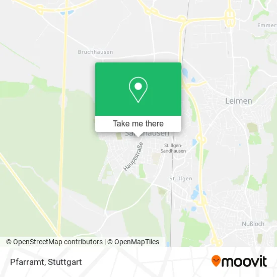
See Pfarramt, Sandhausen, on the map
Public Transit to Pfarramt in Sandhausen
Wondering how to get to Pfarramt in Sandhausen? Moovit helps you find the best way to get to Pfarramt with step-by-step directions from the nearest public transit station.
Moovit provides free maps and live directions to help you navigate through your city. View schedules, routes, timetables, and find out how long does it take to get to Pfarramt in real time.
Looking for the nearest stop or station to Pfarramt? Check out this list of stops closest to your destination: Sandhausen, Altes Rathaus; Sandhausen, Neues Rathaus; Sandhausen, Büchertstraße; Sandhausen, Schulzentrum West; St. Ilgen-Sandhausen Bahnhof; St. Ilgen; Georgi-Marktplatz.
Train: RB68, S3.Light Rail: S3.Bus: 718, 720, 721, 725, 722, 758, 7923, 759, 726.
Want to see if there’s another route that gets you there at an earlier time? Moovit helps you find alternative routes or times. Get directions from and directions to Pfarramt easily from the Moovit App or Website.
We make riding to Pfarramt easy, which is why over 1.5 million users, including users in Sandhausen, trust Moovit as the best app for public transit. You don’t need to download an individual bus app or train app, Moovit is your all-in-one transit app that helps you find the best bus time or train time available.
For information on prices of bus, train and light rail, costs and ride fares to Pfarramt, please check the Moovit app.
Use the app to navigate to popular places including to the airport, hospital, stadium, grocery store, mall, coffee shop, school, college, and university.
Pfarramt Address: Waldstraße 7 69207 Sandhausen street in Sandhausen
- Gemeindezentrum,
- Gemeindereferent und Gemeindezentrum Benno Nestel,
- Erzbischoefliches Ordinariat,
- Hopfenzopfer,
- St. Bartholomäus,
- St.-Bartholomäus-Kirche - Alte Katholische Kirche,
- Sportdienstleistungen - Frank Herrmann,
- Kath. Kindergarten St. Josefshaus,
- Köhler Werner M. Rechtsanwalt,
- St. Josef-Kindergarten,
- Werner M. Köhler,
- Fahrschule Werner Wichert,
- Fahrschule Werner Wichert Sandhausen,
- W. Holzwarth,
- Walter Holzwarth Gaststätte zum Ochsen,
- Albert Burkhardt,
- AWO Sandhausen,
- Awotopia Gem. Ug (Haftungsbeschränkt),
- Die Macht Der Stimme,
- Awo
Places Near Pfarramt (Sandhausen)
- Hanns-Martin-Schleyer-Halle (Stuttgart Hans-Martin-Schleyerhalle), Bad Cannstatt,
- Geilhaus Haus 33a, Reutlingen-Betzingen,
- Hanns-Martin-Schleyer-Halle, Bad Cannstatt,
- FlixBus Haltestelle, Stuttgart,
- Wilhelma (U-Bahn Wilhelma), Bad Cannstatt,
- Marmorsaal Im Weissenburgpark, Stuttgart-Süd,
- Klinikum Stuttgart - Katharinenhospital, Stuttgart-Mitte,
- Porsche-Arena, Bad Cannstatt,
- SI-Centrum, Möhringen,
- Waldfriedhof, Degerloch,
- Porsche Museum, Zuffenhausen,
- Mercedes-Benz Museum, Bad Cannstatt,
- Mercedes-Benz Museum (Mercedes Museum Stuttgart), Bad Cannstatt,
- Pariser Platz Stuttgart, Stuttgart-Mitte,
- Hauptbahnhof Stuttgart, Stuttgart-Mitte,
- Im Wizemann (Halle), Bad Cannstatt,
- Gasometer Pforzheim, Pforzheim,
- Gleis 101/102 (tief), Stuttgart-Mitte,
- Schleyerhalle, Bad Cannstatt,
- Mettingen Eros-Center Puff Laufhaus, Esslingen Am Neckar
How to get to popular places in Stuttgart with public transit
Get around Sandhausen by public transit!
Traveling around Sandhausen has never been so easy. See step by step directions as you travel to any attraction, street or major public transit station. View bus and train schedules, arrival times, service alerts and detailed routes on a map, so you know exactly how to get to anywhere in Sandhausen.
When traveling to any destination around Sandhausen use Moovit's Live Directions with Get Off Notifications to know exactly where and how far to walk, how long to wait for your line, and how many stops are left. Moovit will alert you when it's time to get off — no need to constantly re-check whether yours is the next stop.
Wondering how to use public transit in Sandhausen or how to pay for public transit in Sandhausen? Moovit public transit app can help you navigate your way with public transit easily, and at minimum cost. It includes public transit fees, ticket prices, and costs. Looking for a map of Sandhausen public transit lines? Moovit public transit app shows all public transit maps in Sandhausen with all Bus, Train, Subway, Light Rail, Ferry, S-Bahn and Funicular routes and stops on an interactive map.
Stuttgart has 7 transit type(s), including: Bus, Train, Subway, Light Rail, Ferry, S-Bahn and Funicular, operated by several transit agencies, including SSB - Stadtbahn, SSB, SSB - Seilbahn / Zacke, S-Bahn Stuttgart, Rhein-Neckar-Verkehr GmbH (rnv), Karlsruher Verkehrsverbund, DB AG, DB Regiobus BW, Arverio Baden-Württemberg GmbH, DB RegioNetz Verkehrs GmbH Westfrankenbahn, DB Regio AG Baden-Württemberg, Südwestdeutsche Verkehrs-AG, DB Regio AG Mitte Region Hessen, DB and Bodensee-Oberschwaben-Bahn