How to get to Pfarramt Edingen by bus?
Click on the bus route to see step by step directions with maps, line arrival times and updated time schedules.
How to get to Pfarramt Edingen by train?
Click on the train route to see step by step directions with maps, line arrival times and updated time schedules.
From Marie-Baum-Schule Heidelberg, Wieblingen
58 minFrom BG-Unfallklinik, Ludwigshafen-Nördliche Innenstadt
78 minFrom Berufsbildende Schule Technik 2, Ludwigshafen-Mundenheim
79 minFrom Luxor Filmpalast, Bahnstadt
53 minFrom Krankenhaus GRN, Weinheim
64 minFrom FH 1863, Neckarstadt-Ost/Wohlgelegen
64 minFrom Möbel Höffner, Schwetzingen
64 min
Bus stops near Pfarramt Edingen in Edingen-Neckarhausen
Light Rail stations near Pfarramt Edingen in Edingen-Neckarhausen
Bus lines to Pfarramt Edingen in Edingen-Neckarhausen
What are the closest stations to Pfarramt Edingen?
The closest stations to Pfarramt Edingen are:
- Edingen, Pfälzer Hof Bstg A is 432 meters away, 6 min walk.
- Pfälzer Hof is 434 meters away, 6 min walk.
- Edingen Bahnhof is 435 meters away, 6 min walk.
- Edingen, West Bstg G1 is 463 meters away, 6 min walk.
- Edingen, West Bstg G2 is 1238 meters away, 16 min walk.
Which train lines stop near Pfarramt Edingen?
These train lines stop near Pfarramt Edingen: RB68, RE60, S12, S3.
Which light rail lines stop near Pfarramt Edingen?
These light rail lines stop near Pfarramt Edingen: 5, RNV 5.
Which bus lines stop near Pfarramt Edingen?
These bus lines stop near Pfarramt Edingen: RNV 35, RNV 42.
What’s the nearest light rail station to Pfarramt Edingen in Edingen-Neckarhausen?
The nearest light rail stations to Pfarramt Edingen in Edingen-Neckarhausen are Edingen Bahnhof and Edingen, West Bstg G1. The closest one is a 6 min walk away.
What’s the nearest bus station to Pfarramt Edingen in Edingen-Neckarhausen?
The nearest bus stations to Pfarramt Edingen in Edingen-Neckarhausen are Edingen, Pfälzer Hof Bstg A and Pfälzer Hof. The closest one is a 6 min walk away.
What time is the first light rail to Pfarramt Edingen in Edingen-Neckarhausen?
The 5 is the first light rail that goes to Pfarramt Edingen in Edingen-Neckarhausen. It stops nearby at 4:22 AM.
What time is the last light rail to Pfarramt Edingen in Edingen-Neckarhausen?
The 5 is the last light rail that goes to Pfarramt Edingen in Edingen-Neckarhausen. It stops nearby at 1:38 AM.
What time is the first bus to Pfarramt Edingen in Edingen-Neckarhausen?
The RNV 42 is the first bus that goes to Pfarramt Edingen in Edingen-Neckarhausen. It stops nearby at 4:58 AM.
What time is the last bus to Pfarramt Edingen in Edingen-Neckarhausen?
The RNV 42 is the last bus that goes to Pfarramt Edingen in Edingen-Neckarhausen. It stops nearby at 7:07 PM.
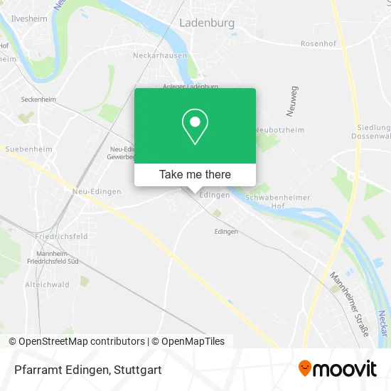
See Pfarramt Edingen, Edingen-Neckarhausen, on the map
Public Transit to Pfarramt Edingen in Edingen-Neckarhausen
Wondering how to get to Pfarramt Edingen in Edingen-Neckarhausen? Moovit helps you find the best way to get to Pfarramt Edingen with step-by-step directions from the nearest public transit station.
Moovit provides free maps and live directions to help you navigate through your city. View schedules, routes, timetables, and find out how long does it take to get to Pfarramt Edingen in real time.
Looking for the nearest stop or station to Pfarramt Edingen? Check out this list of stops closest to your destination: Edingen; Pfälzer Hof; Edingen Bahnhof; Edingen; Edingen.
Train: RB68, RE60, S12, S3.Light Rail: 5, RNV 5.Bus: RNV 35, RNV 42, 42.
Want to see if there’s another route that gets you there at an earlier time? Moovit helps you find alternative routes or times. Get directions from and directions to Pfarramt Edingen easily from the Moovit App or Website.
We make riding to Pfarramt Edingen easy, which is why over 1.5 million users, including users in Edingen-Neckarhausen, trust Moovit as the best app for public transit. You don’t need to download an individual bus app or train app, Moovit is your all-in-one transit app that helps you find the best bus time or train time available.
For information on prices of light rail, bus and train, costs and ride fares to Pfarramt Edingen, please check the Moovit app.
Use the app to navigate to popular places including to the airport, hospital, stadium, grocery store, mall, coffee shop, school, college, and university.
Pfarramt Edingen Address: Gartenstraße 22 Edingen, 68535 Edingen-Neckarhausen street in Edingen-Neckarhausen
- Heidelberg,
- Kath. Pfarramt St. Bruder Klaus,
- St. Bruder Klaus,
- Kindergarten St. Martin,
- Katholisches Pfarrheim,
- Katholischer Kindergarten St. Martin,
- Anne Rinklin,
- Sabine Wingold,
- Winterbauer,
- Josef Angerer Heilpraktikerschule München,
- Katholische Bibliothek,
- Calla Décoration,
- Martin Luther Kindergarten,
- Sonnenhaus,
- Freiwillige Feuerwehr Edingen-Neckarhausen,
- DRK Ortsverein Edingen,
- Sporthalle,
- Il Bagno das Bad GmbH Mario Morsellino,
- Tho-Pa,
- Vincenzo Carus
Places Near Pfarramt Edingen (Edingen-Neckarhausen)
- Hauptbahnhof Stuttgart, Stuttgart-Mitte,
- Porsche-Arena, Bad Cannstatt,
- Pariser Platz Stuttgart, Stuttgart-Mitte,
- Mercedes-Benz Museum (Mercedes Museum Stuttgart), Bad Cannstatt,
- FlixBus Haltestelle, Stuttgart,
- Schleyerhalle, Bad Cannstatt,
- Hanns-Martin-Schleyer-Halle, Bad Cannstatt,
- Geilhaus Haus 33a, Reutlingen-Betzingen,
- Gleis 101/102 (tief), Stuttgart-Mitte,
- Klinikum Stuttgart - Katharinenhospital, Stuttgart-Mitte,
- Wilhelma (U-Bahn Wilhelma), Bad Cannstatt,
- Porsche Museum, Zuffenhausen,
- Mettingen Eros-Center Puff Laufhaus, Esslingen Am Neckar,
- SI-Centrum, Möhringen,
- Im Wizemann (Halle), Bad Cannstatt,
- Hanns-Martin-Schleyer-Halle (Stuttgart Hans-Martin-Schleyerhalle), Bad Cannstatt,
- Waldfriedhof, Degerloch,
- Marmorsaal Im Weissenburgpark, Stuttgart-Süd,
- Mercedes-Benz Museum, Bad Cannstatt,
- Gasometer Pforzheim, Pforzheim
How to get to popular places in Stuttgart with public transit
Get around Edingen-Neckarhausen by public transit!
Traveling around Edingen-Neckarhausen has never been so easy. See step by step directions as you travel to any attraction, street or major public transit station. View bus and train schedules, arrival times, service alerts and detailed routes on a map, so you know exactly how to get to anywhere in Edingen-Neckarhausen.
When traveling to any destination around Edingen-Neckarhausen use Moovit's Live Directions with Get Off Notifications to know exactly where and how far to walk, how long to wait for your line, and how many stops are left. Moovit will alert you when it's time to get off — no need to constantly re-check whether yours is the next stop.
Wondering how to use public transit in Edingen-Neckarhausen or how to pay for public transit in Edingen-Neckarhausen? Moovit public transit app can help you navigate your way with public transit easily, and at minimum cost. It includes public transit fees, ticket prices, and costs. Looking for a map of Edingen-Neckarhausen public transit lines? Moovit public transit app shows all public transit maps in Edingen-Neckarhausen with all Bus, Train, Subway, Light Rail, Ferry, S-Bahn and Funicular routes and stops on an interactive map.
Stuttgart has 7 transit type(s), including: Bus, Train, Subway, Light Rail, Ferry, S-Bahn and Funicular, operated by several transit agencies, including SSB - Stadtbahn, SSB, SSB - Seilbahn / Zacke, S-Bahn Stuttgart, Rhein-Neckar-Verkehr GmbH (rnv), Karlsruher Verkehrsverbund, DB AG, DB Regiobus BW, Arverio Baden-Württemberg GmbH, DB RegioNetz Verkehrs GmbH Westfrankenbahn, DB Regio AG Baden-Württemberg, Südwestdeutsche Verkehrs-AG, DB Regio AG Mitte Region Hessen, DB and Bodensee-Oberschwaben-Bahn