How to get to Pfc-Hrm by bus?
Click on the bus route to see step by step directions with maps, line arrival times and updated time schedules.
From La Croqueteria de Moya, Moya
76 minFrom Bodega Los Berrazales, Agaete
50 minFrom Bañaderos, Arucas
45 minFrom Piscinas Naturales Agaete, Agaete
36 minFrom Restaurante Mesón Los Chorros, Firgas
108 minFrom El Puertillo de Bañaderos, Arucas
42 minFrom Los Charcones, Arucas
44 minFrom Moya, Moya
67 minFrom Consulta Médica de Medicina General José Eladio Pérez Moreno, Santa Mar�De Gu�De Gran Canaria
52 min
Bus stops near Pfc-Hrm in G�Ar
Bus lines to Pfc-Hrm in G�Ar
- GF-L4, Bocabarranco Terminal,VIEW
- AL-L6, Gáldar (El 99) - La Montaña - Gáldar (El 99) - (circular),VIEW
- GL-L401, 401/007 - H - Sta.Mª Guía (Por Gáldar),VIEW
- GL-L402, 199 - C - Sardina del Norte (Por Barrial - Cumbrecillas - Bco del Vino),VIEW
- GL-L404, 404/001 - B - Gáldar,VIEW
- GF-L1, Esq. Nicolas Aguiar (por La Atalaya),VIEW
- 101, San Nicolás (Almacén De Los Picos),VIEW
- 103, Puerto De Las Nieves,VIEW
- 106, Barranco Hondo,VIEW
- 108, Gáldar (Estacion De Guaguas),VIEW
- GL-L101, 187 - A - San Nicolás de Tolentino,VIEW
- GL-L102, 102/016 - C - Valle de Agaete (Por Puerto de Las Nieves),VIEW
- GL-L103, 103/036 - A - Puerto de Las Nieves (Por Gáldar),VIEW
- GL-L106, C - Barranco Hondo,VIEW
- GL-L108, 125 - A - Marmolejos,VIEW
- GL-L403, 403/002 - C - Punta de Gáldar (Por Barrial - Dos Roques - La Furnia),VIEW
- 325, Ingeniería (Campus Tafira),VIEW
- GL-L325, D - Campus Universitario,VIEW
- GF-L2, Galdar ,VIEW
What are the closest stations to Pfc-Hrm?
The closest stations to Pfc-Hrm are:
- Esq Dulceria El Cisne is 313 meters away, 5 min walk.
- C/ Cristóbal Colon 1 is 488 meters away, 7 min walk.
- Policía Local is 527 meters away, 7 min walk.
- C/Calvario-Esq Miguel Mujica is 533 meters away, 7 min walk.
- Seat (Servicios) is 550 meters away, 8 min walk.
- Galdar is 669 meters away, 9 min walk.
Which bus lines stop near Pfc-Hrm?
These bus lines stop near Pfc-Hrm: GL-L102, GL-L103, GL-L105, GL-L107.
What’s the nearest bus station to Pfc-Hrm in G�Ar?
The nearest bus station to Pfc-Hrm in G�Ar is Esq Dulceria El Cisne. It’s a 5 min walk away.
What time is the first bus to Pfc-Hrm in G�Ar?
The GL-L103 is the first bus that goes to Pfc-Hrm in G�Ar. It stops nearby at 6:00 AM.
What time is the last bus to Pfc-Hrm in G�Ar?
The GL-L103 is the last bus that goes to Pfc-Hrm in G�Ar. It stops nearby at 11:49 PM.
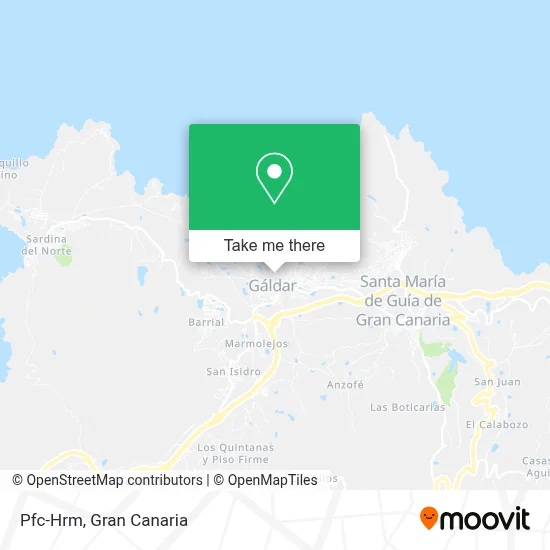
See Pfc-Hrm, G�Ar, on the map
Public Transit to Pfc-Hrm in G�Ar
Wondering how to get to Pfc-Hrm in G�Ar? Moovit helps you find the best way to get to Pfc-Hrm with step-by-step directions from the nearest public transit station.
Moovit provides free maps and live directions to help you navigate through your city. View schedules, routes, timetables, and find out how long does it take to get to Pfc-Hrm in real time.
Looking for the nearest stop or station to Pfc-Hrm? Check out this list of stops closest to your destination: Esq Dulceria El Cisne; C/ Cristóbal Colon 1; Policía Local; C/Calvario-Esq Miguel Mujica; Seat (Servicios); Galdar.
Bus: GL-L102, GL-L103, GL-L105, GL-L107, GF-L4, AL-L6, GL-L401, GL-L402, GL-L404, GF-L1, 101, 103, 106, 108, GL-L101, 325, GL-L325.
Want to see if there’s another route that gets you there at an earlier time? Moovit helps you find alternative routes or times. Get directions from and directions to Pfc-Hrm easily from the Moovit App or Website.
We make riding to Pfc-Hrm easy, which is why over 1.5 million users, including users in G�Ar, trust Moovit as the best app for public transit. You don’t need to download an individual bus app or train app, Moovit is your all-in-one transit app that helps you find the best bus time or train time available.
For information on prices of bus, costs and ride fares to Pfc-Hrm, please check the Moovit app.
Use the app to navigate to popular places including to the airport, hospital, stadium, grocery store, mall, coffee shop, school, college, and university.
Pfc-Hrm Address: Calle Aymide Yacoán, 35460 Gáldar street in G�Ar
- La Bodeguita Ca'Juancri,
- Manteca Colorá,
- Teatro Consistorial de Gáldar,
- Bazar Doramas Galdar,
- Bahuau,
- Gestoria Trujillo y Asociados,
- García Delgado Inversiones,
- Bajitierra,
- Once,
- Prebel,
- Bloque Nacionalista Rural - Nueva Canarias,
- Restaurante Pedadogico Cenobio Valeron,
- Bio-Drago T.I.S.,
- Licencia Municipal,
- Clínica Oftalmológica Albión,
- Consulta Médica de Pediatria,
- Supermercado Atlante,
- Asinor Asesoría Integral de Empresas,
- Nesal Gestores S.L.,
- The Yellow House Climatized Poolsolariumparking. Vivienda Vacacional.
Places Near Pfc-Hrm (G�Ar)
- C.C. El Mirador, Las Palmas De Gran Canaria,
- Centro Comercial Las Arenas, Las Palmas De Gran Canaria,
- IKEA Gran Canaria, Telde,
- Alcampo, Telde,
- Hospital Militar, Las Palmas De Gran Canaria,
- Mogán Mall, Mog�30,
- Cocodrilo Park, Agüimes,
- Vegueta, Las Palmas De Gran Canaria,
- Los Alisios, Las Palmas De Gran Canaria,
- Terminal Naviera Armas, Las Palmas De Gran Canaria,
- La Minilla, Las Palmas De Gran Canaria,
- C.C. Alisios, Las Palmas De Gran Canaria,
- Centro Comercial Las Terrazas, Telde,
- Tanatorio De San Miguel, Las Palmas De Gran Canaria,
- Estadio de Gran Canaria, Las Palmas De Gran Canaria,
- Hospital Dr. Negrín, Las Palmas De Gran Canaria,
- Ferry Bus Armas, Las Palmas De Gran Canaria,
- Centro Comercial Alcampo, Telde,
- CC Las Terrazas, Las Palmas De Gran Canaria,
- Consulta de Traumatología y Cirugía Ortopédica Dr. Juan S Ojeda Castellano, Santa Luc�De Tirajana
How to get to popular places in Gran Canaria with public transit
Get around G�Ar by public transit!
Traveling around G�Ar has never been so easy. See step by step directions as you travel to any attraction, street or major public transit station. View bus and train schedules, arrival times, service alerts and detailed routes on a map, so you know exactly how to get to anywhere in G�Ar.
When traveling to any destination around G�Ar use Moovit's Live Directions with Get Off Notifications to know exactly where and how far to walk, how long to wait for your line, and how many stops are left. Moovit will alert you when it's time to get off — no need to constantly re-check whether yours is the next stop.
Wondering how to use public transit in G�Ar or how to pay for public transit in G�Ar? Moovit public transit app can help you navigate your way with public transit easily, and at minimum cost. It includes public transit fees, ticket prices, and costs. Looking for a map of G�Ar public transit lines? Moovit public transit app shows all public transit maps in G�Ar with all bus routes and stops on an interactive map.
Gran Canaria has 1 transit type(s), including: bus, operated by several transit agencies, including GLOBAL (AUTGC), GLOBAL Salcai-Utinsa S.A.L., GUAGUAS (AUTGC), Guaguas Municipales, PARDILLA BUS (AUTGC), TELBUS (AUTGC) and ALSA-GUMIDAFE (AUTGC)