How to get to Pferdeviertel by bus?
Click on the bus route to see step by step directions with maps, line arrival times and updated time schedules.
How to get to Pferdeviertel by train?
Click on the train route to see step by step directions with maps, line arrival times and updated time schedules.
Light Rail stations near Pferdeviertel in Dresden
- Halle (Saale), Hyazinthenstr., 5 min walk,VIEW
Bus stops near Pferdeviertel in Dresden
Bus lines to Pferdeviertel in Dresden
- 40, Betriebshof Obs,VIEW
- 21, HAVAG gesperrt - Halle (Saale), Kröllwitz,VIEW
- 36, Halle (Saale), Heide-Universitätsklinikum - Zscherben, Schmiede,VIEW
- 42, Halle (Saale), Gartenstadt Nietleben - Halle (Saale), Friedhof Neustadt,VIEW
- 91, Halle (Saale), Göttinger Bogen - Halle (Saale), Am Steintor,VIEW
- 309, Halle (Saale), Hauptbahnhof/ZOB - Schochwitz, Schloßplatz,VIEW
- 312, Halle (Saale), Hauptbahnhof/ZOB - Querfurt, ZOB,VIEW
- 320, Halle (Saale), Hauptbahnhof/ZOB - Bad Lauchstädt, Markt,VIEW
- 380, Köllme, Am Winkel - Halle (Saale), Hauptbahnhof/ZOB,VIEW
- 381, Lieskau, Steinbruchweg - Halle (Saale), Hauptbahnhof/ZOB,VIEW
- X2, Halle (Saale), Hauptbahnhof/ZOB - Halle (Saale), Hans-Dietrich-Genscher-Str.,VIEW
- 34, Halle (Saale), Südpark,VIEW
- 97, Halle (Saale), Heide-Nord,VIEW
- 35, Betriebshof Obs,VIEW
- 22, Halle (Saale), Kröllwitz,VIEW
What are the closest stations to Pferdeviertel?
The closest stations to Pferdeviertel are:
- Halle (Saale), Hyazinthenstr. is 336 meters away, 5 min walk.
- Halle (Saale), Haflingerstr. is 350 meters away, 5 min walk.
- Halle (Saale), An Der Feuerwache is 423 meters away, 6 min walk.
- Halle (Saale), Rennbahnkreuz is 851 meters away, 12 min walk.
Which bus lines stop near Pferdeviertel?
These bus lines stop near Pferdeviertel: 052, 21, 312, 36, 381.
Which train line stops near Pferdeviertel?
S3 (Halle-Nietleben)
Which light rail lines stop near Pferdeviertel?
These light rail lines stop near Pferdeviertel: 10, 2, 4, 9.
What’s the nearest light rail station to Pferdeviertel in Dresden?
The nearest light rail station to Pferdeviertel in Dresden is Halle (Saale), Hyazinthenstr.. It’s a 5 min walk away.
What’s the nearest bus station to Pferdeviertel in Dresden?
The nearest bus station to Pferdeviertel in Dresden is Halle (Saale), Haflingerstr.. It’s a 5 min walk away.
What time is the first light rail to Pferdeviertel in Dresden?
The E is the first light rail that goes to Pferdeviertel in Dresden. It stops nearby at 3:47 AM.
What time is the last light rail to Pferdeviertel in Dresden?
The E is the last light rail that goes to Pferdeviertel in Dresden. It stops nearby at 1:19 AM.
What time is the first bus to Pferdeviertel in Dresden?
The 91 is the first bus that goes to Pferdeviertel in Dresden. It stops nearby at 3:18 AM.
What time is the last bus to Pferdeviertel in Dresden?
The 97 is the last bus that goes to Pferdeviertel in Dresden. It stops nearby at 3:34 AM.
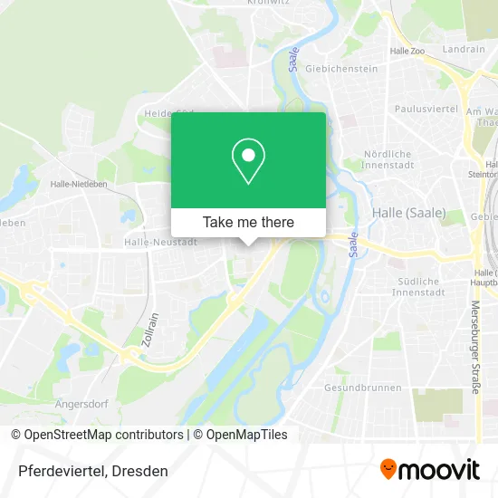
See Pferdeviertel, Dresden, on the map
Public Transit to Pferdeviertel in Dresden
Wondering how to get to Pferdeviertel in Dresden? Moovit helps you find the best way to get to Pferdeviertel with step-by-step directions from the nearest public transit station.
Moovit provides free maps and live directions to help you navigate through your city. View schedules, routes, timetables, and find out how long does it take to get to Pferdeviertel in real time.
Looking for the nearest stop or station to Pferdeviertel? Check out this list of stops closest to your destination: Halle (Saale); Halle (Saale); Halle (Saale); Halle (Saale).
Bus: 052, 21, 312, 36, 381, 40, 42, 91, 309, 34, 97, 35, 22.Train: S3.Light Rail: 10, 2, 4, 9.
Want to see if there’s another route that gets you there at an earlier time? Moovit helps you find alternative routes or times. Get directions from and directions to Pferdeviertel easily from the Moovit App or Website.
We make riding to Pferdeviertel easy, which is why over 1.5 million users, including users in Dresden, trust Moovit as the best app for public transit. You don’t need to download an individual bus app or train app, Moovit is your all-in-one transit app that helps you find the best bus time or train time available.
For information on prices of bus, light rail and train, costs and ride fares to Pferdeviertel, please check the Moovit app.
Use the app to navigate to popular places including to the airport, hospital, stadium, grocery store, mall, coffee shop, school, college, and university.
Pferdeviertel Address: Traberstraße street in Dresden
- Gwg Servicewohnen 60plus,
- Kindertagesstätte Goldener Gockel,
- Park am Stein,
- Creativworker,
- AWO Erziehungshilfe Halle,
- Awo Halle-Merseburg,
- Gwg City Apartments II,
- Lmh Heimtier,
- Halle Klempner Notdienst,
- Mobilblitz Filiale Saale Center Halle,
- Schäfer's,
- Tabakbörse Neubauer,
- Monika Rockrohr,
- Clever Fit Halle-Neustadt,
- Fotofix,
- Ergotherapie im Saale-Center,
- Postfiliale,
- Fahrschule Dri,
- Dipl.Psych. Almut Köppelochmann,
- Dz Bank AG Deutsche Zentral Genossenschaftsbank
Places Near Pferdeviertel (Dresden)
- Freilichtbühne Junge Garde, Dresden,
- Altstadt, Dresden,
- Carolaschlösschen, Dresden,
- Amedia Hotel Dresden Elbpromenade, Dresden,
- Kaufpark Dresden-Nickern, Dresden,
- Landschloß Zuschendorf, Pirna,
- Hans-Erlwein-Gymnasium, Dresden,
- Weisser Hirsch, Dresden,
- Elbepark, Dresden,
- Pfunds Molkerei, Dresden,
- Dresden, Hauptbahnhof (Strehlener Straße), Dresden,
- Oskarshausen, Freital,
- Schloss Pillnitz, Dresden,
- Schloß Übigau, Dresden,
- Biergarten "Gohliser Windmühle", Dresden,
- Dresden Hbf, Dresden,
- Ikea, Dresden,
- Waldmax, Dresden,
- Heinz-Steyer-Stadion, Dresden,
- Krankenhaus St. Joseph-Stift, Dresden
How to get to popular places in Dresden with public transit
Get around Dresden by public transit!
Traveling around Dresden has never been so easy. See step by step directions as you travel to any attraction, street or major public transit station. View bus and train schedules, arrival times, service alerts and detailed routes on a map, so you know exactly how to get to anywhere in Dresden.
When traveling to any destination around Dresden use Moovit's Live Directions with Get Off Notifications to know exactly where and how far to walk, how long to wait for your line, and how many stops are left. Moovit will alert you when it's time to get off — no need to constantly re-check whether yours is the next stop.
Wondering how to use public transit in Dresden or how to pay for public transit in Dresden? Moovit public transit app can help you navigate your way with public transit easily, and at minimum cost. It includes public transit fees, ticket prices, and costs. Looking for a map of Dresden public transit lines? Moovit public transit app shows all public transit maps in Dresden with all Bus, Train, Light Rail, Ferry, Cable Car and Gondola routes and stops on an interactive map.
Dresden has 6 transit type(s), including: Bus, Train, Light Rail, Ferry, Cable Car and Gondola, operated by several transit agencies, including Trilex, DB AG - S-Bahn, DVB AG, alita, RVSOE, Müller.Bus.Reisen, SATRA Eberhardt, VGM, RBO, DB AG, MRB, SDG, Sächsisch-Oberlausitzer Eisenbahngesellschaft, DB Fernverkehr (Codesharing) and Hanseatische Eisenbahn GmbH
Public transit lines with stations closest to Pferdeviertel in Dresden
Bus lines with stations closest to Pferdeviertel in Dresden
Halle (Saale), An Der Feuerwache
 21HAVAG gesperrt - Halle (Saale), Kröllwitz
- 36Halle (Saale), Heide-Universitätsklinikum - Zscherben, Schmiede
- 42Halle (Saale), Gartenstadt Nietleben - Halle (Saale), Friedhof Neustadt
- 91Halle (Saale), Göttinger Bogen - Halle (Saale), Am Steintor
- 309Halle (Saale), Hauptbahnhof/ZOB - Schochwitz, Schloßplatz