How to get to Phoutt Chantha by bus?
Click on the bus route to see step by step directions with maps, line arrival times and updated time schedules.
From Pflanzen Mauk, Verwaltungsgemeinschaft Lauffen am Neckar
105 minFrom Heilbronner Straße 86, Verwaltungsgemeinschaft Brackenheim
120 minFrom Karl-Wüst-Brücke, Heilbronn
46 minFrom Kaufland, Mosbach
75 minFrom Kölle-Zoo, Heilbronn
47 minFrom Eroscenter Heilbronn, Heilbronn
33 minFrom Theresienwiese, Heilbronn
32 minFrom Gaffenberg, Heilbronn
118 minFrom Antalya Pizza & Kebaphaus, Verwaltungsgemeinschaft Eppingen
83 minFrom Knorr, Heilbronn
59 min
How to get to Phoutt Chantha by train?
Click on the train route to see step by step directions with maps, line arrival times and updated time schedules.
Bus stops near Phoutt Chantha in Untereisesheim
Train stations near Phoutt Chantha in Untereisesheim
Bus lines to Phoutt Chantha in Untereisesheim
- 694, Neckarsulm, Realschule,VIEW
- 602R, Bad Friedrichshall-Kochendorf - Bad Friedrichshall-Kochendorf,VIEW
- 691R, Bad Friedrichshall-Kochendorf - Bad Friedrichshall-Kochendorf,VIEW
- MEX 12, Bietigheim Gleis 10 - Heilbronn Hauptbahnhof Gleis 4,VIEW
- MEX 18, Tübingen Hauptbahnhof - Osterburken, Bahnhof,VIEW
- S41, Heilbronn Hbf/Willy-Brandt-Pl. - Mosbach, Bahnhof,VIEW
- S42, Sinsheim, Hauptbahnhof - Heilbronn Hbf/Willy-Brandt-Pl.,VIEW
- 625, Neckarsulm, Audi Werk A13/A15,VIEW
What are the closest stations to Phoutt Chantha?
The closest stations to Phoutt Chantha are:
- Untereisesheim, Mitte is 317 meters away, 5 min walk.
- Bad Friedrichshall-Kochendorf is 1147 meters away, 15 min walk.
- Kochendorf, Gif is 1761 meters away, 23 min walk.
- Neckarsulm Nord Gleis 2 is 3433 meters away, 44 min walk.
Which train lines stop near Phoutt Chantha?
These train lines stop near Phoutt Chantha: S41, S42.
Which bus lines stop near Phoutt Chantha?
These bus lines stop near Phoutt Chantha: 691, 691R, 694.
What’s the nearest train station to Phoutt Chantha in Untereisesheim?
The nearest train station to Phoutt Chantha in Untereisesheim is Bad Friedrichshall-Kochendorf. It’s a 15 min walk away.
What’s the nearest bus station to Phoutt Chantha in Untereisesheim?
The nearest bus station to Phoutt Chantha in Untereisesheim is Untereisesheim, Mitte. It’s a 5 min walk away.
What time is the first light rail to Phoutt Chantha in Untereisesheim?
The S42 is the first light rail that goes to Phoutt Chantha in Untereisesheim. It stops nearby at 4:53 AM.
What time is the last light rail to Phoutt Chantha in Untereisesheim?
The S41 is the last light rail that goes to Phoutt Chantha in Untereisesheim. It stops nearby at 12:53 AM.
What time is the first train to Phoutt Chantha in Untereisesheim?
The S42 is the first train that goes to Phoutt Chantha in Untereisesheim. It stops nearby at 4:53 AM.
What time is the last train to Phoutt Chantha in Untereisesheim?
The S41 is the last train that goes to Phoutt Chantha in Untereisesheim. It stops nearby at 12:51 AM.
What time is the first bus to Phoutt Chantha in Untereisesheim?
The 625 is the first bus that goes to Phoutt Chantha in Untereisesheim. It stops nearby at 5:37 AM.
What time is the last bus to Phoutt Chantha in Untereisesheim?
The 694 is the last bus that goes to Phoutt Chantha in Untereisesheim. It stops nearby at 11:55 PM.
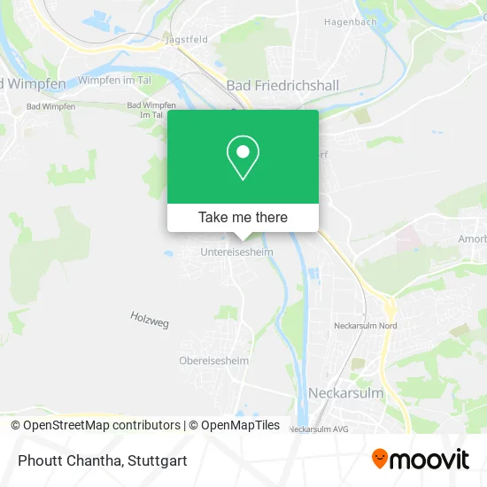
See Phoutt Chantha, Untereisesheim, on the map
Public Transit to Phoutt Chantha in Untereisesheim
Wondering how to get to Phoutt Chantha in Untereisesheim? Moovit helps you find the best way to get to Phoutt Chantha with step-by-step directions from the nearest public transit station.
Moovit provides free maps and live directions to help you navigate through your city. View schedules, routes, timetables, and find out how long does it take to get to Phoutt Chantha in real time.
Looking for the nearest stop or station to Phoutt Chantha? Check out this list of stops closest to your destination: Untereisesheim, Mitte; Bad Friedrichshall-Kochendorf; Kochendorf; Neckarsulm Nord Gleis 2.
Train: S41, S42, MEX12, MEX18, MEX12, MEX18, RE 10A.Bus: 691, 691R, 694, 602R, MEX 12, MEX 18, S41.
Want to see if there’s another route that gets you there at an earlier time? Moovit helps you find alternative routes or times. Get directions from and directions to Phoutt Chantha easily from the Moovit App or Website.
We make riding to Phoutt Chantha easy, which is why over 1.5 million users, including users in Untereisesheim, trust Moovit as the best app for public transit. You don’t need to download an individual bus app or train app, Moovit is your all-in-one transit app that helps you find the best bus time or train time available.
For information on prices of bus and train, costs and ride fares to Phoutt Chantha, please check the Moovit app.
Use the app to navigate to popular places including to the airport, hospital, stadium, grocery store, mall, coffee shop, school, college, and university.
Phoutt Chantha Address: Neckarstraße 49 74257 Untereisesheim street in Untereisesheim
- TSV Untereisesheim,
- Heiko Röthling Hausmeisterservice,
- Dallmann,
- Tsv-Sportheim (By Costa),
- Tsv-Sportheim,
- Sportgaststätte Untereisesheim,
- Isolde Otto,
- Steffen Schleicher - Huk-Coburg Versicherung,
- Grundschule Untereisesheim,
- Regina Schiele-Atalay,
- Andrea Walderich Office,
- Gemeindebücherei Untereisesheim,
- Bücherei,
- Zahnarztpraxis dr Mich,
- Dr. med. dent. Peter Bind,
- Gemeindeverwaltung Untereisesheim Bauamt,
- Adelheid Ott Hausverwaltung und Wohnbau,
- Untereisesheim Durtal,
- Rathaus,
- Kriegerdenkmal
Places Near Phoutt Chantha (Untereisesheim)
- Gasometer Pforzheim, Pforzheim,
- Hauptbahnhof Stuttgart, Stuttgart-Mitte,
- Geilhaus Haus 33a, Reutlingen-Betzingen,
- Klinikum Stuttgart - Katharinenhospital, Stuttgart-Mitte,
- Mercedes-Benz Museum, Bad Cannstatt,
- Gleis 101/102 (tief), Stuttgart-Mitte,
- Pariser Platz Stuttgart, Stuttgart-Mitte,
- Im Wizemann (Halle), Bad Cannstatt,
- Marmorsaal Im Weissenburgpark, Stuttgart-Süd,
- Wilhelma (U-Bahn Wilhelma), Bad Cannstatt,
- Schleyerhalle, Bad Cannstatt,
- SI-Centrum, Möhringen,
- Waldfriedhof, Degerloch,
- Hanns-Martin-Schleyer-Halle, Bad Cannstatt,
- Mettingen Eros-Center Puff Laufhaus, Esslingen Am Neckar,
- Porsche Museum, Zuffenhausen,
- Mercedes-Benz Museum (Mercedes Museum Stuttgart), Bad Cannstatt,
- FlixBus Haltestelle, Stuttgart,
- Hanns-Martin-Schleyer-Halle (Stuttgart Hans-Martin-Schleyerhalle), Bad Cannstatt,
- Porsche-Arena, Bad Cannstatt
How to get to popular places in Stuttgart with public transit
Get around Untereisesheim by public transit!
Traveling around Untereisesheim has never been so easy. See step by step directions as you travel to any attraction, street or major public transit station. View bus and train schedules, arrival times, service alerts and detailed routes on a map, so you know exactly how to get to anywhere in Untereisesheim.
When traveling to any destination around Untereisesheim use Moovit's Live Directions with Get Off Notifications to know exactly where and how far to walk, how long to wait for your line, and how many stops are left. Moovit will alert you when it's time to get off — no need to constantly re-check whether yours is the next stop.
Wondering how to use public transit in Untereisesheim or how to pay for public transit in Untereisesheim? Moovit public transit app can help you navigate your way with public transit easily, and at minimum cost. It includes public transit fees, ticket prices, and costs. Looking for a map of Untereisesheim public transit lines? Moovit public transit app shows all public transit maps in Untereisesheim with all Bus, Train, Subway, Light Rail, Ferry, S-Bahn and Funicular routes and stops on an interactive map.
Stuttgart has 7 transit type(s), including: Bus, Train, Subway, Light Rail, Ferry, S-Bahn and Funicular, operated by several transit agencies, including SSB - Stadtbahn, SSB, SSB - Seilbahn / Zacke, S-Bahn Stuttgart, Rhein-Neckar-Verkehr GmbH (rnv), Karlsruher Verkehrsverbund, DB AG, DB Regiobus BW, Arverio Baden-Württemberg GmbH, DB RegioNetz Verkehrs GmbH Westfrankenbahn, DB Regio AG Baden-Württemberg, Südwestdeutsche Verkehrs-AG, DB Regio AG Mitte Region Hessen, DB and Bodensee-Oberschwaben-Bahn