How to get to Massimo D'Azeglio Square 35 by bus?
Click on the bus route to see step by step directions with maps, line arrival times and updated time schedules.
From Colossus of the Apennines, Vaglia
37 minFrom Don Gnocchi Hospital, Florence
33 minFrom Firenze Food Kiosk, Sesto Fiorentino
53 minFrom Falciani-Villa delle Terme Medical Center, Impruneta
50 minFrom Firenze North Service Area, Sesto Fiorentino
70 minFrom Bruno Buozzi Street, Campi Bisenzio
45 minFrom Madonna del Pagano Street, Florence
50 minFrom Florence North A1 Toll Gate, Campi Bisenzio
71 minFrom 19 San Bartolo Street, Florence
56 minFrom Asmana Wellness World Florence, Campi Bisenzio
59 min
Bus stops near Massimo D'Azeglio Square 35 in Florence
- Colonna Michelangiolo High School, 2 min walk,VIEW
- Donatello Square, 5 min walk,VIEW
- Donatello, 5 min walk,VIEW
- Annigoni Square, 6 min walk,VIEW
- Della Robbia La Farina, 7 min walk,VIEW
- Segni, 8 min walk,VIEW
- Gramsci Porta Alla Croce, 8 min walk,VIEW
- Gherardesca, 8 min walk,VIEW
- Gramsci Beccaria, 8 min walk,VIEW
Light Rail stations near Massimo D'Azeglio Square 35 in Florence
- Liberty - Parterre, 13 min walk,VIEW
Train station near Massimo D'Azeglio Square 35 in Florence
- Florence Campo di Marte, 20 min walk,VIEW
Bus lines to Massimo D'Azeglio Square 35 in Florence
- 6, Torre Galli Hospital,VIEW
- 14, Rocca Tedalda Villa Favard,VIEW
- 18, Tavarnuzze First of May,VIEW
- 23, Croce A Varliano,VIEW
- 31, Grassina Umberto I,VIEW
- 32, Partisan Brigade Gardens,VIEW
- 60, Montelungo Station,VIEW
- SI90, Bibbiena-Consuma-Florence,VIEW
- 322 A, Muraglione Pass-San Godenzo-Rufina-Pontassieve-Florence,VIEW
- 330 A, Fornello-Santa Brigida-Molino Del Piano-Florence,VIEW
- SI330, Arezzo-Montevarchi-San Giovanni Valdarno-Figline Valdarno-Florence,VIEW
- 343 A, Saltino-Vallombrosa-Pontassieve-Florence,VIEW
- 345 A, Florence-Pontassieve,VIEW
- 345BIS A, Pontassieve - Florence (Mascagni/Rosano),VIEW
- 350 A, Rignano sull'Arno-Pontassieve-Florence,VIEW
- 351 A, Montevarchi-Figline Valdarno-Incisa Valdarno-Florence,VIEW
- 353 A, Reggello-Figline Valdarno-Incisa Valdarno-Florence,VIEW
- 354 A, Figline Valdarno-Lucolena-San Polo-Florence,VIEW
- 357 A, Reggello-Rignano Sull'Arno-Pontassieve-Florence,VIEW
- 360 A, Montevarchi-Incisa Valdarno-Pontassieve-Florence,VIEW
What are the closest stations to Massimo D'Azeglio Square 35?
The closest stations to Massimo D'Azeglio Square 35 are:
- Colonna Michelangiolo High School is 139 meters away, 2 min walk.
- Donatello Square is 306 meters away, 5 min walk.
- Donatello is 366 meters away, 5 min walk.
- Annigoni Square is 450 meters away, 6 min walk.
- Della Robbia La Farina is 524 meters away, 7 min walk.
- Segni is 558 meters away, 8 min walk.
- Gramsci Porta Alla Croce is 582 meters away, 8 min walk.
- Gherardesca is 595 meters away, 8 min walk.
- Gramsci Beccaria is 597 meters away, 8 min walk.
- Liberty - Parterre is 980 meters away, 13 min walk.
- Florence Campo di Marte is 1482 meters away, 20 min walk.
Which bus lines stop near Massimo D'Azeglio Square 35?
These bus lines stop near Massimo D'Azeglio Square 35: 13, 17, 23, 32, 6.
What’s the nearest light rail station to Massimo D'Azeglio Square 35 in Florence?
The nearest light rail station to Massimo D'Azeglio Square 35 in Florence is Liberty - Parterre. It’s a 13 min walk away.
What’s the nearest train station to Massimo D'Azeglio Square 35 in Florence?
The nearest train station to Massimo D'Azeglio Square 35 in Florence is Florence Campo di Marte. It’s a 20 min walk away.
What’s the nearest bus station to Massimo D'Azeglio Square 35 in Florence?
The nearest bus station to Massimo D'Azeglio Square 35 in Florence is Colonna Michelangiolo High School. It’s a 2 min walk away.
What time is the first light rail to Massimo D'Azeglio Square 35 in Florence?
The T2 is the first light rail that goes to Massimo D'Azeglio Square 35 in Florence. It stops nearby at 5:02 AM.
What time is the last light rail to Massimo D'Azeglio Square 35 in Florence?
The T2 is the last light rail that goes to Massimo D'Azeglio Square 35 in Florence. It stops nearby at 12:36 AM.
What time is the first train to Massimo D'Azeglio Square 35 in Florence?
The R is the first train that goes to Massimo D'Azeglio Square 35 in Florence. It stops nearby at 6:06 AM.
What time is the last train to Massimo D'Azeglio Square 35 in Florence?
The R is the last train that goes to Massimo D'Azeglio Square 35 in Florence. It stops nearby at 11:39 PM.
What time is the first bus to Massimo D'Azeglio Square 35 in Florence?
The 17 is the first bus that goes to Massimo D'Azeglio Square 35 in Florence. It stops nearby at 5:38 AM.
What time is the last bus to Massimo D'Azeglio Square 35 in Florence?
The 14 is the last bus that goes to Massimo D'Azeglio Square 35 in Florence. It stops nearby at 1:24 AM.
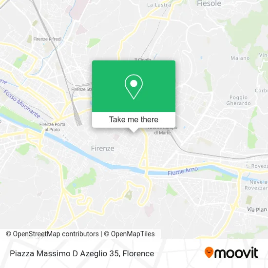
See Massimo D'Azeglio Square 35, Florence, on the map
Public Transit to Massimo D'Azeglio Square 35 in Florence
Wondering how to get to Massimo D'Azeglio Square 35 in Florence? Moovit helps you find the best way to get to Massimo D'Azeglio Square 35 with step-by-step directions from the nearest public transit station.
Moovit provides free maps and live directions to help you navigate through your city. View schedules, routes, timetables, and find out how long does it take to get to Massimo D'Azeglio Square 35 in real time.
Looking for the nearest stop or station to Massimo D'Azeglio Square 35? Check out this list of stops closest to your destination: Colonna Michelangiolo High School; Donatello Square; Donatello; Annigoni Square; Della Robbia La Farina; Segni; Gramsci Porta Alla Croce; Gherardesca; Gramsci Beccaria; Liberty - Parterre; Florence Campo di Marte.
Bus: 13, 17, 23, 32, 6, 14, 18, 31, SI90, 322 A, 330 A, SI330, 343 A, ST6, SI330, 360 A, 370 A, C2, C3, 8.Train: R, R, R, R, R.
Want to see if there’s another route that gets you there at an earlier time? Moovit helps you find alternative routes or times. Get directions from and directions to Massimo D'Azeglio Square 35 easily from the Moovit App or Website.
We make riding to Massimo D'Azeglio Square 35 easy, which is why over 1.5 million users, including users in Florence, trust Moovit as the best app for public transit. You don’t need to download an individual bus app or train app, Moovit is your all-in-one transit app that helps you find the best bus time or train time available.
For information on prices of bus and light rail, costs and ride fares to Massimo D'Azeglio Square 35, please check the Moovit app.
Use the app to navigate to popular places including to the airport, hospital, stadium, grocery store, mall, coffee shop, school, college, and university.
Location: Florence
- Castello Diffusion,
- Mg Development by Mirco Galeotti,
- D'Azeglio Square,
- Giuseppe Giusti Street 1,
- Giuseppe Giusti Street / Massimo D'Azeglio Square,
- Sebastiano Misericordia Foundation of Florence,
- Hotel Regency Small Luxury Hotels of the World Florence,
- Sert - Ufm Florence A - District 1,
- Isabella Fabrizia Ruffo of Calabria,
- Borgo Pinti 68,
- Geneva,
- Massimo D'Azeglio Square 18,
- Borgo Pinti / Via della Colonna,
- Massimo d'Azeglio Square / Giovan Battista Niccolini Street,
- Castelnuovo Scientific High School,
- Oreria,
- Church of Santa Maria Maddalena dei Pazzi,
- Stefano Ricci - Luxury Men's Clothing,
- D'Azeglio Parking,
- Vittorio Alfieri Street, 1
Places Near Massimo D'Azeglio Square 35 (Florence)
- I Gigli, Campi Bisenzio,
- Torregalli Hospital Scandicci *, Scandicci,
- Mandela Forum (Nelson Mandela Forum), Florence,
- Tobacco Manufacture, Florence,
- Michelangelo Square, Florence,
- Viola Park, Bagno a Ripoli,
- Verdi Theater, Florence,
- Santa Maria Nuova Hospital, Florence,
- Michelangelo Square, Florence,
- Asmana, Campi Bisenzio,
- OOO, Florence,
- IKEA Florence, Sesto Fiorentino,
- Field of Mars, Florence,
- Artemio Franchi Municipal Stadium, Florence,
- Wanny Palace, Florence,
- Piero Palagi Hospital Facility-Florence, Florence,
- Nelson Mandela Forum, Florence,
- Santa Maria Novella Station, Florence,
- Cascine Park, Florence,
- Campi Bisenzio, Campi Bisenzio
How to get to popular places in Florence with public transit
Get around Florence by public transit!
Traveling around Florence has never been so easy. See step by step directions as you travel to any attraction, street or major public transit station. View bus and train schedules, arrival times, service alerts and detailed routes on a map, so you know exactly how to get to anywhere in Florence.
When traveling to any destination around Florence use Moovit's Live Directions with Get Off Notifications to know exactly where and how far to walk, how long to wait for your line, and how many stops are left. Moovit will alert you when it's time to get off — no need to constantly re-check whether yours is the next stop.
Wondering how to use public transit in Florence or how to pay for public transit in Florence? Moovit public transit app can help you navigate your way with public transit easily, and at minimum cost. It includes public transit fees, ticket prices, and costs. Looking for a map of Florence public transit lines? Moovit public transit app shows all public transit maps in Florence with all Bus, Train, Light Rail, Ferry and Funicular routes and stops on an interactive map.
Florence has 5 transit type(s), including: Bus, Train, Light Rail, Ferry and Funicular, operated by several transit agencies, including Florence Urban - Tuscan Bus Lines, GEST, Florence and Province - Tuscan Bus Lines, Livorno and Province - Tuscan Bus Lines, Arezzo, Florence and Provinces - Tuscan Bus Lines, Prato and Province - Tuscan Bus Lines, Massa, Carrara and Province - Tuscan Bus Lines, Pisa and Province - Tuscan Bus Lines, Grosseto, Siena and Provinces - Tuscan Bus Lines, Arezzo, Siena and Provinces - Tuscan Bus Lines, Pistoia and Province - Tuscan Bus Lines, Siena and Province - Tuscan Bus Lines, Arezzo and Province - Tuscan Bus Lines, Lucca and Province - Tuscan Bus Lines and Trenitalia