Directions to Pimenta de Cheiro (Ermesinde) with public transportation
The following transit lines have routes that pass near Pimenta de Cheiro
 Bus: 5010, 701, 704, 705, 7011.
- Train: LINHA DE BRAGA, LINHA DE GUIMARAES, LINHA DO MARCO, LINHA DE LEIXOES, IR.
- Metro: F.
How to get to Pimenta de Cheiro by bus?
Click on the bus route to see step by step directions with maps, line arrival times and updated time schedules.
From Estação Do Metro De Pedras Rubras, Moreira
68 minFrom Aula Magna FMUP, Paranhos
30 minFrom Teatro Sá da Bandeira, Cedofeita, Santo Ildefonso, Sé, Miragaia, São Nicolau e Vitória
40 minFrom Instituto Português de Oncologia do Porto, Paranhos
30 minFrom Regimento de Transmissões (RTm), Ramalde
44 minFrom Hospital Pedro Hispano, São Mamede de Infesta e Senhora da Hora
47 minFrom Rua Beato Inácio de Azevedo 61, Ramalde
63 minFrom Hospital da Luz - Clínica do Porto, Ramalde
63 minFrom Parque de S. Roque, Campanhã
42 minFrom Hospital Pedro Hispano - Unidade Local de Saúde de Matosinhos, E.P.E., São Mamede de Infesta e Senhora da Hora
50 min
How to get to Pimenta de Cheiro by train?
Click on the train route to see step by step directions with maps, line arrival times and updated time schedules.
How to get to Pimenta de Cheiro by metro?
Click on the metro route to see step by step directions with maps, line arrival times and updated time schedules.
Bus stops near Pimenta de Cheiro in Ermesinde
Train stations near Pimenta de Cheiro in Ermesinde
Bus lines to Pimenta de Cheiro in Ermesinde
What are the closest stations to Pimenta de Cheiro?
The closest stations to Pimenta de Cheiro are:
- Ribeiro Teles is 12 meters away, 1 min walk.
- Joaquim Teixeira is 52 meters away, 2 min walk.
- J. F. Ermesinde is 202 meters away, 3 min walk.
- J.F. Ermesinde is 258 meters away, 4 min walk.
- Alberto Taborda is 289 meters away, 5 min walk.
- Loja Cidadão Ermesinde is 446 meters away, 7 min walk.
- São Gemil is 818 meters away, 11 min walk.
- Águas Santas / Palmilheira is 1835 meters away, 24 min walk.
- Ermesinde is 4806 meters away, 62 min walk.
Which bus lines stop near Pimenta de Cheiro?
These bus lines stop near Pimenta de Cheiro: 5010, 701, 704, 705.
Which train lines stop near Pimenta de Cheiro?
These train lines stop near Pimenta de Cheiro: LINHA DE BRAGA, LINHA DE GUIMARAES, LINHA DO MARCO.
Which metro line stops near Pimenta de Cheiro?
F (Fânzeres)
What’s the nearest train station to Pimenta de Cheiro in Ermesinde?
The nearest train station to Pimenta de Cheiro in Ermesinde is São Gemil. It’s a 11 min walk away.
What’s the nearest bus station to Pimenta de Cheiro in Ermesinde?
The nearest bus station to Pimenta de Cheiro in Ermesinde is Ribeiro Teles. It’s a 1 min walk away.
What time is the first train to Pimenta de Cheiro in Ermesinde?
The LINHA DO MARCO is the first train that goes to Pimenta de Cheiro in Ermesinde. It stops nearby at 3:03 AM.
What time is the last train to Pimenta de Cheiro in Ermesinde?
The LINHA DE BRAGA is the last train that goes to Pimenta de Cheiro in Ermesinde. It stops nearby at 1:11 AM.
What time is the first bus to Pimenta de Cheiro in Ermesinde?
The 705 is the first bus that goes to Pimenta de Cheiro in Ermesinde. It stops nearby at 6:09 AM.
What time is the last bus to Pimenta de Cheiro in Ermesinde?
The 8025 is the last bus that goes to Pimenta de Cheiro in Ermesinde. It stops nearby at 1:42 AM.
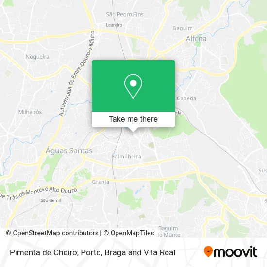
See Pimenta de Cheiro, Ermesinde, on the map
Public Transit to Pimenta de Cheiro in Ermesinde
Wondering how to get to Pimenta de Cheiro in Ermesinde? Moovit helps you find the best way to get to Pimenta de Cheiro with step-by-step directions from the nearest public transit station.
Moovit provides free maps and live directions to help you navigate through your city. View schedules, routes, timetables, and find out how long does it take to get to Pimenta de Cheiro in real time.
Looking for the nearest stop or station to Pimenta de Cheiro? Check out this list of stops closest to your destination: Ribeiro Teles; Joaquim Teixeira; J. F. Ermesinde; J.F. Ermesinde; Alberto Taborda; Loja Cidadão Ermesinde; São Gemil; Águas Santas / Palmilheira; Ermesinde.
Bus: 5010, 701, 704, 705, 7011, 7014, 7012.Train: LINHA DE BRAGA, LINHA DE GUIMARAES, LINHA DO MARCO, LINHA DE LEIXOES, IR, IR, IR, IR, IR.Metro: F.
Want to see if there’s another route that gets you there at an earlier time? Moovit helps you find alternative routes or times. Get directions from and directions to Pimenta de Cheiro easily from the Moovit App or Website.
We make riding to Pimenta de Cheiro easy, which is why over 1.5 million users, including users in Ermesinde, trust Moovit as the best app for public transit. You don’t need to download an individual bus app or train app, Moovit is your all-in-one transit app that helps you find the best bus time or train time available.
For information on prices of bus, train and metro, costs and ride fares to Pimenta de Cheiro, please check the Moovit app.
Use the app to navigate to popular places including to the airport, hospital, stadium, grocery store, mall, coffee shop, school, college, and university.
Pimenta de Cheiro Address: Rua José Joaquim Ribeiro Teles Ermesinde, 4445-485 Valongo street in Ermesinde
- Rua José Joaquim Ribeiro Teles 424,
- Restaurante Japonês Sakurai Sushi Bar Teppan Yaki,
- Era,
- O Baionês,
- Urban Clinic Ermesinde,
- Sakurai Sushi Bar,
- Restaurante Prova Real,
- Fátima Martins Cabeleireiros,
- Intermarché,
- Lidl,
- Restaurante Atlantiko,
- Sociedade Interbancaria de Serviços S a Sibs,
- Padaria Raiz Quadrada,
- Ka te Kero,
- Casa do Benfica Em Ermesinde,
- LavaZinde - Lavandaria Self-Service,
- BP Oil,
- Particularidade & Encanto-Restauração Lda,
- Chesterschool - Ensino de Línguas,
- Orisfaber - Mobiliário
Places Near Pimenta de Cheiro (Ermesinde)
- El Corte Inglés de Gaia, Mafamude e Vilar do Paraíso,
- Hospital de Santo António, Cedofeita, Santo Ildefonso, Sé, Miragaia, São Nicolau e Vitória,
- Canidelo, Vila Nova De Gaia,
- Zoo Santo Inácio, Vila Nova De Gaia,
- Valongo, Valongo,
- VILA do CONDE PORTO FASHION OUTLET, Modivas,
- Estádio do Dragão, Campanhã,
- Senhor de Matosinhos, Matosinhos e Leça da Palmeira,
- Parque Aquatico Amarante - Aqua Aventura, Amarante,
- Leça da Palmeira, Matosinhos e Leça da Palmeira,
- Acesso ao Shopping Parque Nascente, Campanhã,
- Hospital da Prelada, Ramalde,
- Rua Calouste Gulbenkian, Lordelo do Ouro e Massarelos,
- Hospital Santos Silva, Vila Nova De Gaia,
- MAR Shopping, Matosinhos e Leça da Palmeira,
- Avintes, Vila Nova De Gaia,
- Espinho, Espinho,
- Palácio de Cristal, Lordelo do Ouro e Massarelos,
- Maia, Maia,
- Arrábida Shopping, Santa Marinha e São Pedro da Afurada
How to get to popular places in Porto, Braga and Vila Real with public transit
Get around Ermesinde by public transit!
Traveling around Ermesinde has never been so easy. See step by step directions as you travel to any attraction, street or major public transit station. View bus and train schedules, arrival times, service alerts and detailed routes on a map, so you know exactly how to get to anywhere in Ermesinde.
When traveling to any destination around Ermesinde use Moovit's Live Directions with Get Off Notifications to know exactly where and how far to walk, how long to wait for your line, and how many stops are left. Moovit will alert you when it's time to get off — no need to constantly re-check whether yours is the next stop.
Wondering how to use public transit in Ermesinde or how to pay for public transit in Ermesinde? Moovit public transit app can help you navigate your way with public transit easily, and at minimum cost. It includes public transit fees, ticket prices, and costs. Looking for a map of Ermesinde public transit lines? Moovit public transit app shows all public transit maps in Ermesinde with all Bus, Train, Metro, Ferry, Funicular and Gondola routes and stops on an interactive map.
Porto, Braga and Vila Real has 6 transit type(s), including: Bus, Train, Metro, Ferry, Funicular and Gondola, operated by several transit agencies, including Metro do Porto, Metro do Porto - Metrobus, CP - Comboios de Portugal, STCP, UNIR Mobilidade da Area Metropolitana do Porto, Getbus - Aerobus, Mobiave, Valpibus, TUB - Transportes Urbanos de Braga, TuViana, Guimabus, Ave Mobilidade, Cávado Mobilidade, Transdev and Câmara Municipal de Santo Tirso