How to get to Pinguim Multiuso by bus?
Click on the bus route to see step by step directions with maps, line arrival times and updated time schedules.
From Cemitério De Campo Grande, Campo Grande
38 minFrom R. Eng. Trindade 429, Campo Grande
37 minFrom Estrada do Magarça, Campo Grande
23 minFrom BRT - Estação Ilha de Guaratiba, Guaratiba
19 minFrom Praia Da Barra De Guaratiba, Barra De Guaratiba
57 minFrom Estrada Do Campinho, Campo Grande
34 minFrom Vargem Grande, Vargem Grande
53 minFrom Estrada do Cabuçu, Campo Grande
39 minFrom Hospital Municipal Rocha Faria, Campo Grande
37 minFrom Sepetiba, Sepetiba
51 min
Bus stops near Pinguim Multiuso in Guaratiba
- Estrada Do Mato Alto, 8033-8043, 1 min walk,VIEW
- Posto De Saúde Dr. Maia Bittencourt (Fazenda Modelo), 3 min walk,VIEW
- Estrada Do Mato Alto, 7762 | Obom Atacadão, 5 min walk,VIEW
- Terminal Mato Alto, 5 min walk,VIEW
- Avenida Dom João VI / Terminal Mato Alto (Sentido Santa Cruz), 8 min walk,VIEW
- Terminal Mato Alto :: Lado Sul - Plataforma 1, 9 min walk,VIEW
- Terminal Mato Alto :: Lado Sul - Plataforma 2, 9 min walk,VIEW
Bus lines to Pinguim Multiuso in Guaratiba
- 853, Terminal Deodoro - Terminal Mato Alto (via Vila Kennedy / Posse),VIEW
- SV 853, Terminal Deodoro - Terminal Mato Alto (Via Mendanha / Vila Kennedy),VIEW
- 854, Terminal Campo Grande - BRT Ilha de Guaratiba (Via Cachamorra / Iaraquã),VIEW
- 856, Terminal Campo Grande - Capoeira Grande (via Piraquê),VIEW
- 857, Terminal Campo Grande - Terminal Pingo D'água (Via Cachamorra / Estrada do Catruz),VIEW
- SN 857, Terminal Campo Grande - BRT Pingo D'água (via Cachamorra / Estrada do Catruz),VIEW
- 866, Campo Grande - Pedra (Via Magarça),VIEW
- 867, Campo Grande - Barra de Guaratiba (Via Estrada da Ilha),VIEW
- SN 867, Campo Grande - Barra de Guaratiba (Via Estrada da Ilha),VIEW
- 883, Terminal Mato Alto - Terminal Deodoro (via Cachamorra),VIEW
- 2334, Campo Grande - Castelo (Brs 3 - Via Recreio / Copacabana),VIEW
- 2803, Vila Kennedy - Barra da Tijuca (Via Posse),VIEW
- 2804, Bangu - Barra da Tijuca (Via Cachamorra),VIEW
- 820, Terminal Mato Alto,VIEW
- 852, Campo Grande ↔ Pedra (Via Mato Alto),VIEW
- 10, Santa Cruz,VIEW
- 11, Santa Cruz (Parador),VIEW
- 12, Alvorada,VIEW
- 13, Alvorada (Expresso),VIEW
- 15, Terminal Curral Falso ,VIEW
What are the closest stations to Pinguim Multiuso?
The closest stations to Pinguim Multiuso are:
- Estrada Do Mato Alto, 8033-8043 is 23 meters away, 1 min walk.
- Posto De Saúde Dr. Maia Bittencourt (Fazenda Modelo) is 188 meters away, 3 min walk.
- Estrada Do Mato Alto, 7762 | Obom Atacadão is 311 meters away, 5 min walk.
- Terminal Mato Alto is 330 meters away, 5 min walk.
- Avenida Dom João VI / Terminal Mato Alto (Sentido Santa Cruz) is 578 meters away, 8 min walk.
- Terminal Mato Alto :: Lado Sul - Plataforma 1 is 638 meters away, 9 min walk.
- Terminal Mato Alto :: Lado Sul - Plataforma 2 is 663 meters away, 9 min walk.
Which bus lines stop near Pinguim Multiuso?
These bus lines stop near Pinguim Multiuso: 10, 13, 2334, 2803, 2804, 857, 867.
What’s the nearest bus station to Pinguim Multiuso in Guaratiba?
The nearest bus station to Pinguim Multiuso in Guaratiba is Estrada Do Mato Alto, 8033-8043. It’s a 1 min walk away.
What time is the first bus to Pinguim Multiuso in Guaratiba?
The 883 is the first bus that goes to Pinguim Multiuso in Guaratiba. It stops nearby at 3:00 AM.
What time is the last bus to Pinguim Multiuso in Guaratiba?
The 866 is the last bus that goes to Pinguim Multiuso in Guaratiba. It stops nearby at 3:26 AM.
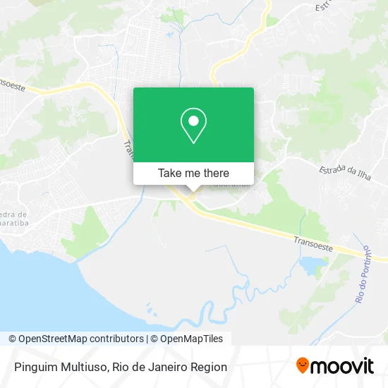
See Pinguim Multiuso, Guaratiba, on the map
Public Transit to Pinguim Multiuso in Guaratiba
Wondering how to get to Pinguim Multiuso in Guaratiba? Moovit helps you find the best way to get to Pinguim Multiuso with step-by-step directions from the nearest public transit station.
Moovit provides free maps and live directions to help you navigate through your city. View schedules, routes, timetables, and find out how long does it take to get to Pinguim Multiuso in real time.
Looking for the nearest stop or station to Pinguim Multiuso? Check out this list of stops closest to your destination: Estrada Do Mato Alto; Posto De Saúde Dr. Maia Bittencourt (Fazenda Modelo); Estrada Do Mato Alto; Terminal Mato Alto; Avenida Dom João VI / Terminal Mato Alto (Sentido Santa Cruz); Terminal Mato Alto :: Lado Sul - Plataforma 1; Terminal Mato Alto :: Lado Sul - Plataforma 2.
Bus: 10, 13, 2334, 2803, 2804, 857, 867, 853, SV 853, 854, 856, 820, 852, 11, 12, 15, 460S (EXECUTIVO), 2335, 2337, 2338, 2802, 872.
Want to see if there’s another route that gets you there at an earlier time? Moovit helps you find alternative routes or times. Get directions from and directions to Pinguim Multiuso easily from the Moovit App or Website.
We make riding to Pinguim Multiuso easy, which is why over 1.5 million users, including users in Guaratiba, trust Moovit as the best app for public transit. You don’t need to download an individual bus app or train app, Moovit is your all-in-one transit app that helps you find the best bus time or train time available.
For information on prices of bus, costs and ride fares to Pinguim Multiuso, please check the Moovit app.
Use the app to navigate to popular places including to the airport, hospital, stadium, grocery store, mall, coffee shop, school, college, and university.
Pinguim Multiuso Address: Estrada do Mato Alto, 499 Guaratiba Rio de Janeiro-RJ 23030-320 street in Guaratiba
- Condomínio Reserva da Praia III,
- Casa da Mineira,
- Sítio Marron Glacê,
- Expresso Manauara,
- Rota do Açai,
- Cabelo de Homem Barbearia,
- Quintal Churrasco Gaucho,
- Academia Body Vision,
- Tere.Sorvete.Jardimmonteiro,
- Fazenda Modelo,
- Cepag,
- Cetex,
- Posto de Saúde Maia Bittencourt,
- Fazenda Modelo Sepda,
- Palco Pedra De Guaratiba (Réveillon 2025),
- Centro de castração fazenda modelo,
- Ponte Sobre o Rio Piraquê,
- Vr Construções, Reformas & Reparos,
- Shell,
- Abaiara Artefatos de Cimento
Places Near Pinguim Multiuso (Guaratiba)
- Hospital Federal Do Andaraí, Andaraí,
- Norte Shopping, Cachambi,
- Avenida Venezuela 134, Saúde,
- Niterói, Niterói,
- Hospital Pedro Ernesto, Vila Isabel,
- Shopping Nova América, Del Castilho,
- Feira Livre da Gloria, Glória,
- Avenida Rio Branco, Centro,
- Shopping Downtown, Barra Da Tijuca,
- Shopping Rio Sul, Botafogo,
- Rua Ulysses Guimarães 16, Cidade Nova,
- Rio De Janeiro,
- Rodoviária Novo Rio (Rodoviária do Rio de Janeiro), Santo Cristo,
- Shopping RioSul, Botafogo,
- Hospital Federal Cardoso Fontes, Jacarepaguá,
- Hospital Municipal Ronaldo Gazolla, Acari,
- Feirão De Malhas, Duque De Caxias,
- Rua Licínio Cardoso, São Francisco Xavier,
- Museu Do Amanhã, Centro,
- Praia do Arpoador, Ipanema
How to get to popular places in Rio de Janeiro Region with public transit
Get around Guaratiba by public transit!
Traveling around Guaratiba has never been so easy. See step by step directions as you travel to any attraction, street or major public transit station. View bus and train schedules, arrival times, service alerts and detailed routes on a map, so you know exactly how to get to anywhere in Guaratiba.
When traveling to any destination around Guaratiba use Moovit's Live Directions with Get Off Notifications to know exactly where and how far to walk, how long to wait for your line, and how many stops are left. Moovit will alert you when it's time to get off — no need to constantly re-check whether yours is the next stop.
Wondering how to use public transit in Guaratiba or how to pay for public transit in Guaratiba? Moovit public transit app can help you navigate your way with public transit easily, and at minimum cost. It includes public transit fees, ticket prices, and costs. Looking for a map of Guaratiba public transit lines? Moovit public transit app shows all public transit maps in Guaratiba with all Bus, Train, Metro, Light Rail, Ferry, Cable Car, Gondola and Funicular routes and stops on an interactive map.
Rio de Janeiro Region has 8 transit type(s), including: Bus, Train, Metro, Light Rail, Ferry, Cable Car, Gondola and Funicular, operated by several transit agencies, including TrensRJ, Metrô Rio, VLT Carioca, Barcas Rio, BRT MOBI-Rio, Auto Viação Alpha, Auto Viação Tijuca, Gire Transportes, Transurb, Viação Nossa Senhora das Graças, Consórcio INTERSUL, Braso Lisboa (Municipal), Caprichosa Auto Ônibus, Auto Viação Três Amigos and Rodoviária Âncora Matias
Public transit lines with stations closest to Pinguim Multiuso in Guaratiba
Bus lines with stations closest to Pinguim Multiuso in Guaratiba
Estrada Do Mato Alto, 8033-8043
 853Terminal Deodoro - Terminal Mato Alto (via Vila Kennedy / Posse)
- SV 853Terminal Deodoro - Terminal Mato Alto (Via Mendanha / Vila Kennedy)
- 854Terminal Campo Grande - BRT Ilha de Guaratiba (Via Cachamorra / Iaraquã)
- 856Terminal Campo Grande - Capoeira Grande (via Piraquê)
- 857Terminal Campo Grande - Terminal Pingo D'água (Via Cachamorra / Estrada do Catruz)