Directions to Pininos (San Gregorio Atzompa) with public transportation
The following transit lines have routes that pass near Pininos
 Bus: RUTA 3, RUTA 3A, RUTA CREE - MADERO, RUTA TRANSPORTES, RUTA 1.
How to get to Pininos by bus?
Click on the bus route to see step by step directions with maps, line arrival times and updated time schedules.
From Juzgado Municipal de lo Civil y lo Penal San Andrés Cholula, Santa Isabel Cholula
47 minFrom clinica 13 imss, San Andrés Cholula
33 minFrom Auditorio Explanada Puebla, Puebla
49 minFrom Universidad Tecnológica de Puebla, Puebla
52 minFrom Fraccionamiento Lomas del Marmol, Puebla
47 minFrom Col. Viveros del Valle, Puebla
54 minFrom Avenida Juan de Palafox y Mendoza 2606, Puebla
35 minFrom En Una Combi, San Andrés Cholula
29 minFrom San Lorenzo Almecatla, San Pedro Cholula
42 minFrom Misiones de San Francisco, Juan C. Bonilla
48 min
Bus stops near Pininos in San Gregorio Atzompa
Bus lines to Pininos in San Gregorio Atzompa
- RUTA CREE - MADERO, Ramal Madero- Animas (Circuito),VIEW
- RUTA 3, Ramal 2, La Flor - Bello Horizonte,VIEW
- RUTA 3A, Ramal 1 Zaragoza - Bello Horizonte (Ida),VIEW
- RUTA TRANSPORTES, Ramal Transportes - Tonantzintla Y Anexas S.A. De C. V. (Ida),VIEW
- RUTA 1, Puebla,VIEW
- RUTA M6B, Ramal 1, Villas Manzanares- Centro,VIEW
- RUTA M8, Ramal 1, San Matías Cocoyotla - Cleotilde Torres (Ida),VIEW
- RUTA S14A, Ramal 4, Santa María Xixitla - Puebla Centro,VIEW
- RUTA S16, Ramal 1, San Matías Cocoyotla - Ferrocarrilera,VIEW
- RUTA S25, Ramal 5, Cholula Centro - Puebla Centro,VIEW
- RUTA COORDINADOS PUEBLA, Ramal Coordinados Puebla - San Martín S.A De C.V (Regreso),VIEW
- TRANSPORTE NOCTURNO, Paseo Bravo - Cholula (Circular),VIEW
- RUTA S1 "A" HUEJOTZINGO, Ramal Ozolco - Cholula Puebla (Circuito),VIEW
- RUTA M6A, Ramal 1, San Juan Cuautlancingo - Centro,VIEW
- RUTA M7, Ramal 1, Bello Horizonte - Centro 2,VIEW
- RUTA S11, Ramal 3, San Miguel Xoxtla - Ferrocarrilera,VIEW
- RUTA S14B, Ramal 1, San Pedro Mexicaltzingo -Puebla Centro,VIEW
- RUTA M22, Ramal 1, Sanctorum Nueva Almenania - San Miguelito,VIEW
- RUTA S23, Ramal 1, Santa María Acuexcomac - Centro,VIEW
- RUTA 24, Ramal 1 Rafael Ávila C. Manantiales- Luz Del Alba (Ida),VIEW
What are the closest stations to Pininos?
The closest stations to Pininos are:
- Calzada Zavaleta, 124 is 11 meters away, 1 min walk.
- Calzada Zavaleta, 53a is 107 meters away, 2 min walk.
- Blvrd. Forjadores De Puebla-Calzada Zavaleta is 386 meters away, 6 min walk.
- Boulevard Forjadores De Puebla, 8146 is 464 meters away, 7 min walk.
- Boulevard Forjadores De Puebla, 109 is 468 meters away, 7 min walk.
Which bus lines stop near Pininos?
These bus lines stop near Pininos: RUTA 3, RUTA 3A, RUTA CREE - MADERO.
What’s the nearest bus station to Pininos in San Gregorio Atzompa?
The nearest bus station to Pininos in San Gregorio Atzompa is Calzada Zavaleta, 124. It’s a 1 min walk away.
What time is the first bus to Pininos in San Gregorio Atzompa?
The TRANSPORTE NOCTURNO is the first bus that goes to Pininos in San Gregorio Atzompa. It stops nearby at 3:10 AM.
What time is the last bus to Pininos in San Gregorio Atzompa?
The TRANSPORTE NOCTURNO is the last bus that goes to Pininos in San Gregorio Atzompa. It stops nearby at 2:47 AM.
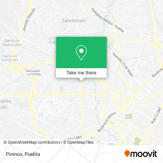
See Pininos, San Gregorio Atzompa, on the map
Public Transit to Pininos in San Gregorio Atzompa
Wondering how to get to Pininos in San Gregorio Atzompa? Moovit helps you find the best way to get to Pininos with step-by-step directions from the nearest public transit station.
Moovit provides free maps and live directions to help you navigate through your city. View schedules, routes, timetables, and find out how long does it take to get to Pininos in real time.
Looking for the nearest stop or station to Pininos? Check out this list of stops closest to your destination: Calzada Zavaleta; Calzada Zavaleta; Blvrd. Forjadores De Puebla-Calzada Zavaleta; Boulevard Forjadores De Puebla; Boulevard Forjadores De Puebla.
Bus: RUTA 3, RUTA 3A, RUTA CREE - MADERO, RUTA TRANSPORTES, RUTA 1, RUTA M6B, RUTA M8, RUTA S14A, RUTA COORDINADOS PUEBLA, TRANSPORTE NOCTURNO, RUTA 1, RUTA S1 "A" HUEJOTZINGO, RUTA M6A, RUTA SAN NICOLÁS DE LOS RANCHOS, RUTA 1.
Want to see if there’s another route that gets you there at an earlier time? Moovit helps you find alternative routes or times. Get directions from and directions to Pininos easily from the Moovit App or Website.
We make riding to Pininos easy, which is why over 1.5 million users, including users in San Gregorio Atzompa, trust Moovit as the best app for public transit. You don’t need to download an individual bus app or train app, Moovit is your all-in-one transit app that helps you find the best bus time or train time available.
For information on prices of bus, costs and ride fares to Pininos, please check the Moovit app.
Use the app to navigate to popular places including to the airport, hospital, stadium, grocery store, mall, coffee shop, school, college, and university.
Pininos Address: Calzada Zavaleta 124, Santa Cruz Buenavista, 72150 Puebla, Puebla street in San Gregorio Atzompa
- Dagda Travel,
- Nüwa Belleza Integral,
- Plaza Britania Zavaleta,
- smart Fit Plazavaleta Puebla,
- Afore Sura,
- Crochet Puebla,
- Panda Chen,
- Convisa,
- Secretaria de Economia Delegación Puebla,
- Los Pescadores del Mar Restaurante Familiar,
- Papel Hacer y Aprender,
- Grupo Marpa Puebla - Michelín Car Service,
- Ami Chocolates,
- Froggin English For Kids,
- Balletarte Instituto de Danza,
- Colonia Santa Cruz Buenavista,
- Co-Nect Working,
- Grupo Edi,
- Servicios Holísticos y Spa,
- sura
Places Near Pininos (San Gregorio Atzompa)
- Tres Cruces, Puebla,
- Hospital General Regional 36 IMSS San Alejandro, San Andrés Cholula,
- Galerías Serdán, San Pedro Cholula,
- 25 Zona Militar, Puebla,
- Hospital Imss La Margarita, Puebla,
- Parque Ecologico, Pue., San Andrés Cholula,
- Ciudad Universitaria, Puebla,
- Parque Puebla, Puebla,
- Ciudad Judicial del Estado de Puebla, San Andrés Cholula,
- Plaza Las Animas, Puebla,
- Estadio Cuauhtémoc, Puebla,
- Plaza Dorada Centro Comercial, Puebla,
- Centro Comercial Angelópolis, San Andrés Cholula,
- Zona de los Fuertes, Puebla,
- Secretaria de Finanzas, Puebla,
- Centro Integral de Servicios CIS, San Andrés Cholula,
- Complejo Cultural Universitario, Ocoyucan,
- SAT, San Andrés Cholula,
- Hospital Traumatología y Ortopedia de Puebla, San Pedro Cholula,
- Centro de Desarrollo Comunitario Tres Cruces, Puebla
How to get to popular places in Puebla with public transit
Get around San Gregorio Atzompa by public transit!
Traveling around San Gregorio Atzompa has never been so easy. See step by step directions as you travel to any attraction, street or major public transit station. View bus and train schedules, arrival times, service alerts and detailed routes on a map, so you know exactly how to get to anywhere in San Gregorio Atzompa.
When traveling to any destination around San Gregorio Atzompa use Moovit's Live Directions with Get Off Notifications to know exactly where and how far to walk, how long to wait for your line, and how many stops are left. Moovit will alert you when it's time to get off — no need to constantly re-check whether yours is the next stop.
Wondering how to use public transit in San Gregorio Atzompa or how to pay for public transit in San Gregorio Atzompa? Moovit public transit app can help you navigate your way with public transit easily, and at minimum cost. It includes public transit fees, ticket prices, and costs. Looking for a map of San Gregorio Atzompa public transit lines? Moovit public transit app shows all public transit maps in San Gregorio Atzompa with all bus routes and stops on an interactive map.
Puebla has 1 transit type(s), including: bus, operated by several transit agencies, including RUTA, RUTA Alimentadoras, Rutas Convencionales and Líneas temporales