How to get to Pink by Victoria's Secret by bus?
Click on the bus route to see step by step directions with maps, line arrival times and updated time schedules.
From moakley federal court house, Boston
69 minFrom MBTA Suffolk Downs Station, Boston
108 minFrom Embassy Suites by Hilton Boston at Logan Airport, Boston
68 minFrom Assembly Row, Somerville
61 minFrom USS Constitution (USS Constitution Museum), Boston
66 minFrom Hilton Garden Inn Boston Logan Airport, Boston
74 minFrom La Quinta Inn & Suites Boston Somerville, Somerville
66 minFrom Gateway Center, Everett
54 minFrom Encore Boston Harbor, Everett
51 minFrom Reelhouse, Boston
74 min
Bus stops near Pink by Victoria's Secret in Saugus
Bus lines to Pink by Victoria's Secret in Saugus
What are the closest stations to Pink by Victoria's Secret?
The closest stations to Pink by Victoria's Secret are:
- Square One Mall @ Sears is 232 yards away, 3 min walk.
- 190 Main St is 898 yards away, 11 min walk.
Which bus lines stop near Pink by Victoria's Secret?
These bus lines stop near Pink by Victoria's Secret: 429, 430.
What’s the nearest bus station to Pink by Victoria's Secret in Saugus?
The nearest bus station to Pink by Victoria's Secret in Saugus is Square One Mall @ Sears. It’s a 3 min walk away.
What time is the first bus to Pink by Victoria's Secret in Saugus?
The 429 is the first bus that goes to Pink by Victoria's Secret in Saugus. It stops nearby at 5:53 AM.
What time is the last bus to Pink by Victoria's Secret in Saugus?
The 429 is the last bus that goes to Pink by Victoria's Secret in Saugus. It stops nearby at 10:43 PM.
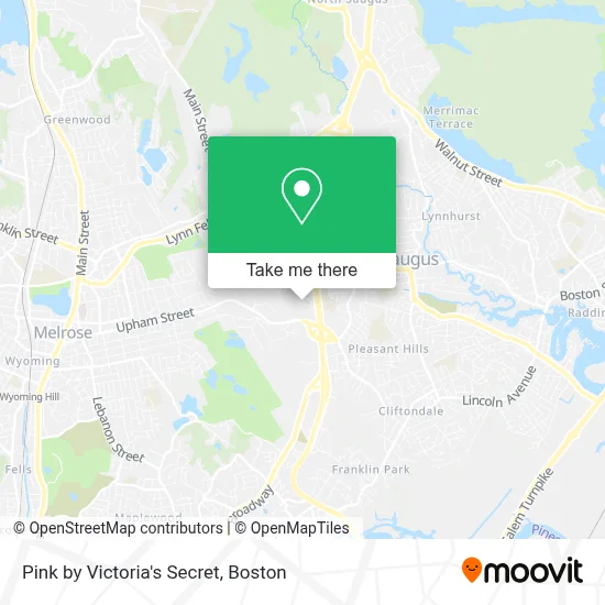
See Pink by Victoria's Secret, Saugus, on the map
Public Transit to Pink by Victoria's Secret in Saugus
Wondering how to get to Pink by Victoria's Secret in Saugus? Moovit helps you find the best way to get to Pink by Victoria's Secret with step-by-step directions from the nearest public transit station.
Moovit provides free maps and live directions to help you navigate through your city. View schedules, routes, timetables, and find out how long does it take to get to Pink by Victoria's Secret in real time.
Looking for the nearest stop or station to Pink by Victoria's Secret? Check out this list of stops closest to your destination: Square One Mall @ Sears; 190 Main St.
Bus: 429, 430, 428.
Want to see if there’s another route that gets you there at an earlier time? Moovit helps you find alternative routes or times. Get directions from and directions to Pink by Victoria's Secret easily from the Moovit App or Website.
We make riding to Pink by Victoria's Secret easy, which is why over 1.7 million users, including users in Saugus, trust Moovit as the best app for public transit. You don’t need to download an individual bus app or train app, Moovit is your all-in-one transit app that helps you find the best bus time or train time available.
For information on prices of bus and subway, costs and ride fares to Pink by Victoria's Secret, please check the Moovit app.
Use the app to navigate to popular places including to the airport, hospital, stadium, grocery store, mall, coffee shop, school, college, and university.
Pink by Victoria's Secret Address: 1201 Broadway, Spc E235 street in Saugus
- Empire,
- New Plumbers,
- Gatcha,
- Urban Planet,
- Beardedapes,
- Direct SAT TV,
- Journeys Kidz,
- JD Sports,
- Ilker Bergin,
- Halloween Scream,
- JC Smoothies,
- Pholicious,
- Track23,
- Track23 (Track 23),
- Verizon Wireless,
- MAC,
- Go the Game Store,
- K B Toys,
- Pandora,
- Dellaria Salon
Places Near Pink by Victoria's Secret (Saugus)
- Castle Island, Boston,
- Boston Common, Boston,
- Quincy Market, Boston,
- Seaport District, Boston,
- Massachusetts General Hospital, Boston,
- House Of Blues, Boston,
- Leader Bank Pavilion (Leader Bank Pavillion), Boston,
- Faneuil Hall, Boston,
- Museum Of Science, Boston,
- Boston Children's Hospital, Boston,
- Mgm Music Hall, Boston,
- Wang Theater, Boston,
- Boston Medical Center, Boston,
- Boston Convention & Exhibition Center, Boston,
- Isabella Stewart Gardner Museum, Boston,
- Td Garden, Boston,
- Prudential Center, Boston,
- Wilbur Theatre, Boston,
- North End, Boston,
- Cheers, Boston
How to get to popular places in Boston with public transit
Get around Saugus by public transit!
Traveling around Saugus has never been so easy. See step by step directions as you travel to any attraction, street or major public transit station. View bus and train schedules, arrival times, service alerts and detailed routes on a map, so you know exactly how to get to anywhere in Saugus.
When traveling to any destination around Saugus use Moovit's Live Directions with Get Off Notifications to know exactly where and how far to walk, how long to wait for your line, and how many stops are left. Moovit will alert you when it's time to get off — no need to constantly re-check whether yours is the next stop.
Wondering how to use public transit in Saugus or how to pay for public transit in Saugus? Moovit public transit app can help you navigate your way with public transit easily, and at minimum cost. It includes public transit fees, ticket prices, and costs. Looking for a map of Saugus public transit lines? Moovit public transit app shows all public transit maps in Saugus with all Bus, Train, Subway and Ferry routes and stops on an interactive map.
Boston has 4 transit type(s), including: Bus, Train, Subway and Ferry, operated by several transit agencies, including MBTA, Southeastern Regional Transit Authority, MetroWest Regional Transit Authority, Rhode Island Public Transit Authority, WRTA, Lowell Regional Transit Authority, Merrimack Valley Transit, Montachusett Regional Transit Authority, Cape Cod Regional Transit Authority, Brockton Area Transit Authority, Martha's Vineyard Transit Authority, the WAVE - Nantucket Regional Transit Authority, GATRA, Cape Ann Transportation Authority and Massport