How to get to Pinturas Economicas de Aguascalientes by bus?
Click on the bus route to see step by step directions with maps, line arrival times and updated time schedules.
Bus stops near Pinturas Economicas de Aguascalientes
Bus lines to Pinturas Economicas de Aguascalientes
What are the closest stations to Pinturas Economicas de Aguascalientes?
The closest stations to Pinturas Economicas de Aguascalientes are:
- Avenida Heroe Inmortal, 702 is 54 meters away, 1 min walk.
- Avenida Siglo Xxi, 424a is 92 meters away, 2 min walk.
- Avenida Heroe Inmortal, 1202 is 241 meters away, 4 min walk.
Which bus lines stop near Pinturas Economicas de Aguascalientes?
These bus lines stop near Pinturas Economicas de Aguascalientes: RUTA 02, RUTA 07, RUTA 18, RUTA 42, RUTA 50.
What’s the nearest bus station to Pinturas Economicas de Aguascalientes?
The nearest bus station to Pinturas Economicas de Aguascalientes is Avenida Heroe Inmortal, 702. It’s a 1 min walk away.
What time is the first bus to Pinturas Economicas de Aguascalientes?
The RUTA 37 is the first bus that goes to Pinturas Economicas de Aguascalientes. It stops nearby at 6:01 AM.
What time is the last bus to Pinturas Economicas de Aguascalientes?
The RUTA 07 is the last bus that goes to Pinturas Economicas de Aguascalientes. It stops nearby at 11:02 PM.
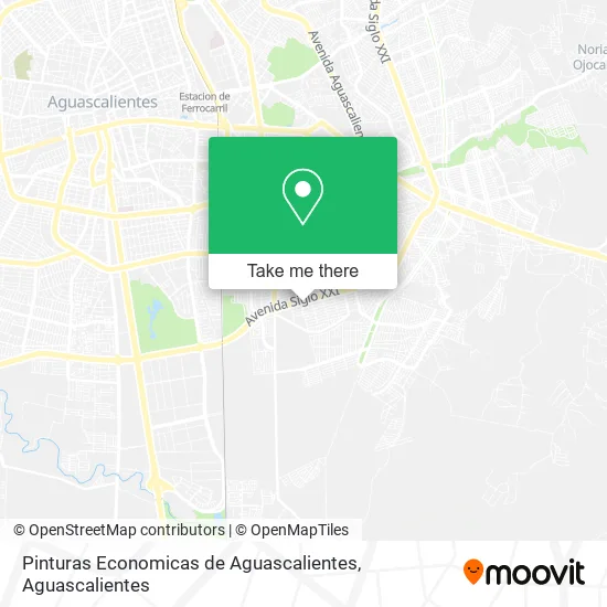
See Pinturas Economicas de Aguascalientes on the map
Public Transportation to Pinturas Economicas de Aguascalientes
Wondering how to get to Pinturas Economicas de Aguascalientes? Moovit helps you find the best way to get to Pinturas Economicas de Aguascalientes with step-by-step directions from the nearest public transit station.
Moovit provides free maps and live directions to help you navigate through your city. View schedules, routes, timetables, and find out how long does it take to get to Pinturas Economicas de Aguascalientes in real time.
Looking for the nearest stop or station to Pinturas Economicas de Aguascalientes? Check out this list of stops closest to your destination: Avenida Heroe Inmortal; Avenida Siglo Xxi; Avenida Heroe Inmortal.
Bus: RUTA 02, RUTA 07, RUTA 18, RUTA 42, RUTA 50, RUTA 14, RUTA 36, RUTA 37.
Want to see if there’s another route that gets you there at an earlier time? Moovit helps you find alternative routes or times. Get directions from and directions to Pinturas Economicas de Aguascalientes easily from the Moovit App or Website.
We make riding to Pinturas Economicas de Aguascalientes easy, which is why over 1.5 million users, including users in Aguascalientes, trust Moovit as the best app for public transit. You don’t need to download an individual bus app or train app, Moovit is your all-in-one transit app that helps you find the best bus time or train time available.
For information on prices of bus, costs and ride fares to Pinturas Economicas de Aguascalientes, please check the Moovit app.
Use the app to navigate to popular places including to the airport, hospital, stadium, grocery store, mall, coffee shop, school, college, and university.
Pinturas Economicas de Aguascalientes Address: Pinturas Economicas de Aguascalientes, Avenida Siglo XXI 403, Fraccionamiento Morelos 2da Sección, street in Aguascalientes
- CAJA POPULAR MEXICANA,
- London Gym,
- Consultorio de Podologia,
- Acumuladores Bustos Hnos,
- Autopartes Wolf Morelo,
- Casa de Empeño Presto Cash,
- Venta de Mangonadas y Dulces,
- Innhala Eventos,
- Ceafit Fitness Center,
- Salon El Paraíso,
- Emiliano Zapata,
- COMPRA VENTA DE ORO RUBI,
- Banquetes Poblanita,
- Avostek,
- Venta de Discos y Casetes,
- Abarrotes-Hermanos Galeana,
- Aviario Lucycon,
- TIENDA DE NOVEDADES MARY,
- Muebles Clau,
- Artículos de Belleza Luma
Places Near Pinturas Economicas de Aguascalientes
- Villas de Nuestra Señora de la Asunción, Aguascalientes,
- Parque Las Tres Centurias, Aguascalientes,
- Aeropuerto de Aguascalientes S.A. de C.V., Aguascalientes,
- La Isla San Marcos, Aguascalientes,
- Imss Clinica 1, Aguascalientes,
- Agropecuario, Aguascalientes,
- Centro, Aguascalientes,
- Villasuncion, Aguascalientes,
- Isla San Marcos, Aguascalientes,
- Jesús María, Aguascalientes,
- Blvd. Luis Donaldo Colosio, Aguascalientes,
- Central De Autobuses, Aguascalientes,
- Universidad Autónoma de Aguascalientes, Aguascalientes,
- Nuevo Hospital Hidalgo, Aguascalientes,
- ESPACIOS, Aguascalientes,
- Hospital Imss No. 3, Aguascalientes,
- Ciudad industrial, Aguascalientes,
- Centro Comercial Altaria, Aguascalientes,
- clinica 3 uaa, Aguascalientes,
- Terminal De Combis, Aguascalientes
How to get to popular places in Aguascalientes with public transit
Get around Aguascalientes by public transit!
Traveling around Aguascalientes has never been so easy. See step by step directions as you travel to any attraction, street or major public transit station. View bus and train schedules, arrival times, service alerts and detailed routes on a map, so you know exactly how to get to anywhere in Aguascalientes.
When traveling to any destination around Aguascalientes use Moovit's Live Directions with Get Off Notifications to know exactly where and how far to walk, how long to wait for your line, and how many stops are left. Moovit will alert you when it's time to get off — no need to constantly re-check whether yours is the next stop.
Wondering how to use public transit in Aguascalientes or how to pay for public transit in Aguascalientes? Moovit public transit app can help you navigate your way with public transit easily, and at minimum cost. It includes public transit fees, ticket prices, and costs. Looking for a map of Aguascalientes public transit lines? Moovit public transit app shows all public transit maps in Aguascalientes with all bus routes and stops on an interactive map.
Aguascalientes has 1 transit type(s), including: bus, operated by several transit agencies, including Coordinación General de Movilidad