How to get to Pires by bus?
Click on the bus route to see step by step directions with maps, line arrival times and updated time schedules.
From Av. Las Begonias, San Isidro
42 minFrom Flora Tristán Cuadra 1, La Molina
64 minFrom Hospital José Casimiro Ulloa, Miraflores
27 minFrom Av. San Luis, San Borja
43 minFrom NATCLAR, La Victori
46 minFrom Manchay, Pachacamac
50 minFrom Universidad Marcelino Champagnat, Santiago D
33 minFrom UTEC, Barranco
38 minFrom Av El Derby Santiago De Surco, Santiago D
36 minFrom ATV Canal 9, San Isidro
45 min
How to get to Pires by metro?
Click on the metro route to see step by step directions with maps, line arrival times and updated time schedules.
Bus stops near Pires in Lima
Metro station near Pires in Lima
- Villa Maria, 33 min walk,VIEW
Bus lines to Pires in Lima
- 1111, Universitaria (Lima) - San Gabriel (Villa María Del Triunfo),VIEW
- 1093, S.J.M. - Surquillo - S.J.M.,VIEW
- 1097, Av. Santa Rosa (San Juan De Lurigancho) - Las Palmas (Pachacamac) ,VIEW
- 1108, Montevideo (Lima) - Cementerio (Villa El Salvador),VIEW
- 1262, Pastor Sevilla (Villa El Salvador) - Pachacútec (Ventanilla),VIEW
- 1284, Canta Callao (San Martin De Porres),VIEW
- 1384, Av.Pachacutec (V.M.T.) - San Genaro (Chorrillos),VIEW
- 1471, Av. Juan Velasco Alvarado (Villa El Salvador) - Oquendo (San Martin De Porres),VIEW
- 7802, S.J.M. - V.M.T. - S.J.M.,VIEW
- 7803, V.M.T - S.J.M,VIEW
- 7807, S.J.M. - V.E.S. - S.J.M.,VIEW
- 1056, Villa El Salvador - San Juan de Lurigancho,VIEW
- 1060, Campoy (San Juan De Lurigancho) - Nueva Esperanza (Villa María Del Triunfo),VIEW
- 1099, 28 De Julio (Lima) - San Gabriel (Villa María Del Triunfo),VIEW
- 1100, Huaycan (Ate) - Las Palmas (Pachacamac),VIEW
- 1109, San Gabriel (Villa María Del Triunfo) - Espinar (Miraflores),VIEW
- 1110, Miraflores - VMT,VIEW
- 1123, José Gálvez (Villa María Del Triunfo) - Parque Kennedy (Miraflores),VIEW
- 1124, V.M.T. - Surquillo,VIEW
- 1125, Surquillo - V.M.T.,VIEW
What are the closest stations to Pires?
The closest stations to Pires are:
- Baltazar is 269 meters away, 4 min walk.
- Maria Auxiliadora is 372 meters away, 5 min walk.
- Los Héroes is 390 meters away, 6 min walk.
- Avenida Tomás Guzmán, 577 is 566 meters away, 8 min walk.
- Villa Maria is 2592 meters away, 33 min walk.
Which bus lines stop near Pires?
These bus lines stop near Pires: 1097, 1099, 1100, 1108, 1123, 1128, 1417, 1472, 8614.
Which metro line stops near Pires?
LINEA 1 (Bayóvar (San Juan De Lurigancho) - Separadora Industrial (Villa El Salvador))
What’s the nearest bus station to Pires in Lima?
The nearest bus station to Pires in Lima is Baltazar. It’s a 4 min walk away.
What time is the first metro to Pires in Lima?
The LINEA 1 is the first metro that goes to Pires in Lima. It stops nearby at 5:04 AM.
What time is the last metro to Pires in Lima?
The LINEA 1 is the last metro that goes to Pires in Lima. It stops nearby at 10:42 PM.
What time is the first bus to Pires in Lima?
The 1471 is the first bus that goes to Pires in Lima. It stops nearby at 4:06 AM.
What time is the last bus to Pires in Lima?
The 1280 is the last bus that goes to Pires in Lima. It stops nearby at 1:34 AM.
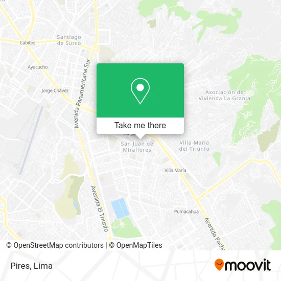
See Pires, Lima, on the map
Public Transit to Pires in Lima
Wondering how to get to Pires in Lima? Moovit helps you find the best way to get to Pires with step-by-step directions from the nearest public transit station.
Moovit provides free maps and live directions to help you navigate through your city. View schedules, routes, timetables, and find out how long does it take to get to Pires in real time.
Looking for the nearest stop or station to Pires? Check out this list of stops closest to your destination: Baltazar; Maria Auxiliadora; Los Héroes; Avenida Tomás Guzmán; Villa Maria.
Bus: 1097, 1099, 1100, 1108, 1123, 1128, 1417, 1472, 8614, 1111, 1093, 1262, 1284, 1056, 1060, 1109, 1315, 7804, 7811, OM19.Metro: LINEA 1.
Want to see if there’s another route that gets you there at an earlier time? Moovit helps you find alternative routes or times. Get directions from and directions to Pires easily from the Moovit App or Website.
We make riding to Pires easy, which is why over 1.5 million users, including users in Lima, trust Moovit as the best app for public transit. You don’t need to download an individual bus app or train app, Moovit is your all-in-one transit app that helps you find the best bus time or train time available.
For information on prices of bus and metro, costs and ride fares to Pires, please check the Moovit app.
Use the app to navigate to popular places including to the airport, hospital, stadium, grocery store, mall, coffee shop, school, college, and university.
Pires Address: Jirón Felipe Arancibia San Juan de Miraflores Parcela D, 15801 San Juan de Miraflores street in Lima
- Constructoras-Zeus Constructora E Inmobiliaria S.C.R.L,
- jr joaquin bernal 1078 zn D jr joaquin bernal 1078 zn D,
- Parque 6 De Agosto,
- Calle Máximo Gorbitz,
- Ávila Moron Maximo Rolando,
- Cusi,
- Poder Judicial - sede Joaquín Bernal,
- Colegio Secundaria Annies School,
- Bodega Hortencia,
- Colegio Secundaria Emmanuel College,
- Jardín - Guardería Los Angelitos de Cautivo,
- I. E. P. Mi Seguno Hogar,
- Annies School,
- Business Services-Flores Ocaña Linda Marilyn,
- Osinergmin,
- Business Services-Perez Acosta Sarita Yrenia,
- San Juan de Miraflores - Hostal Zona Franca,
- AV TOMAS GUZMÁN N° 835 ZONA D SAN JUAN DE MIRAFLORES,
- Sunarp San Juan De Miraflores,
- Coria de la Cruz Francisco Sergio
Places Near Pires (Lima)
- Parque Kennedy, Miraflores,
- Larcomar, Miraflores,
- Av. La Marina, San Miguel,
- Circuito Mágico Del Agua, Lima,
- Mall Del Sur,
- Hospital Edgardo Rebagliati Martins, Jesus Mari,
- Miraflores, Miraflores,
- Plaza San Miguel, San Miguel,
- Real Plaza Salaverry, Jesus Mari,
- Real Plaza Puruchuco, Ate,
- Parque de las Leyendas, San Miguel,
- Jockey Plaza, Santiago D,
- Av. Salaverry, Jesus Mari,
- Paradero Av.Brasil,
- Aeropuerto Internacional Jorge Chávez, Ventanilla,
- Centro Comercial Plaza Norte, Independen,
- Barranco, Barranco,
- Av. Abancay, Lima,
- Gamarra,
- av arequipa, Lima
How to get to popular places in Lima with public transit
Get around Lima by public transit!
Traveling around Lima has never been so easy. See step by step directions as you travel to any attraction, street or major public transit station. View bus and train schedules, arrival times, service alerts and detailed routes on a map, so you know exactly how to get to anywhere in Lima.
When traveling to any destination around Lima use Moovit's Live Directions with Get Off Notifications to know exactly where and how far to walk, how long to wait for your line, and how many stops are left. Moovit will alert you when it's time to get off — no need to constantly re-check whether yours is the next stop.
Wondering how to use public transit in Lima or how to pay for public transit in Lima? Moovit public transit app can help you navigate your way with public transit easily, and at minimum cost. It includes public transit fees, ticket prices, and costs. Looking for a map of Lima public transit lines? Moovit public transit app shows all public transit maps in Lima with all Bus, Metro and Ferry routes and stops on an interactive map.
Lima has 3 transit type(s), including: Bus, Metro and Ferry, operated by several transit agencies, including Metro de Lima Línea 2 , Metro de Lima, Corredor Rojo, Metropolitano, Metropolitano - Alimentadores, Corredor Morado, Corredor Azul, Rutas Tradicionales, Transportes y Servicios La Esperanza S.A., Las Flores S.A., Virgen de la Asunción S.A., Consorcio HAM, Transportes y Service Canadá S.A., ETUL4SA and ETUCHISA