How to get to Pixel Control by bus?
Click on the bus route to see step by step directions with maps, line arrival times and updated time schedules.
From DGT - Centro de Exámenes de Móstoles, Móstoles
53 minFrom Hospital Universitario De Fuenlabrada., Área Metropolitana De Madrid Y Corredor Del Henares
33 minFrom Villaviciosa de Odón, Villaviciosa De Odón
47 minFrom Tanatorio De Móstoles, Área Metropolitana De Madrid Y Corredor Del Henares
74 minFrom X Madrid, Alcorcón
56 minFrom Hospital Quirón Sur Alcorcón, Alcorcón
58 minFrom Policía Nacional - Comisaría De Alcorcón., Área Metropolitana De Madrid Y Corredor Del Henares
68 minFrom Hospital Universitario HM Puerta del Sur, Móstoles
33 minFrom Recinto Ferial de Fuenlabrada, Fuenlabrada
32 minFrom Hospital Universitario Rey Juan Carlos, Móstoles
58 min
Bus stops near Pixel Control in Arroyomolinos
Bus lines to Pixel Control in Arroyomolinos
What are the closest stations to Pixel Control?
The closest stations to Pixel Control are:
- Emilia Pardo Bazán - Instituto is 186 meters away, 3 min walk.
- Miguel De Cervantes - Instituto is 186 meters away, 3 min walk.
- Rosalía De Castro - Benito Pérez Galdós is 234 meters away, 4 min walk.
- Ctra. Fuenlabrada - Urb. La Rinconada is 404 meters away, 6 min walk.
Which bus lines stop near Pixel Control?
These bus lines stop near Pixel Control: 495, 496, 499.
What’s the nearest bus station to Pixel Control in Arroyomolinos?
The nearest bus stations to Pixel Control in Arroyomolinos are Emilia Pardo Bazán - Instituto and Miguel De Cervantes - Instituto. The closest one is a 3 min walk away.
What time is the first bus to Pixel Control in Arroyomolinos?
The 498 is the first bus that goes to Pixel Control in Arroyomolinos. It stops nearby at 3:06 AM.
What time is the last bus to Pixel Control in Arroyomolinos?
The N808 is the last bus that goes to Pixel Control in Arroyomolinos. It stops nearby at 2:46 AM.
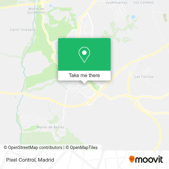
See Pixel Control, Arroyomolinos, on the map
Public Transit to Pixel Control in Arroyomolinos
Wondering how to get to Pixel Control in Arroyomolinos? Moovit helps you find the best way to get to Pixel Control with step-by-step directions from the nearest public transit station.
Moovit provides free maps and live directions to help you navigate through your city. View schedules, routes, timetables, and find out how long does it take to get to Pixel Control in real time.
Looking for the nearest stop or station to Pixel Control? Check out this list of stops closest to your destination: Emilia Pardo Bazán - Instituto; Miguel De Cervantes - Instituto; Rosalía De Castro - Benito Pérez Galdós; Ctra. Fuenlabrada - Urb. La Rinconada.
Bus: 495, 496, 499, 1B, 1A, 498, N808.
Want to see if there’s another route that gets you there at an earlier time? Moovit helps you find alternative routes or times. Get directions from and directions to Pixel Control easily from the Moovit App or Website.
We make riding to Pixel Control easy, which is why over 1.5 million users, including users in Arroyomolinos, trust Moovit as the best app for public transit. You don’t need to download an individual bus app or train app, Moovit is your all-in-one transit app that helps you find the best bus time or train time available.
For information on prices of bus, metro and train, costs and ride fares to Pixel Control, please check the Moovit app.
Use the app to navigate to popular places including to the airport, hospital, stadium, grocery store, mall, coffee shop, school, college, and university.
Pixel Control Address: Calle Miguel de Cervantes, 62 28939 Arroyomolinos street in Arroyomolinos
- Luis Ortega Pasero,
- Rest Arroyomolinos,
- Estanco Molina,
- Calle Emilia Pardo Bazán,
- Ies Gabriela Mistral,
- Instituto De Educación Secundaria Gabriela Mistral,
- Madgo,
- Ramos Gómez Oscar,
- Parque De La Rinconada,
- Calle Rosalía de Castro,
- Escuela Infantil Campanilla,
- Calle Miró,
- Aleo,
- Consulta Drsaboalloca,
- Regalarte y Estilo,
- Campanilla Escuela Infantil Publica,
- Bws Global Sport,
- Garryauto,
- Calle Dalí,
- Gardez Servicios Hipotecarios
Places Near Pixel Control (Arroyomolinos)
- Sala La Riviera, Madrid,
- Hospital Universitario Ramón y Cajal, Madrid,
- Centro Comercial La Gavia, Área Metropolitana De Madrid Y Corredor Del Henares,
- Mercadillo de Majadahonda, Majadahonda,
- Wizink Center, Madrid,
- Mendez Alvaro, Madrid,
- Nassica, Área Metropolitana De Madrid Y Corredor Del Henares,
- Centro Comercial Islazul, Área Metropolitana De Madrid Y Corredor Del Henares,
- Rastro De Madrid, Área Metropolitana De Madrid Y Corredor Del Henares,
- Palacio De Vistalegre, Área Metropolitana De Madrid Y Corredor Del Henares,
- Calle de López de Hoyos 169, Madrid,
- Estacion de Chamartin, Madrid,
- Hospital Clínico Universitario San Carlos, Madrid,
- Hospital Universitario La Paz, Madrid,
- Centro Comercial Oasiz Madrid, Área Metropolitana De Madrid Y Corredor Del Henares,
- Tres Aguas, Alcorcón,
- Plenilunio, Área Metropolitana De Madrid Y Corredor Del Henares,
- Plaza Mayor, Madrid,
- Estadio Wanda Metropolitano, Área Metropolitana De Madrid Y Corredor Del Henares,
- Centro Comercial La Vaguada, Área Metropolitana De Madrid Y Corredor Del Henares
How to get to popular places in Madrid with public transit
Get around Arroyomolinos by public transit!
Traveling around Arroyomolinos has never been so easy. See step by step directions as you travel to any attraction, street or major public transit station. View bus and train schedules, arrival times, service alerts and detailed routes on a map, so you know exactly how to get to anywhere in Arroyomolinos.
When traveling to any destination around Arroyomolinos use Moovit's Live Directions with Get Off Notifications to know exactly where and how far to walk, how long to wait for your line, and how many stops are left. Moovit will alert you when it's time to get off — no need to constantly re-check whether yours is the next stop.
Wondering how to use public transit in Arroyomolinos or how to pay for public transit in Arroyomolinos? Moovit public transit app can help you navigate your way with public transit easily, and at minimum cost. It includes public transit fees, ticket prices, and costs. Looking for a map of Arroyomolinos public transit lines? Moovit public transit app shows all public transit maps in Arroyomolinos with all Bus, Train, Metro and Light Rail routes and stops on an interactive map.
Madrid has 4 transit type(s), including: Bus, Train, Metro and Light Rail, operated by several transit agencies, including Metro de Madrid, Metro Ligero, Tranvía de Parla, Renfe Cercanías - Servicios de Autobús especiales, Renfe Cercanias, Renfe Cercanías, EMT, Interurbanos, Urbanos de Alcalá de Henares, Urbanos de Alcobendas, Urbanos de Alcorcón, Urbanos de Algete, Urbanos de Aranjuez, Urbanos de Arganda del Rey and Urbanos de Arroyomolinos