How to get to Pixelspass by bus?
Click on the bus route to see step by step directions with maps, line arrival times and updated time schedules.
From Hoftheater, Dresden
39 minFrom Altfranken, Dresden
55 minFrom Möbel Kraft, Dresden
62 minFrom Spitzhausstraße, Dresden
29 minFrom Zschoner Grund, Dresden
65 minFrom Schloss Wackerbarth, Radebeul
71 minFrom Schwebebahn Dresden, Dresden
51 minFrom Strandbad Friedewald, Moritzburg
50 minFrom Babisnauer Pappel, Bannewitz
102 minFrom Kleinzschachwitz, Dresden
77 min
How to get to Pixelspass by train?
Click on the train route to see step by step directions with maps, line arrival times and updated time schedules.
Light Rail stations near Pixelspass in Dresden
Train stations near Pixelspass in Dresden
Bus stops near Pixelspass in Dresden
Bus lines to Pixelspass in Dresden
- 261, Rossendorf Forschungszentrum,VIEW
- 477, Dresden Postplatz,VIEW
- 81, Wilschdorf,VIEW
- 478, Bärnsdorf Wendeplatz,VIEW
- 81, Hellerhofstraße,VIEW
- 060, Berlin Zob [Fernbus],VIEW
- 070, S+U Alexanderplatz Bhf (Berlin),VIEW
- 270, Warnemünde Strand,VIEW
- N60, Vienna Central Station,VIEW
- N160, Copenhagen Busterminal,VIEW
What are the closest stations to Pixelspass?
The closest stations to Pixelspass are:
- Bahnhof Neustadt is 320 meters away, 5 min walk.
- Dresden-Neustadt is 323 meters away, 5 min walk.
- Dresden Bahnhof Neustadt is 327 meters away, 5 min walk.
- Dresden Albertplatz is 375 meters away, 5 min walk.
Which bus lines stop near Pixelspass?
These bus lines stop near Pixelspass: 261, 477, 478, 68, 81.
Which train lines stop near Pixelspass?
These train lines stop near Pixelspass: RB31, RE50, S1, S2.
Which light rail lines stop near Pixelspass?
These light rail lines stop near Pixelspass: 11, 3, 7.
What’s the nearest light rail station to Pixelspass in Dresden?
The nearest light rail stations to Pixelspass in Dresden are Bahnhof Neustadt and Dresden Bahnhof Neustadt. The closest one is a 5 min walk away.
What’s the nearest train station to Pixelspass in Dresden?
The nearest train stations to Pixelspass in Dresden are Dresden-Neustadt and Dresden Bahnhof Neustadt. The closest one is a 5 min walk away.
What’s the nearest bus station to Pixelspass in Dresden?
The nearest bus station to Pixelspass in Dresden is Dresden Albertplatz. It’s a 5 min walk away.
What time is the first light rail to Pixelspass in Dresden?
The 11 is the first light rail that goes to Pixelspass in Dresden. It stops nearby at 3:22 AM.
What time is the last light rail to Pixelspass in Dresden?
The 11 is the last light rail that goes to Pixelspass in Dresden. It stops nearby at 2:52 AM.
What time is the first train to Pixelspass in Dresden?
The RB60 is the first train that goes to Pixelspass in Dresden. It stops nearby at 4:02 AM.
What time is the last train to Pixelspass in Dresden?
The 12N is the last train that goes to Pixelspass in Dresden. It stops nearby at 7:01 AM.
What time is the first bus to Pixelspass in Dresden?
The 81 is the first bus that goes to Pixelspass in Dresden. It stops nearby at 3:02 AM.
What time is the last bus to Pixelspass in Dresden?
The N160 is the last bus that goes to Pixelspass in Dresden. It stops nearby at 11:30 AM.
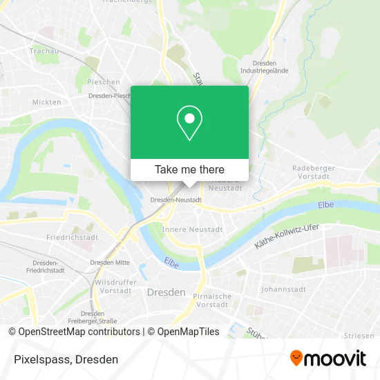
See Pixelspass, Dresden, on the map
Public Transit to Pixelspass in Dresden
Wondering how to get to Pixelspass in Dresden? Moovit helps you find the best way to get to Pixelspass with step-by-step directions from the nearest public transit station.
Moovit provides free maps and live directions to help you navigate through your city. View schedules, routes, timetables, and find out how long does it take to get to Pixelspass in real time.
Looking for the nearest stop or station to Pixelspass? Check out this list of stops closest to your destination: Bahnhof Neustadt; Dresden-Neustadt; Dresden Bahnhof Neustadt; Dresden Albertplatz.
Bus: 261, 477, 478, 68, 81.Train: RB31, RE50, S1, S2, 50.Light Rail: 11, 3, 7.
Want to see if there’s another route that gets you there at an earlier time? Moovit helps you find alternative routes or times. Get directions from and directions to Pixelspass easily from the Moovit App or Website.
We make riding to Pixelspass easy, which is why over 1.5 million users, including users in Dresden, trust Moovit as the best app for public transit. You don’t need to download an individual bus app or train app, Moovit is your all-in-one transit app that helps you find the best bus time or train time available.
For information on prices of bus, train and light rail, costs and ride fares to Pixelspass, please check the Moovit app.
Use the app to navigate to popular places including to the airport, hospital, stadium, grocery store, mall, coffee shop, school, college, and university.
Pixelspass Address: Stetzscher Straße 7 Neustadt, 01097 Dresden street in Dresden
- Wordpress,
- Dixiel am K,
- Moxy Dresden Neustadt,
- Dfb - Regionalverband Sachsen,
- Landesverband Mitteldeutschland,
- Löser & Partner Werbeagentur,
- Gabriel,
- Bistum Dresden-Meißen,
- Ru.Ma.Re. Bonsai G,
- Yoga Nanda Dresden,
- Dr. med. Sören Löscher,
- Kurt Biedenkopf,
- Praxis Weinmann,
- Cambio E V,
- Baer Service,
- Sabine Soeder,
- Burchard Führer,
- Cm-Immobilien,
- Cmdd,
- Ingenieurbüro Lange
Places Near Pixelspass (Dresden)
- Freilichtbühne Junge Garde, Dresden,
- Heinz-Steyer-Stadion, Dresden,
- Amedia Hotel Dresden Elbpromenade, Dresden,
- Landschloß Zuschendorf, Pirna,
- Ikea, Dresden,
- Krankenhaus St. Joseph-Stift, Dresden,
- Oskarshausen, Freital,
- Elbepark, Dresden,
- Dresden, Hauptbahnhof (Strehlener Straße), Dresden,
- Dresden Hbf, Dresden,
- Schloß Übigau, Dresden,
- Altstadt, Dresden,
- Kaufpark Dresden-Nickern, Dresden,
- Schloss Pillnitz, Dresden,
- Waldmax, Dresden,
- Weisser Hirsch, Dresden,
- Carolaschlösschen, Dresden,
- Pfunds Molkerei, Dresden,
- Hans-Erlwein-Gymnasium, Dresden,
- Biergarten "Gohliser Windmühle", Dresden
How to get to popular places in Dresden with public transit
Get around Dresden by public transit!
Traveling around Dresden has never been so easy. See step by step directions as you travel to any attraction, street or major public transit station. View bus and train schedules, arrival times, service alerts and detailed routes on a map, so you know exactly how to get to anywhere in Dresden.
When traveling to any destination around Dresden use Moovit's Live Directions with Get Off Notifications to know exactly where and how far to walk, how long to wait for your line, and how many stops are left. Moovit will alert you when it's time to get off — no need to constantly re-check whether yours is the next stop.
Wondering how to use public transit in Dresden or how to pay for public transit in Dresden? Moovit public transit app can help you navigate your way with public transit easily, and at minimum cost. It includes public transit fees, ticket prices, and costs. Looking for a map of Dresden public transit lines? Moovit public transit app shows all public transit maps in Dresden with all Bus, Train, Light Rail, Ferry, Cable Car and Gondola routes and stops on an interactive map.
Dresden has 6 transit type(s), including: Bus, Train, Light Rail, Ferry, Cable Car and Gondola, operated by several transit agencies, including Trilex, DB AG - S-Bahn, DVB AG, alita, RVSOE, Müller.Bus.Reisen, SATRA Eberhardt, VGM, RBO, DB AG, MRB, SDG, Sächsisch-Oberlausitzer Eisenbahngesellschaft, DB Fernverkehr (Codesharing) and Hanseatische Eisenbahn GmbH