Directions to Pixi Fest (Ocoyucan) with public transportation
The following transit lines have routes that pass near Pixi Fest
 Bus: RUTA 45, RUTA AZUMIATLA, RUTA LOMA BELLA, RUTA 25 NVE.
How to get to Pixi Fest by bus?
Click on the bus route to see step by step directions with maps, line arrival times and updated time schedules.
From Preparatoria Alfonso Calderón Moreno, Puebla
51 minFrom Sanctorum, San Pedro Cholula
52 minFrom RUTA: Rivera Anaya, Puebla
60 minFrom Hospital Cruz Roja Ciudad de Puebla, San Andrés Cholula
33 minFrom Tianguis Los Lavaderos, San Andrés Cholula
44 minFrom Guadalupe Caleras, San Pedro Cholula
52 minFrom IMSS UMF 6, San Pedro Cholula
33 minFrom Centro Expositor Puebla, Puebla
49 minFrom Unidad Médica Cuautlancingo, San Pedro Cholula
64 minFrom Villa Verde, Puebla
48 min
Bus stops near Pixi Fest in Ocoyucan
Bus lines to Pixi Fest in Ocoyucan
What are the closest stations to Pixi Fest?
The closest stations to Pixi Fest are:
- Libertad 736 is 103 meters away, 2 min walk.
- Avenida Nacional, 6174 is 249 meters away, 4 min walk.
Which bus lines stop near Pixi Fest?
These bus lines stop near Pixi Fest: RUTA 45, RUTA AZUMIATLA, RUTA LOMA BELLA.
What’s the nearest bus station to Pixi Fest in Ocoyucan?
The nearest bus station to Pixi Fest in Ocoyucan is Libertad 736. It’s a 2 min walk away.
What time is the first bus to Pixi Fest in Ocoyucan?
The RUTA 45 is the first bus that goes to Pixi Fest in Ocoyucan. It stops nearby at 6:03 AM.
What time is the last bus to Pixi Fest in Ocoyucan?
The RUTA AZUMIATLA is the last bus that goes to Pixi Fest in Ocoyucan. It stops nearby at 11:24 PM.
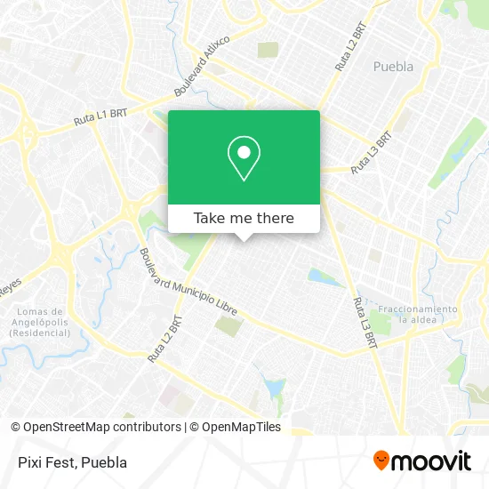
See Pixi Fest, Ocoyucan, on the map
Public Transit to Pixi Fest in Ocoyucan
Wondering how to get to Pixi Fest in Ocoyucan? Moovit helps you find the best way to get to Pixi Fest with step-by-step directions from the nearest public transit station.
Moovit provides free maps and live directions to help you navigate through your city. View schedules, routes, timetables, and find out how long does it take to get to Pixi Fest in real time.
Looking for the nearest stop or station to Pixi Fest? Check out this list of stops closest to your destination: Libertad 736; Avenida Nacional.
Bus: RUTA 45, RUTA AZUMIATLA, RUTA LOMA BELLA, RUTA 25 NVE.
Want to see if there’s another route that gets you there at an earlier time? Moovit helps you find alternative routes or times. Get directions from and directions to Pixi Fest easily from the Moovit App or Website.
We make riding to Pixi Fest easy, which is why over 1.5 million users, including users in Ocoyucan, trust Moovit as the best app for public transit. You don’t need to download an individual bus app or train app, Moovit is your all-in-one transit app that helps you find the best bus time or train time available.
For information on prices of bus, costs and ride fares to Pixi Fest, please check the Moovit app.
Use the app to navigate to popular places including to the airport, hospital, stadium, grocery store, mall, coffee shop, school, college, and university.
Pixi Fest Address: Pixi Fest, Privada Guadalupe Victoria 736, Leobardo Coca C, 72450 Puebla, Puebla street in Ocoyucan
- Papeleria Famadi,
- Garoto Moda Infantil,
- Benito Juárez,
- Credito Especializado al Campo Cresca,
- Optica Optik-Er,
- Estética,
- Club Nutricional Herbalife,
- Granjas Del Sur,
- TAPICERIA EN GENERAL,
- Dark King,
- Holjim,
- Dogo,
- Muebles Jb,
- Hamburguezas,
- Groom House,
- Cochera,
- Deli Tutti Pastelería,
- Motonet Refacciones,
- Estetica Unisex de Vicky,
- Centro de Servicio
Places Near Pixi Fest (Ocoyucan)
- Tres Cruces, Puebla,
- Zona de los Fuertes, Puebla,
- Complejo Cultural Universitario, Ocoyucan,
- Hospital Traumatología y Ortopedia de Puebla, San Pedro Cholula,
- Parque Puebla, Puebla,
- Plaza Dorada Centro Comercial, Puebla,
- Ciudad Judicial del Estado de Puebla, San Andrés Cholula,
- Centro de Desarrollo Comunitario Tres Cruces, Puebla,
- SAT, San Andrés Cholula,
- 25 Zona Militar, Puebla,
- Centro Integral de Servicios CIS, San Andrés Cholula,
- Parque Ecologico, Pue., San Andrés Cholula,
- Hospital Imss La Margarita, Puebla,
- Hospital General Regional 36 IMSS San Alejandro, San Andrés Cholula,
- Centro Comercial Angelópolis, San Andrés Cholula,
- Estadio Cuauhtémoc, Puebla,
- Galerías Serdán, San Pedro Cholula,
- Ciudad Universitaria, Puebla,
- Plaza Las Animas, Puebla,
- Secretaria de Finanzas, Puebla
How to get to popular places in Puebla with public transit
Get around Ocoyucan by public transit!
Traveling around Ocoyucan has never been so easy. See step by step directions as you travel to any attraction, street or major public transit station. View bus and train schedules, arrival times, service alerts and detailed routes on a map, so you know exactly how to get to anywhere in Ocoyucan.
When traveling to any destination around Ocoyucan use Moovit's Live Directions with Get Off Notifications to know exactly where and how far to walk, how long to wait for your line, and how many stops are left. Moovit will alert you when it's time to get off — no need to constantly re-check whether yours is the next stop.
Wondering how to use public transit in Ocoyucan or how to pay for public transit in Ocoyucan? Moovit public transit app can help you navigate your way with public transit easily, and at minimum cost. It includes public transit fees, ticket prices, and costs. Looking for a map of Ocoyucan public transit lines? Moovit public transit app shows all public transit maps in Ocoyucan with all bus routes and stops on an interactive map.
Puebla has 1 transit type(s), including: bus, operated by several transit agencies, including RUTA, RUTA Alimentadoras, Rutas Convencionales and Líneas temporales