How to get to Plastic Processing Systems by bus?
Click on the bus route to see step by step directions with maps, line arrival times and updated time schedules.
From Head Start of Marion and Hamilton Counties, Indianapolis City (Balance)
38 minFrom Chef Dan's Food Truck, Indianapolis City (Balance)
56 minFrom Envive Healthcare, Indianapolis City (Balance)
53 minFrom 46th Street & Emerson Avenue, Indianapolis City (Balance)
43 minFrom SMS Bus Lot, Indianapolis City (Balance)
36 minFrom Rockitcoin, Indianapolis City (Balance)
44 minFrom Butler High Ropes Course, Indianapolis City (Balance)
40 minFrom Elevated Esthetics Relax and Rejuvenate, Indianapolis City (Balance)
46 minFrom Saint Francis Medical Arts Leasing Office, Beech Grove
40 min
Bus stops near Plastic Processing Systems in Indianapolis City (Balance)
- Indianapolis (E Washington St), 6 min walk,VIEW
- Ctc-K, 6 min walk,VIEW
- Ctc-C, 6 min walk,VIEW
- Ctc-D, 7 min walk,VIEW
- Ctc-H, 7 min walk,VIEW
- Ctc-R, 7 min walk,VIEW
- Ctc-J, 7 min walk,VIEW
- Ctc-Q, 8 min walk,VIEW
- Ohio St & Meridian St, 8 min walk,VIEW
- Ctc-G, 10 min walk,VIEW
- Ctc-F, 10 min walk,VIEW
- Ctc-T, 10 min walk,VIEW
- Ctc-S, 13 min walk,VIEW
Bus lines to Plastic Processing Systems in Indianapolis City (Balance)
- FLIXBUS 2511, Milwaukee - Chicago - Columbus,VIEW
- FLIXBUS 2512, Chicago - Louisville - Atlanta,VIEW
- FLIXBUS 2514, Madison - Chicago - Cincinnati,VIEW
- FLIXBUS 2515, Chicago - Indianapolis - Bloomington,IN,VIEW
- FLIXBUS N2640, NYC - Pittsburgh - Chicago,VIEW
- FLIXBUS N2642, NYC - Cincinnati - Chicago,VIEW
- 16, Transit Center,VIEW
- 24, Ameriplex,VIEW
- 10, Meijer Avon,VIEW
- 28, Transit Center,VIEW
- 92, Transit Center,VIEW
- 13, Keystone & National,VIEW
- 56, Emerson/Thompson,VIEW
- 6, Harding,VIEW
- 11, East 16th St,VIEW
- 15, West 34th St,VIEW
- 21, East 21st St,VIEW
- 31, U S 31,VIEW
- 37, Park 100,VIEW
- 38, West 38th St,VIEW
What are the closest stations to Plastic Processing Systems?
The closest stations to Plastic Processing Systems are:
- Indianapolis (E Washington St) is 440 yards away, 6 min walk.
- Ctc-K is 453 yards away, 6 min walk.
- Ctc-C is 481 yards away, 6 min walk.
- Ctc-D is 504 yards away, 7 min walk.
- Ctc-H is 545 yards away, 7 min walk.
- Ctc-R is 559 yards away, 7 min walk.
- Ctc-J is 570 yards away, 7 min walk.
- Ctc-Q is 577 yards away, 8 min walk.
- Ohio St & Meridian St is 642 yards away, 8 min walk.
- Ctc-G is 747 yards away, 10 min walk.
- Ctc-F is 793 yards away, 10 min walk.
- Ctc-T is 823 yards away, 10 min walk.
- Ctc-S is 1045 yards away, 13 min walk.
Which bus lines stop near Plastic Processing Systems?
These bus lines stop near Plastic Processing Systems: 10, 19, 25, 28, 3, 38, 4, 56, 90.
What’s the nearest bus station to Plastic Processing Systems in Indianapolis City (Balance)?
The nearest bus stations to Plastic Processing Systems in Indianapolis City (Balance) are Indianapolis (E Washington St), Ctc-K and Ctc-C. The closest one is a 6 min walk away.
What time is the first bus to Plastic Processing Systems in Indianapolis City (Balance)?
The FLIXBUS N2640 is the first bus that goes to Plastic Processing Systems in Indianapolis City (Balance). It stops nearby at 3:15 AM.
What time is the last bus to Plastic Processing Systems in Indianapolis City (Balance)?
The FLIXBUS N2642 is the last bus that goes to Plastic Processing Systems in Indianapolis City (Balance). It stops nearby at 4:10 PM.
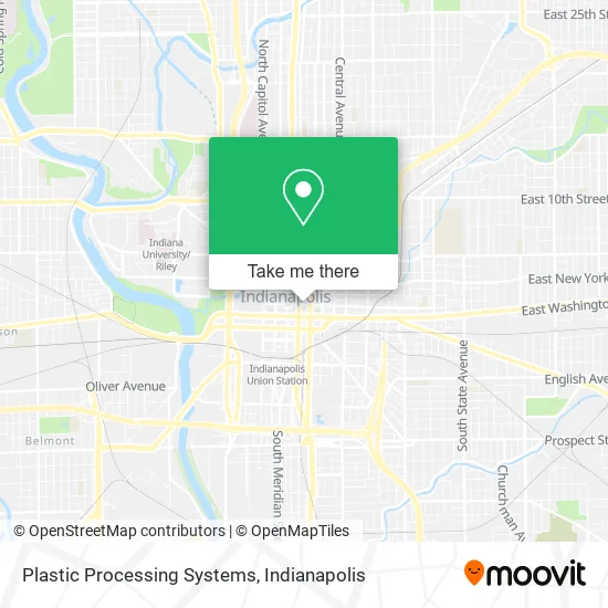
See Plastic Processing Systems, Indianapolis City (Balance), on the map
Public Transit to Plastic Processing Systems in Indianapolis City (Balance)
Wondering how to get to Plastic Processing Systems in Indianapolis City (Balance)? Moovit helps you find the best way to get to Plastic Processing Systems with step-by-step directions from the nearest public transit station.
Moovit provides free maps and live directions to help you navigate through your city. View schedules, routes, timetables, and find out how long does it take to get to Plastic Processing Systems in real time.
Looking for the nearest stop or station to Plastic Processing Systems? Check out this list of stops closest to your destination: Indianapolis (E Washington St); Ctc-K; Ctc-C; Ctc-D; Ctc-H; Ctc-R; Ctc-J; Ctc-Q; Ohio St & Meridian St; Ctc-G; Ctc-F; Ctc-T; Ctc-S.
Bus: 10, 19, 25, 28, 3, 38, 4, 56, 90, FLIXBUS 2511, FLIXBUS 2512, FLIXBUS 2514, FLIXBUS 2515, FLIXBUS N2640, 16, 24, 92, 13, 6, 11, 15, 21, 31.
Want to see if there’s another route that gets you there at an earlier time? Moovit helps you find alternative routes or times. Get directions from and directions to Plastic Processing Systems easily from the Moovit App or Website.
We make riding to Plastic Processing Systems easy, which is why over 1.5 million users, including users in Indianapolis City (Balance), trust Moovit as the best app for public transit. You don’t need to download an individual bus app or train app, Moovit is your all-in-one transit app that helps you find the best bus time or train time available.
For information on prices of bus, costs and ride fares to Plastic Processing Systems, please check the Moovit app.
Use the app to navigate to popular places including to the airport, hospital, stadium, grocery store, mall, coffee shop, school, college, and university.
Plastic Processing Systems Address: 120 E Market St Indianapolis, IN 46204 street in Indianapolis City (Balance)
- Aample Transportation,
- Million Dollar Bosses Cleaning Services,
- The Retreat USA,
- Eco-Clean Indy,
- Genesis Global Leg,
- Lush Beauty Salon,
- 120 Market Suites (120 Collective),
- Midstate Healthcare,
- Elevator One,
- El Equipo Defensa Penal en las Noticias Portal de Cliente Alguien,
- Law Office of Edgardo Martinez,
- Moving Forward Counseling,
- Global Enterprises,
- No Limit Marketing,
- Jason P Wischmeyer Attorney,
- Riley Parker Law,
- Indyautoinjury,
- Hessler Law PC,
- Indy LSG,
- Hamid Saahir
Places Near Plastic Processing Systems (Indianapolis City (Balance))
- Eskenazi Hospital, Indianapolis City (Balance),
- Gainbridge Fieldhouse, Indianapolis City (Balance),
- Cotter's Massage Parlor With Happy Endings, Indianapolis City (Balance),
- Lilly Corporate Center (Eli Lilly & Co), Indianapolis City (Balance),
- Jersey Barn, Indianapolis City (Balance),
- I-465 / I-65 Interchange, Indianapolis City (Balance),
- Plainfield, IN, Plainfield,
- I U Health Methodist Hospital, Indianapolis City (Balance),
- Indiana, Indianapolis City (Balance),
- Indianapolis Airport Zone 2, Indianapolis City (Balance),
- St. Vincent Hospital - Indianapolis, Indianapolis City (Balance),
- Indianapolis Motor Speedway, Speedway,
- Lucas Oil Stadium, Indianapolis City (Balance),
- Methodist Hospital of Indianapolis, Indianapolis City (Balance),
- THE BALT, Indianapolis City (Balance),
- 119 W 19th St Parking, Indianapolis City (Balance),
- Indiana Convention Center, Indianapolis City (Balance),
- St. Vincent entrance #1, Indianapolis City (Balance),
- Train Ride At Castleton Mall, Indianapolis City (Balance),
- Castleton Square Mall, Indianapolis
How to get to popular places in Indianapolis with public transit
Get around Indianapolis City (Balance) by public transit!
Traveling around Indianapolis City (Balance) has never been so easy. See step by step directions as you travel to any attraction, street or major public transit station. View bus and train schedules, arrival times, service alerts and detailed routes on a map, so you know exactly how to get to anywhere in Indianapolis City (Balance).
When traveling to any destination around Indianapolis City (Balance) use Moovit's Live Directions with Get Off Notifications to know exactly where and how far to walk, how long to wait for your line, and how many stops are left. Moovit will alert you when it's time to get off — no need to constantly re-check whether yours is the next stop.
Wondering how to use public transit in Indianapolis City (Balance) or how to pay for public transit in Indianapolis City (Balance)? Moovit public transit app can help you navigate your way with public transit easily, and at minimum cost. It includes public transit fees, ticket prices, and costs. Looking for a map of Indianapolis City (Balance) public transit lines? Moovit public transit app shows all public transit maps in Indianapolis City (Balance) with all bus routes and stops on an interactive map.
Indianapolis has 1 transit type(s), including: bus, operated by several transit agencies, including IndyGo, FlixBus-us and Greyhound-us