How to get to Play Centers by bus?
Click on the bus route to see step by step directions with maps, line arrival times and updated time schedules.
From Port of Baltimore - Cruise Maryland Terminal, Baltimore
94 minFrom Clarence M. Mitchell, Jr. Courthouse, Baltimore
53 minFrom Canton, Baltimore
77 minFrom I-70 at Security Blvd Baltimore City Lot Park & Ride, Baltimore
58 minFrom CFG Bank Arena, Baltimore
57 minFrom I-695 @ Exit 26 (York Rd/MD 45), Baltimore County
48 minFrom I-83 Exit 16 (Timonium Road), Baltimore County
78 minFrom Walters Art Museum, Baltimore
42 minFrom University Of Maryland Baltimore (Umbc), Baltimore County
93 minFrom Walmart, Baltimore County
79 min
How to get to Play Centers by metro?
Click on the metro route to see step by step directions with maps, line arrival times and updated time schedules.
Bus stops near Play Centers in Baltimore
Metro station near Play Centers in Baltimore
- Rogers Ave Metro, 16 min walk,VIEW
Light Rail stations near Play Centers in Baltimore
- Woodberry, 47 min walk,VIEW
Bus lines to Play Centers in Baltimore
What are the closest stations to Play Centers?
The closest stations to Play Centers are:
- Cylburn Ave & Greenspring Ave is 455 yards away, 6 min walk.
- Greenspring Ave & Cold Spring Ln is 557 yards away, 7 min walk.
- Cold Spring Ln & Greenspring Ave Eb is 621 yards away, 8 min walk.
- Rogers Ave Metro is 1295 yards away, 16 min walk.
- Woodberry is 3988 yards away, 47 min walk.
Which bus line stops near Play Centers?
91 (Sinai Hospital)
Which metro line stops near Play Centers?
METRO (Towards Owing Mills)
What’s the nearest metro station to Play Centers in Baltimore?
The nearest metro station to Play Centers in Baltimore is Rogers Ave Metro. It’s a 16 min walk away.
What’s the nearest bus station to Play Centers in Baltimore?
The nearest bus station to Play Centers in Baltimore is Cylburn Ave & Greenspring Ave. It’s a 6 min walk away.
What time is the first light rail to Play Centers in Baltimore?
The LIGHT RAILLINK is the first light rail that goes to Play Centers in Baltimore. It stops nearby at 4:26 AM.
What time is the last light rail to Play Centers in Baltimore?
The LIGHT RAILLINK is the last light rail that goes to Play Centers in Baltimore. It stops nearby at 12:47 AM.
What time is the first metro to Play Centers in Baltimore?
The METRO is the first metro that goes to Play Centers in Baltimore. It stops nearby at 4:56 AM.
What time is the last metro to Play Centers in Baltimore?
The METRO is the last metro that goes to Play Centers in Baltimore. It stops nearby at 12:19 AM.
What time is the first bus to Play Centers in Baltimore?
The 31 is the first bus that goes to Play Centers in Baltimore. It stops nearby at 3:42 AM.
What time is the last bus to Play Centers in Baltimore?
The 31 is the last bus that goes to Play Centers in Baltimore. It stops nearby at 2:12 AM.
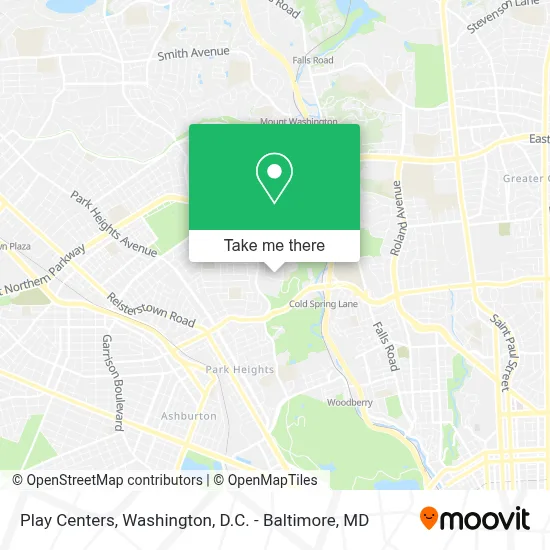
See Play Centers, Baltimore, on the map
Public Transit to Play Centers in Baltimore
Wondering how to get to Play Centers in Baltimore? Moovit helps you find the best way to get to Play Centers with step-by-step directions from the nearest public transit station.
Moovit provides free maps and live directions to help you navigate through your city. View schedules, routes, timetables, and find out how long does it take to get to Play Centers in real time.
Looking for the nearest stop or station to Play Centers? Check out this list of stops closest to your destination: Cylburn Ave & Greenspring Ave; Greenspring Ave & Cold Spring Ln; Cold Spring Ln & Greenspring Ave Eb; Rogers Ave Metro; Woodberry.
Bus: 91, 31, 38, 28.Metro: METRO.
Want to see if there’s another route that gets you there at an earlier time? Moovit helps you find alternative routes or times. Get directions from and directions to Play Centers easily from the Moovit App or Website.
We make riding to Play Centers easy, which is why over 1.7 million users, including users in Baltimore, trust Moovit as the best app for public transit. You don’t need to download an individual bus app or train app, Moovit is your all-in-one transit app that helps you find the best bus time or train time available.
For information on prices of bus, metro and light rail, costs and ride fares to Play Centers, please check the Moovit app.
Use the app to navigate to popular places including to the airport, hospital, stadium, grocery store, mall, coffee shop, school, college, and university.
Play Centers Address: 4701 Yellowwood Ave street in Baltimore
- KIPP Harmony Academy,
- Cylburn Arboretum,
- Cold Spring Greenspring,
- American Dreams & Happiness,
- Green Spring Overlook,
- I-83 Exit 9 (W Cold Spring Rd),
- Sinai Hospital,
- Sinai Hospital Main Entrance,
- Entrance I-83 N,
- Rosenbloom Building,
- Sinai Hospital The Hoffberger Building,
- Bend Hill,
- Sinai Hospital of Baltimore,
- Baltimore Polytechnic Institute,
- Baltimore Poly Tech High School,
- Coppermine Training Center at Cross Key,
- Levindale Hebrew Geriatric Center And Hospital,
- Western High School,
- Park Heights Ave (cold spring lane and park heights),
- Family Dollar
Places Near Play Centers (Baltimore)
- Rock Creek Tennis Center, Washington,
- Marriott Marquis Washington, DC, Washington,
- M&T Bank Stadium, Baltimore,
- Pennsylvania Ave NW (3rd st and pennsylvania), Washington,
- Capital One Arena, Washington,
- Westfield Montgomery Mall, Montgomery County,
- The Anthem, Washington,
- Washington DC VA Medical Center, Washington,
- National Theatre, Washington,
- National Zoo, Washington,
- National Museum of African American History and Culture, Washington,
- Georgetown, Washington,
- Warner Theatre, Washington,
- Museum Of The Bible, Washington,
- PG Mall, Prince George's County,
- Camden Yards, Baltimore,
- Amazon Hq2, Arlington County,
- Washington National Cathedral, Washington,
- Sibley Memorial Hospital, Washington,
- Basilica of the National Shrine, Washington
How to get to popular places in Washington, D.C. - Baltimore, MD with public transit
Get around Baltimore by public transit!
Traveling around Baltimore has never been so easy. See step by step directions as you travel to any attraction, street or major public transit station. View bus and train schedules, arrival times, service alerts and detailed routes on a map, so you know exactly how to get to anywhere in Baltimore.
When traveling to any destination around Baltimore use Moovit's Live Directions with Get Off Notifications to know exactly where and how far to walk, how long to wait for your line, and how many stops are left. Moovit will alert you when it's time to get off — no need to constantly re-check whether yours is the next stop.
Wondering how to use public transit in Baltimore or how to pay for public transit in Baltimore? Moovit public transit app can help you navigate your way with public transit easily, and at minimum cost. It includes public transit fees, ticket prices, and costs. Looking for a map of Baltimore public transit lines? Moovit public transit app shows all public transit maps in Baltimore with all Bus, Train, Metro, Light Rail and Ferry routes and stops on an interactive map.
Washington, D.C. - Baltimore, MD has 5 transit type(s), including: Bus, Train, Metro, Light Rail and Ferry, operated by several transit agencies, including WMATA, Montgomery County Ride On, Fairfax Connector, TheBus, PRTC, DASH - Alexandria, Arlington Transit (ART), RTA of Central Maryland, MDOT MTA, MDOT MTA Light RailLink, MDOT MTA Commuter Bus, MDOT MTA Local Bus, FXBGO!, Virginia Railway Express (VRE) and MARC