How to get to Play Store by bus?
Click on the bus route to see step by step directions with maps, line arrival times and updated time schedules.
From Centre Commercial Grand Plaisir, Plaisir
117 minFrom Orgeval, Orgeval
83 minFrom IKEA, Plaisir
145 minFrom Cergy Préfecture, Cergy
117 minFrom Osny, Osny
146 minFrom Les 3 Fontaines, Cergy
120 minFrom Camp militaire de Frileuse, Beynes
144 minFrom Hôpital de Poissy, Poissy
68 minFrom Chambourcy, Chambourcy
76 minFrom Clinique Sainte Marie, Osny
136 min
How to get to Play Store by train?
Click on the train route to see step by step directions with maps, line arrival times and updated time schedules.
Bus stops near Play Store in Rosny-Sur-Seine
Train station near Play Store in Rosny-Sur-Seine
- Rosny-Sur-Seine, 9 min walk,VIEW
Bus lines to Play Store in Rosny-Sur-Seine
What are the closest stations to Play Store?
The closest stations to Play Store are:
- Saint Charles is 175 meters away, 3 min walk.
- Mairie is 425 meters away, 6 min walk.
- Collège Sully is 619 meters away, 9 min walk.
- Gare de Rosny-Sur-Seine is 668 meters away, 10 min walk.
- Rosny-Sur-Seine is 668 meters away, 9 min walk.
Which train line stops near Play Store?
J (Paris-Saint-Lazare)
Which bus line stops near Play Store?
5413 (Bonnières-Sur-Seine Gare Routière - Quai 2)
What’s the nearest train station to Play Store in Rosny-Sur-Seine?
The nearest train station to Play Store in Rosny-Sur-Seine is Rosny-Sur-Seine. It’s a 9 min walk away.
What’s the nearest bus station to Play Store in Rosny-Sur-Seine?
The nearest bus station to Play Store in Rosny-Sur-Seine is Saint Charles. It’s a 3 min walk away.
What time is the first train to Play Store in Rosny-Sur-Seine?
The J is the first train that goes to Play Store in Rosny-Sur-Seine. It stops nearby at 5:27 AM.
What time is the last train to Play Store in Rosny-Sur-Seine?
The J is the last train that goes to Play Store in Rosny-Sur-Seine. It stops nearby at 10:03 PM.
What time is the first bus to Play Store in Rosny-Sur-Seine?
The 5412 is the first bus that goes to Play Store in Rosny-Sur-Seine. It stops nearby at 5:30 AM.
What time is the last bus to Play Store in Rosny-Sur-Seine?
The 5426 is the last bus that goes to Play Store in Rosny-Sur-Seine. It stops nearby at 9:40 PM.
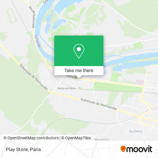
See Play Store, Rosny-Sur-Seine, on the map
Public Transit to Play Store in Rosny-Sur-Seine
Wondering how to get to Play Store in Rosny-Sur-Seine? Moovit helps you find the best way to get to Play Store with step-by-step directions from the nearest public transit station.
Moovit provides free maps and live directions to help you navigate through your city. View schedules, routes, timetables, and find out how long does it take to get to Play Store in real time.
Looking for the nearest stop or station to Play Store? Check out this list of stops closest to your destination: Saint Charles; Mairie; Collège Sully; Gare de Rosny-Sur-Seine; Rosny-Sur-Seine.
Train: J, TER.Bus: 5413, 5421, 5426, 5412, 5424, 5462, 5401.
Want to see if there’s another route that gets you there at an earlier time? Moovit helps you find alternative routes or times. Get directions from and directions to Play Store easily from the Moovit App or Website.
We make riding to Play Store easy, which is why over 1.5 million users, including users in Rosny-Sur-Seine, trust Moovit as the best app for public transit. You don’t need to download an individual bus app or train app, Moovit is your all-in-one transit app that helps you find the best bus time or train time available.
For information on prices of bus and train, costs and ride fares to Play Store, please check the Moovit app.
Use the app to navigate to popular places including to the airport, hospital, stadium, grocery store, mall, coffee shop, school, college, and university.
Play Store Address: 6 Grande Place 78710 Rosny-sur-Seine street in Rosny-Sur-Seine
- 31 Rue Régine Pernoud Garage,
- Super U,
- Les Petites Lumières,
- Brothers House,
- Amazon Locker-Adeo,
- Makala Laverie,
- Le Saint-Charles,
- Maison et Services Rosnysurseine,
- Rosnysurseine-Emploi,
- Chateau de Rosny-Sur-Seine,
- Tequamis,
- Kam,
- FedEx,
- Ad Séniors Rosny-sur-Seine,
- Western Union,
- Rosny Conduite,
- Bar de la Mairie,
- Mairie de Rosny-sur-Seine,
- Association Amelior. Readaptation Corporelle Association Pour l'Amélioration à la Réadaptation Corp,
- Rti-Reamet
Places Near Play Store (Rosny-Sur-Seine)
- Beaugrenelle, Paris,
- 29 Rue Manin, Paris,
- Fondation Louis Vuitton, Paris,
- Hopital Lariboisière, Paris,
- Hôpital Pitié Salpêtrière, Paris,
- Galeries Lafayette Haussmann, Paris,
- Hôpital Henri Mondor, Creteil,
- Hopital Foch, Suresnes,
- Hôpital Necker, Paris,
- Créteil Soleil, Creteil,
- Gare Routière Flixbus, Paris,
- Hôpital Beaujon, Clichy,
- Marché Saint-Pierre, Paris,
- Atelier Des Lumieres, Paris,
- Hôpital de la Pitié-Salpêtrière, Paris,
- Centre Hospitalier des 15/20, Paris,
- Hôpital Cochin, Paris,
- Hôpital Saint-Joseph, Paris,
- Galeries Lafayette, Paris,
- Théâtre Mogador, Paris
How to get to popular places in Paris with public transit
Get around Rosny-Sur-Seine by public transit!
Traveling around Rosny-Sur-Seine has never been so easy. See step by step directions as you travel to any attraction, street or major public transit station. View bus and train schedules, arrival times, service alerts and detailed routes on a map, so you know exactly how to get to anywhere in Rosny-Sur-Seine.
When traveling to any destination around Rosny-Sur-Seine use Moovit's Live Directions with Get Off Notifications to know exactly where and how far to walk, how long to wait for your line, and how many stops are left. Moovit will alert you when it's time to get off — no need to constantly re-check whether yours is the next stop.
Wondering how to use public transit in Rosny-Sur-Seine or how to pay for public transit in Rosny-Sur-Seine? Moovit public transit app can help you navigate your way with public transit easily, and at minimum cost. It includes public transit fees, ticket prices, and costs. Looking for a map of Rosny-Sur-Seine public transit lines? Moovit public transit app shows all public transit maps in Rosny-Sur-Seine with all Bus, Train, Metro, Light Rail, RER, Funicular and Gondola routes and stops on an interactive map.
Paris has 7 transit type(s), including: Bus, Train, Metro, Light Rail, RER, Funicular and Gondola, operated by several transit agencies, including RATP, RER, RER Bus de remplacement, Train, Train Bus de remplacement, Tramway Bus de remplacement, TER, ADP, Magical Shuttle, Argenteuil - Boucles de Seine, Autocars Dominique, Bièvre, Brie et 2 Morin, Le Bus - C.C. du Clermontois and Cœur d’Essonne