Directions to Plaza Cholula (San Jerónimo Tecuanipan) with public transportation
The following transit lines have routes that pass near Plaza Cholula
How to get to Plaza Cholula by bus?
Click on the bus route to see step by step directions with maps, line arrival times and updated time schedules.
From Universidad Anáhuac Puebla, Ocoyucan
36 minFrom Col. Emiliano Zapata San Andres Cholula, Ocoyucan
39 minFrom Centro Ecoturistico Apatlaco, Nealtican
37 minFrom Clínica 2 ISSSTEP, San Andrés Cholula
57 minFrom Plaza San Bartolo, Ocoyucan
52 minFrom Condusef Puebla, San Andrés Cholula
33 minFrom Terminal Flecha Azul, San Andrés Cholula
40 minFrom CAPU, San Pedro Cholula
41 minFrom Sector Estatal De Vialidad 105 Poniente, Ocoyucan
56 minFrom Concepción Guadalupe, San Andrés Cholula
53 min
Bus stops near Plaza Cholula in San Jerónimo Tecuanipan
Bus lines to Plaza Cholula in San Jerónimo Tecuanipan
- TRANSPORTE NOCTURNO, Paseo Bravo - Cholula (Circular),VIEW
- RECORRIDO 4, San Andrés Cholula - Paseo Bravo (Circular),VIEW
- RUTA S14A, Ramal 2, San Agustín Calvario - Puebla Centro,VIEW
- RUTA SAN ANDRÉS CHOLULA, Ramal 4, Santiago Xicotenco,VIEW
- LÍNEA PERIFÉRICO, Ramal Finsa - Buap (Circuito),VIEW
- RUTA PUEBLA-CHOLULA, Ramal 1, Puebla - San Cristóbal Tepontla (Ida),VIEW
- RUTA S14B, Ramal 1, San Pedro Mexicaltzingo -Puebla Centro,VIEW
- RUTA S16, Ramal 4, San Matías Cocoyotla - Santa Bárbara Almoloya,VIEW
- RUTA S25, Ramal 5, Cholula Centro - Puebla Centro,VIEW
What are the closest stations to Plaza Cholula?
The closest stations to Plaza Cholula are:
- Av 12 Ote Y Calle 8 Norte is 82 meters away, 2 min walk.
- Privada 8 Norte, 1211 is 94 meters away, 2 min walk.
- Avenida 12 Oriente Y 6 Norte is 121 meters away, 2 min walk.
- Calle 6 Norte, 1012 is 126 meters away, 2 min walk.
- Calle 8 Norte, 907 is 153 meters away, 3 min walk.
Which bus lines stop near Plaza Cholula?
These bus lines stop near Plaza Cholula: LÍNEA PERIFÉRICO, RECORRIDO 4, RUTA PUEBLA-CHOLULA, RUTA S14A, RUTA SAN ANDRÉS CHOLULA.
What’s the nearest bus station to Plaza Cholula in San Jerónimo Tecuanipan?
The nearest bus stations to Plaza Cholula in San Jerónimo Tecuanipan are Av 12 Ote Y Calle 8 Norte, Privada 8 Norte, 1211, Avenida 12 Oriente Y 6 Norte and Calle 6 Norte, 1012. The closest one is a 2 min walk away.
What time is the first bus to Plaza Cholula in San Jerónimo Tecuanipan?
The TRANSPORTE NOCTURNO is the first bus that goes to Plaza Cholula in San Jerónimo Tecuanipan. It stops nearby at 3:34 AM.
What time is the last bus to Plaza Cholula in San Jerónimo Tecuanipan?
The TRANSPORTE NOCTURNO is the last bus that goes to Plaza Cholula in San Jerónimo Tecuanipan. It stops nearby at 2:34 AM.
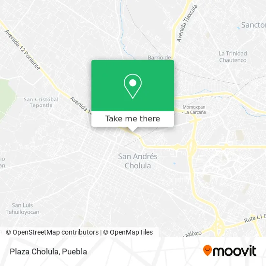
See Plaza Cholula, San Jerónimo Tecuanipan, on the map
Public Transit to Plaza Cholula in San Jerónimo Tecuanipan
Wondering how to get to Plaza Cholula in San Jerónimo Tecuanipan? Moovit helps you find the best way to get to Plaza Cholula with step-by-step directions from the nearest public transit station.
Moovit provides free maps and live directions to help you navigate through your city. View schedules, routes, timetables, and find out how long does it take to get to Plaza Cholula in real time.
Looking for the nearest stop or station to Plaza Cholula? Check out this list of stops closest to your destination: Av 12 Ote Y Calle 8 Norte; Privada 8 Norte; Avenida 12 Oriente Y 6 Norte; Calle 6 Norte; Calle 8 Norte.
Bus: LÍNEA PERIFÉRICO, RECORRIDO 4, RUTA PUEBLA-CHOLULA, RUTA S14A, RUTA SAN ANDRÉS CHOLULA, TRANSPORTE NOCTURNO, RUTA S14B, RUTA S16, RUTA S25.
Want to see if there’s another route that gets you there at an earlier time? Moovit helps you find alternative routes or times. Get directions from and directions to Plaza Cholula easily from the Moovit App or Website.
We make riding to Plaza Cholula easy, which is why over 1.5 million users, including users in San Jerónimo Tecuanipan, trust Moovit as the best app for public transit. You don’t need to download an individual bus app or train app, Moovit is your all-in-one transit app that helps you find the best bus time or train time available.
For information on prices of bus, costs and ride fares to Plaza Cholula, please check the Moovit app.
Use the app to navigate to popular places including to the airport, hospital, stadium, grocery store, mall, coffee shop, school, college, and university.
Location: San Jerónimo Tecuanipan, Puebla
- Laboratorio Chopo,
- Container City,
- Taqueria Los Trompos,
- Packmail,
- Maternidad La Sagrada Familia,
- Dental Cisneros Odontología Integral,
- Galería de Arte Llerandi,
- Mofles 1215,
- Tintoreria Los Ángeles,
- Florería La Flor de Mayo,
- Miscelania La Tiendita,
- Postres en Cholula,
- Barbacoa El Borreguito de Hidalgo,
- Tecnología en Bicicletas y Refacciones Tecnobyr,
- Distribuidora Roxana,
- Puesto de Memelas,
- Centro Quiropractico Papaqui,
- Miscelánea Juquilita,
- Sociedad Integral Emprendedora Siembra,
- Morena Distrito 10 Cholula, puebla
Places Near Plaza Cholula (San Jerónimo Tecuanipan)
- Plaza Las Animas, Puebla,
- Centro Integral de Servicios CIS, San Andrés Cholula,
- Centro Comercial Angelópolis, San Andrés Cholula,
- Hospital Traumatología y Ortopedia de Puebla, San Pedro Cholula,
- Secretaria de Finanzas, Puebla,
- Estadio Cuauhtémoc, Puebla,
- Hospital Imss La Margarita, Puebla,
- Centro de Desarrollo Comunitario Tres Cruces, Puebla,
- Zona de los Fuertes, Puebla,
- SAT, San Andrés Cholula,
- Parque Ecologico, Pue., San Andrés Cholula,
- Parque Puebla, Puebla,
- Galerías Serdán, San Pedro Cholula,
- Ciudad Judicial del Estado de Puebla, San Andrés Cholula,
- 25 Zona Militar, Puebla,
- Ciudad Universitaria, Puebla,
- Hospital General Regional 36 IMSS San Alejandro, San Andrés Cholula,
- Tres Cruces, Puebla,
- Plaza Dorada Centro Comercial, Puebla,
- Complejo Cultural Universitario, Ocoyucan
How to get to popular places in Puebla with public transit
Get around San Jerónimo Tecuanipan by public transit!
Traveling around San Jerónimo Tecuanipan has never been so easy. See step by step directions as you travel to any attraction, street or major public transit station. View bus and train schedules, arrival times, service alerts and detailed routes on a map, so you know exactly how to get to anywhere in San Jerónimo Tecuanipan.
When traveling to any destination around San Jerónimo Tecuanipan use Moovit's Live Directions with Get Off Notifications to know exactly where and how far to walk, how long to wait for your line, and how many stops are left. Moovit will alert you when it's time to get off — no need to constantly re-check whether yours is the next stop.
Wondering how to use public transit in San Jerónimo Tecuanipan or how to pay for public transit in San Jerónimo Tecuanipan? Moovit public transit app can help you navigate your way with public transit easily, and at minimum cost. It includes public transit fees, ticket prices, and costs. Looking for a map of San Jerónimo Tecuanipan public transit lines? Moovit public transit app shows all public transit maps in San Jerónimo Tecuanipan with all bus routes and stops on an interactive map.
Puebla has 1 transit type(s), including: bus, operated by several transit agencies, including RUTA, RUTA Alimentadoras, Rutas Convencionales and Líneas temporales