How to get to Plot It by bus?
Click on the bus route to see step by step directions with maps, line arrival times and updated time schedules.
How to get to Plot It by train?
Click on the train route to see step by step directions with maps, line arrival times and updated time schedules.
From Epplesee, Rheinstetten
49 minFrom Hopfenschlingel, Vereinbarte Verwaltungsgemeinschaft Rastatt
41 minFrom POCO Einrichtungsmärkte, Pforzheim
90 minFrom Karlsruher Straße, Pforzheim
89 minFrom Schloss Neuenbürg, Verwaltungsgemeinschaft Neuenbürg
131 minFrom Müller Fleisch, Birkenfeld
116 minFrom Waldbronn Eistreff, Waldbronn
72 min
Bus stops near Plot It in Bruchhausen
Train stations near Plot It in Bruchhausen
Bus lines to Plot It in Bruchhausen
What are the closest stations to Plot It?
The closest stations to Plot It are:
- Ettlingenweier Im Stöck is 173 meters away, 3 min walk.
- Bruchhausen am Sang is 418 meters away, 6 min walk.
- Bruchhausen (B. Ettlingen) is 434 meters away, 6 min walk.
- Ettlingen West is 3973 meters away, 51 min walk.
Which train lines stop near Plot It?
These train lines stop near Plot It: RB 44, RB41, RB44, S71.
Which bus lines stop near Plot It?
These bus lines stop near Plot It: 104, 106, 107.
What’s the nearest train station to Plot It in Bruchhausen?
The nearest train station to Plot It in Bruchhausen is Bruchhausen (B. Ettlingen). It’s a 6 min walk away.
What’s the nearest bus station to Plot It in Bruchhausen?
The nearest bus station to Plot It in Bruchhausen is Ettlingenweier Im Stöck. It’s a 3 min walk away.
What time is the first light rail to Plot It in Bruchhausen?
The S71 is the first light rail that goes to Plot It in Bruchhausen. It stops nearby at 5:24 AM.
What time is the last light rail to Plot It in Bruchhausen?
The S71 is the last light rail that goes to Plot It in Bruchhausen. It stops nearby at 10:57 PM.
What time is the first train to Plot It in Bruchhausen?
The S71 is the first train that goes to Plot It in Bruchhausen. It stops nearby at 5:21 AM.
What time is the last train to Plot It in Bruchhausen?
The RB 44 is the last train that goes to Plot It in Bruchhausen. It stops nearby at 1:56 AM.
What time is the first bus to Plot It in Bruchhausen?
The 110 is the first bus that goes to Plot It in Bruchhausen. It stops nearby at 4:54 AM.
What time is the last bus to Plot It in Bruchhausen?
The 104 is the last bus that goes to Plot It in Bruchhausen. It stops nearby at 12:41 AM.
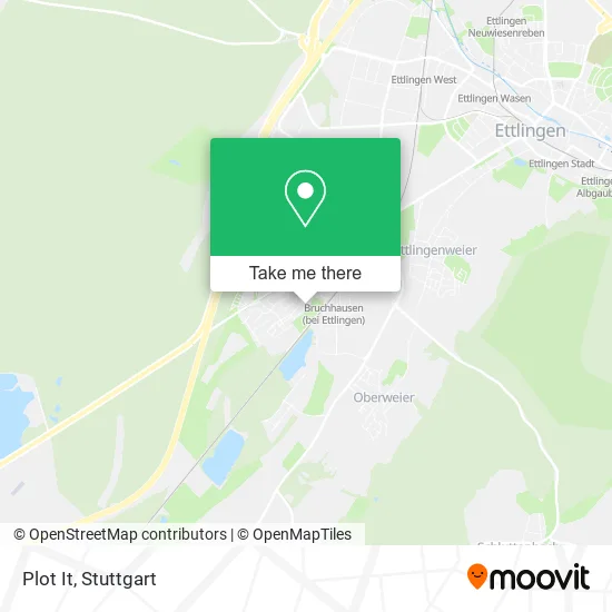
See Plot It, Bruchhausen, on the map
Public Transit to Plot It in Bruchhausen
Wondering how to get to Plot It in Bruchhausen? Moovit helps you find the best way to get to Plot It with step-by-step directions from the nearest public transit station.
Moovit provides free maps and live directions to help you navigate through your city. View schedules, routes, timetables, and find out how long does it take to get to Plot It in real time.
Looking for the nearest stop or station to Plot It? Check out this list of stops closest to your destination: Ettlingenweier Im Stöck; Bruchhausen am Sang; Bruchhausen (B. Ettlingen); Ettlingen West.
Train: RB 44, RB41, RB44, S71, S81, RE2, RE7, S32, RE40, RE 2, RE 7, RE 40, RB 41, FEX.Bus: 104, 106, 107.
Want to see if there’s another route that gets you there at an earlier time? Moovit helps you find alternative routes or times. Get directions from and directions to Plot It easily from the Moovit App or Website.
We make riding to Plot It easy, which is why over 1.5 million users, including users in Bruchhausen, trust Moovit as the best app for public transit. You don’t need to download an individual bus app or train app, Moovit is your all-in-one transit app that helps you find the best bus time or train time available.
For information on prices of train, bus and light rail, costs and ride fares to Plot It, please check the Moovit app.
Use the app to navigate to popular places including to the airport, hospital, stadium, grocery store, mall, coffee shop, school, college, and university.
Plot It Address: Aalweg 1 Bruchhausen, 76275 Ettlingen street in Bruchhausen
- Thomas Zoller,
- Jungtieren Herzlich Willkommen,
- Schildkrötenranch,
- Musikverein Ettlingen,
- Teich,
- Playjazz (Christof Steiner),
- Huk-Coburg,
- Paulina Rogucka,
- Umspannstation Bruchhausen Badstraße,
- Consulting Pro Optima,
- Elektro-Klein, Ralf und Frank Klein,
- Franz Elter,
- Schneider Ulrich U. Vesselinka,
- Seipl Installationen,
- Dungeon Tattoos,
- Time2be Werbeagentur Ettlingen,
- Mrg Mediation,
- Schulze Erwin Maßagepraxis,
- Dang,
- Roland Ehni Architekt
Places Near Plot It (Bruchhausen)
- Marmorsaal Im Weissenburgpark, Stuttgart-Süd,
- SI-Centrum, Möhringen,
- Geilhaus Haus 33a, Reutlingen-Betzingen,
- Porsche Museum, Zuffenhausen,
- Mercedes-Benz Museum (Mercedes Museum Stuttgart), Bad Cannstatt,
- Porsche-Arena, Bad Cannstatt,
- Hauptbahnhof Stuttgart, Stuttgart-Mitte,
- Waldfriedhof, Degerloch,
- Mettingen Eros-Center Puff Laufhaus, Esslingen Am Neckar,
- Im Wizemann (Halle), Bad Cannstatt,
- Hanns-Martin-Schleyer-Halle, Bad Cannstatt,
- Klinikum Stuttgart - Katharinenhospital, Stuttgart-Mitte,
- Wilhelma (U-Bahn Wilhelma), Bad Cannstatt,
- Gasometer Pforzheim, Pforzheim,
- Gleis 101/102 (tief), Stuttgart-Mitte,
- FlixBus Haltestelle, Stuttgart,
- Pariser Platz Stuttgart, Stuttgart-Mitte,
- Hanns-Martin-Schleyer-Halle (Stuttgart Hans-Martin-Schleyerhalle), Bad Cannstatt,
- Schleyerhalle, Bad Cannstatt,
- Mercedes-Benz Museum, Bad Cannstatt
How to get to popular places in Stuttgart with public transit
Get around Bruchhausen by public transit!
Traveling around Bruchhausen has never been so easy. See step by step directions as you travel to any attraction, street or major public transit station. View bus and train schedules, arrival times, service alerts and detailed routes on a map, so you know exactly how to get to anywhere in Bruchhausen.
When traveling to any destination around Bruchhausen use Moovit's Live Directions with Get Off Notifications to know exactly where and how far to walk, how long to wait for your line, and how many stops are left. Moovit will alert you when it's time to get off — no need to constantly re-check whether yours is the next stop.
Wondering how to use public transit in Bruchhausen or how to pay for public transit in Bruchhausen? Moovit public transit app can help you navigate your way with public transit easily, and at minimum cost. It includes public transit fees, ticket prices, and costs. Looking for a map of Bruchhausen public transit lines? Moovit public transit app shows all public transit maps in Bruchhausen with all Bus, Train, Subway, Light Rail, Ferry, S-Bahn and Funicular routes and stops on an interactive map.
Stuttgart has 7 transit type(s), including: Bus, Train, Subway, Light Rail, Ferry, S-Bahn and Funicular, operated by several transit agencies, including SSB - Stadtbahn, SSB, SSB - Seilbahn / Zacke, S-Bahn Stuttgart, Rhein-Neckar-Verkehr GmbH (rnv), Karlsruher Verkehrsverbund, DB AG, DB Regiobus BW, Arverio Baden-Württemberg GmbH, DB RegioNetz Verkehrs GmbH Westfrankenbahn, DB Regio AG Baden-Württemberg, Südwestdeutsche Verkehrs-AG, DB Regio AG Mitte Region Hessen, DB and Bodensee-Oberschwaben-Bahn