How to get to Pmat by bus?
Click on the bus route to see step by step directions with maps, line arrival times and updated time schedules.
Bus stops near Pmat in Norfolk
What are the closest stations to Pmat?
The closest stations to Pmat are:
- Hampton & Runnymede is 187 yards away, 3 min walk.
- Little Creek & Shirland is 437 yards away, 6 min walk.
Which bus lines stop near Pmat?
These bus lines stop near Pmat: 021, 961.
What’s the nearest bus station to Pmat in Norfolk?
The nearest bus station to Pmat in Norfolk is Hampton & Runnymede. It’s a 3 min walk away.
What time is the first bus to Pmat in Norfolk?
The 021 is the first bus that goes to Pmat in Norfolk. It stops nearby at 5:24 AM.
What time is the last bus to Pmat in Norfolk?
The 021 is the last bus that goes to Pmat in Norfolk. It stops nearby at 1:22 AM.
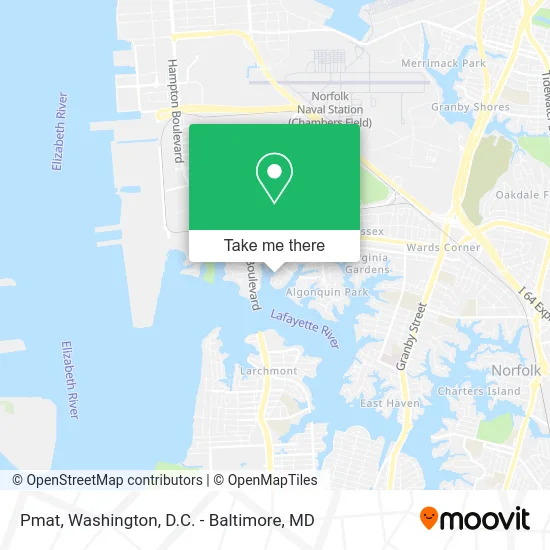
See Pmat, Norfolk, on the map
Public Transit to Pmat in Norfolk
Wondering how to get to Pmat in Norfolk? Moovit helps you find the best way to get to Pmat with step-by-step directions from the nearest public transit station.
Moovit provides free maps and live directions to help you navigate through your city. View schedules, routes, timetables, and find out how long does it take to get to Pmat in real time.
Looking for the nearest stop or station to Pmat? Check out this list of stops closest to your destination: Hampton & Runnymede; Little Creek & Shirland.
Bus: 021, 961, 002.
Want to see if there’s another route that gets you there at an earlier time? Moovit helps you find alternative routes or times. Get directions from and directions to Pmat easily from the Moovit App or Website.
We make riding to Pmat easy, which is why over 1.5 million users, including users in Norfolk, trust Moovit as the best app for public transit. You don’t need to download an individual bus app or train app, Moovit is your all-in-one transit app that helps you find the best bus time or train time available.
For information on prices of bus, costs and ride fares to Pmat, please check the Moovit app.
Use the app to navigate to popular places including to the airport, hospital, stadium, grocery store, mall, coffee shop, school, college, and university.
Pmat Address: 1348 Bayonne St Norfolk, VA 23505 street in Norfolk
- Prince Landscapes,
- Sprowgal Investments,
- Beitinjaneh Firas,
- Algonquin Condominium,
- The Algonquin House,
- Marine Chemist Atlantic,
- Meadowbrook,
- USPS Collection Box - Blue Box,
- Loch-Meadow Kindergarten,
- Hampton Blvd Farmers Market,
- Lee's Friends Helping People Live with Cancer,
- Church of the Good Shepherd,
- Industrial Prosperity 365 Consulting,
- USPS Collection Box - Blue Box,
- Andrew T Zoby & Son,
- The Virginia Rowing Company,
- Second Presbyterian Church,
- Naval Station Child Development Center,
- Presbyterian Church,
- Tidewater Pastoral Counseling Services
Places Near Pmat (Norfolk)
- Sibley Memorial Hospital, Washington,
- Capital One Arena, Washington,
- National Mall, Washington,
- Basilica of the National Shrine, Washington,
- Museum Of The Bible, Washington,
- Georgetown, Washington,
- M&T Bank Stadium, Baltimore,
- Pennsylvania Ave NW (3rd st and pennsylvania), Washington,
- Marriott Marquis Washington, DC, Washington,
- National Zoo, Washington,
- The Anthem, Washington,
- National Museum of African American History and Culture, Washington,
- Amazon Hq2, Arlington County,
- Washington DC VA Medical Center, Washington,
- Camden Yards, Baltimore,
- Washington National Cathedral, Washington,
- Westfield Montgomery Mall, Montgomery County,
- Warner Theatre, Washington,
- Rock Creek Tennis Center, Washington,
- PG Mall, Prince George's County
How to get to popular places in Washington, D.C. - Baltimore, MD with public transit
Get around Norfolk by public transit!
Traveling around Norfolk has never been so easy. See step by step directions as you travel to any attraction, street or major public transit station. View bus and train schedules, arrival times, service alerts and detailed routes on a map, so you know exactly how to get to anywhere in Norfolk.
When traveling to any destination around Norfolk use Moovit's Live Directions with Get Off Notifications to know exactly where and how far to walk, how long to wait for your line, and how many stops are left. Moovit will alert you when it's time to get off — no need to constantly re-check whether yours is the next stop.
Wondering how to use public transit in Norfolk or how to pay for public transit in Norfolk? Moovit public transit app can help you navigate your way with public transit easily, and at minimum cost. It includes public transit fees, ticket prices, and costs. Looking for a map of Norfolk public transit lines? Moovit public transit app shows all public transit maps in Norfolk with all Bus, Train, Metro, Light Rail and Ferry routes and stops on an interactive map.
Washington, D.C. - Baltimore, MD has 5 transit type(s), including: Bus, Train, Metro, Light Rail and Ferry, operated by several transit agencies, including WMATA, Montgomery County Ride On, Fairfax Connector, TheBus, PRTC, DASH - Alexandria, Arlington Transit (ART), RTA of Central Maryland, MDOT MTA, MDOT MTA Light RailLink, MDOT MTA Commuter Bus, MDOT MTA Local Bus, FXBGO!, Virginia Railway Express (VRE) and MARC