How to get to Pnc Bank by bus?
Click on the bus route to see step by step directions with maps, line arrival times and updated time schedules.
From Marlboro Pike, Prince George's County
242 minFrom Centre at Forestville Mall, Prince George's County
236 minFrom Fort Washington, MD, Prince George's County
244 minFrom Clinton, MD, Prince George's County
251 minFrom Waldorf, MD, Charles County
161 minFrom Andrews Air Force Base, Prince George's County
249 minFrom Upper Marlboro Courthouse, Prince George's County
307 minFrom Joint Base Andrews, Prince George's County
250 min
Bus stop near Pnc Bank in Saint Mary's County
- Md 235 Opp. Hollywood Medical Center Nb, 10 min walk,VIEW
Bus lines to Pnc Bank in Saint Mary's County
What are the closest stations to Pnc Bank?
The closest stations to Pnc Bank are:
- Md 235 Opp. Hollywood Medical Center Nb is 781 yards away, 10 min walk.
Which bus lines stop near Pnc Bank?
These bus lines stop near Pnc Bank: 4, 715.
What’s the nearest bus station to Pnc Bank in Saint Mary's County?
The nearest bus station to Pnc Bank in Saint Mary's County is Md 235 Opp. Hollywood Medical Center Nb. It’s a 10 min walk away.
What time is the first bus to Pnc Bank in Saint Mary's County?
The 1 is the first bus that goes to Pnc Bank in Saint Mary's County. It stops nearby at 6:09 AM.
What time is the last bus to Pnc Bank in Saint Mary's County?
The 4 is the last bus that goes to Pnc Bank in Saint Mary's County. It stops nearby at 6:31 PM.
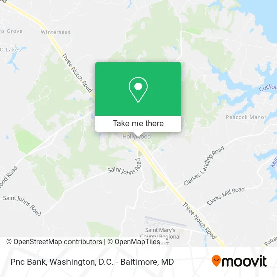
See Pnc Bank, Saint Mary's County, on the map
Public Transit to Pnc Bank in Saint Mary's County
Wondering how to get to Pnc Bank in Saint Mary's County? Moovit helps you find the best way to get to Pnc Bank with step-by-step directions from the nearest public transit station.
Moovit provides free maps and live directions to help you navigate through your city. View schedules, routes, timetables, and find out how long does it take to get to Pnc Bank in real time.
Looking for the nearest stop or station to Pnc Bank? Check out this list of stops closest to your destination: Md 235 Opp. Hollywood Medical Center Nb.
Bus: 4, 715, 1, 14.
Want to see if there’s another route that gets you there at an earlier time? Moovit helps you find alternative routes or times. Get directions from and directions to Pnc Bank easily from the Moovit App or Website.
We make riding to Pnc Bank easy, which is why over 1.7 million users, including users in Saint Mary's County, trust Moovit as the best app for public transit. You don’t need to download an individual bus app or train app, Moovit is your all-in-one transit app that helps you find the best bus time or train time available.
For information on prices of bus and metro, costs and ride fares to Pnc Bank, please check the Moovit app.
Use the app to navigate to popular places including to the airport, hospital, stadium, grocery store, mall, coffee shop, school, college, and university.
Pnc Bank Address: 24385 Mervell Dean Rd street in Saint Mary's County
- Md Custom Construction,
- Southern Maryland House Calls,
- Bethel 42 - Job's Daughters International,
- Dean Home Supply And Service Co,
- Prep And Play Preschool And Daycare Center,
- Raj Holistic Healing Spa,
- Redbox,
- Arlene Dean,
- Taylor Gladu First Home Mortgage,
- Truth Bible Church Office,
- Jim Moran - First Home Mortgage,
- Mala Handworks,
- Anchored Roots Farm,
- St. John's Summer Program,
- Southern Maryland Holly Jolly Light Trail,
- Gloria Huber, Realtor,
- Amber Herrera Torres- Realtor®,
- Lara Moore- the Southside Group,
- Residential Real Estate Services,
- Christina Nelson
Places Near Pnc Bank (Saint Mary's County)
- Warner Theatre, Washington,
- PG Mall, Prince George's County,
- National Theatre, Washington,
- Rock Creek Tennis Center, Washington,
- Washington DC VA Medical Center, Washington,
- National Zoo, Washington,
- Pennsylvania Ave NW (3rd st and pennsylvania), Washington,
- National Museum of African American History and Culture, Washington,
- Museum Of The Bible, Washington,
- The Anthem, Washington,
- Washington National Cathedral, Washington,
- Amazon Hq2, Arlington County,
- Sibley Memorial Hospital, Washington,
- Westfield Montgomery Mall, Montgomery County,
- Marriott Marquis Washington, DC, Washington,
- Camden Yards, Baltimore,
- M&T Bank Stadium, Baltimore,
- Capital One Arena, Washington,
- Basilica of the National Shrine, Washington,
- Georgetown, Washington
How to get to popular places in Washington, D.C. - Baltimore, MD with public transit
Get around Saint Mary's County by public transit!
Traveling around Saint Mary's County has never been so easy. See step by step directions as you travel to any attraction, street or major public transit station. View bus and train schedules, arrival times, service alerts and detailed routes on a map, so you know exactly how to get to anywhere in Saint Mary's County.
When traveling to any destination around Saint Mary's County use Moovit's Live Directions with Get Off Notifications to know exactly where and how far to walk, how long to wait for your line, and how many stops are left. Moovit will alert you when it's time to get off — no need to constantly re-check whether yours is the next stop.
Wondering how to use public transit in Saint Mary's County or how to pay for public transit in Saint Mary's County? Moovit public transit app can help you navigate your way with public transit easily, and at minimum cost. It includes public transit fees, ticket prices, and costs. Looking for a map of Saint Mary's County public transit lines? Moovit public transit app shows all public transit maps in Saint Mary's County with all Bus, Train, Metro, Light Rail and Ferry routes and stops on an interactive map.
Washington, D.C. - Baltimore, MD has 5 transit type(s), including: Bus, Train, Metro, Light Rail and Ferry, operated by several transit agencies, including WMATA, Montgomery County Ride On, Fairfax Connector, TheBus, PRTC, DASH - Alexandria, Arlington Transit (ART), RTA of Central Maryland, MDOT MTA, MDOT MTA Light RailLink, MDOT MTA Commuter Bus, MDOT MTA Local Bus, FXBGO!, Virginia Railway Express (VRE) and MARC