How to get to Pnc Bank by bus?
Click on the bus route to see step by step directions with maps, line arrival times and updated time schedules.
From Bullis School, Montgomery County
83 minFrom Montgomery College-Rockville, Montgomery County
46 minFrom Montgomery County Fairgrounds, Montgomery County
27 minFrom Clarksburg Premium Outlets, Montgomery County
50 minFrom Park Potomac Place, Montgomery County
66 minFrom Adventist HealthCare Shady Grove Medical Center, Montgomery County
32 minFrom Clarksburg Premium Outlets, Montgomery County
50 minFrom I-270 Exit 9A/B (I-370 / Sam Eig Hwy. Interchange), Montgomery County
65 minFrom Glenstone Museum, Montgomery County
62 minFrom Rockville, MD, Montgomery County
53 min
How to get to Pnc Bank by train?
Click on the train route to see step by step directions with maps, line arrival times and updated time schedules.
Bus stops near Pnc Bank in Montgomery County
Train station near Pnc Bank in Montgomery County
- Germantown Marc Eb, 18 min walk,VIEW
Bus lines to Pnc Bank in Montgomery County
What are the closest stations to Pnc Bank?
The closest stations to Pnc Bank are:
- Kingsview Village Ave & Clopper Rd is 179 yards away, 3 min walk.
- Clopper Rd & Village Fountain Dr is 308 yards away, 5 min walk.
- Kingsview Park & Ride & Clopper Rd is 330 yards away, 5 min walk.
- Germantown Marc Eb is 1491 yards away, 18 min walk.
Which bus lines stop near Pnc Bank?
These bus lines stop near Pnc Bank: 61, 74, 78.
Which train line stops near Pnc Bank?
MARC (Inbound - Brunswick)
What’s the nearest train station to Pnc Bank in Montgomery County?
The nearest train station to Pnc Bank in Montgomery County is Germantown Marc Eb. It’s a 18 min walk away.
What’s the nearest bus station to Pnc Bank in Montgomery County?
The nearest bus station to Pnc Bank in Montgomery County is Kingsview Village Ave & Clopper Rd. It’s a 3 min walk away.
What time is the first train to Pnc Bank in Montgomery County?
The MARC is the first train that goes to Pnc Bank in Montgomery County. It stops nearby at 5:19 AM.
What time is the last train to Pnc Bank in Montgomery County?
The MARC is the last train that goes to Pnc Bank in Montgomery County. It stops nearby at 8:07 PM.
What time is the first bus to Pnc Bank in Montgomery County?
The 61 is the first bus that goes to Pnc Bank in Montgomery County. It stops nearby at 4:26 AM.
What time is the last bus to Pnc Bank in Montgomery County?
The 61 is the last bus that goes to Pnc Bank in Montgomery County. It stops nearby at 12:25 AM.
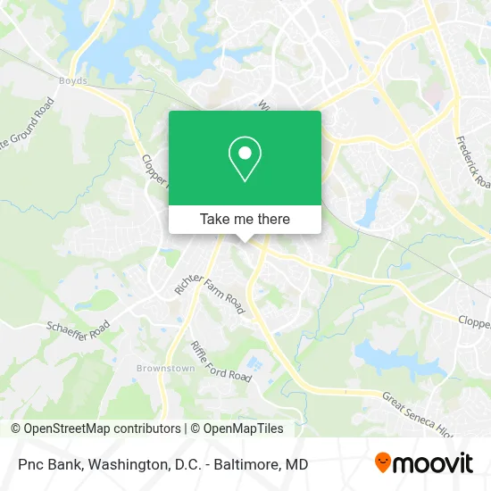
See Pnc Bank, Montgomery County, on the map
Public Transit to Pnc Bank in Montgomery County
Wondering how to get to Pnc Bank in Montgomery County? Moovit helps you find the best way to get to Pnc Bank with step-by-step directions from the nearest public transit station.
Moovit provides free maps and live directions to help you navigate through your city. View schedules, routes, timetables, and find out how long does it take to get to Pnc Bank in real time.
Looking for the nearest stop or station to Pnc Bank? Check out this list of stops closest to your destination: Kingsview Village Ave & Clopper Rd; Clopper Rd & Village Fountain Dr; Kingsview Park & Ride & Clopper Rd; Germantown Marc Eb.
Bus: 61, 74, 78, 71, 98.Train: MARC.
Want to see if there’s another route that gets you there at an earlier time? Moovit helps you find alternative routes or times. Get directions from and directions to Pnc Bank easily from the Moovit App or Website.
We make riding to Pnc Bank easy, which is why over 1.7 million users, including users in Montgomery County, trust Moovit as the best app for public transit. You don’t need to download an individual bus app or train app, Moovit is your all-in-one transit app that helps you find the best bus time or train time available.
For information on prices of bus, metro and train, costs and ride fares to Pnc Bank, please check the Moovit app.
Use the app to navigate to popular places including to the airport, hospital, stadium, grocery store, mall, coffee shop, school, college, and university.
Pnc Bank Address: 18331 Leaman Farm Rd street in Montgomery County
- Clopper Road P+R,
- Northwest High School,
- Kingsview Middle School,
- Germantown Recreational Park,
- Germantown Elementary,
- Germantown, Maryland,
- Germantown Station,
- Germantown MARC Station,
- Germantown Flea Market,
- Lancaster Dutch Market,
- Children's Hospital,
- USPS,
- USPS,
- Lancaster County Dutch Market,
- CVS/pharmacy,
- Seneca Valley High School,
- Seneca Valley High School ,
- T-Mobile,
- Amazon Locker-Driftwood,
- The Cross Chinese Baptist Church
Places Near Pnc Bank (Montgomery County)
- Marriott Marquis Washington, DC, Washington,
- Warner Theatre, Washington,
- Westfield Montgomery Mall, Montgomery County,
- Camden Yards, Baltimore,
- Sibley Memorial Hospital, Washington,
- PG Mall, Prince George's County,
- M&T Bank Stadium, Baltimore,
- Georgetown, Washington,
- National Zoo, Washington,
- Washington National Cathedral, Washington,
- Basilica of the National Shrine, Washington,
- Amazon Hq2, Arlington County,
- Capital One Arena, Washington,
- Pennsylvania Ave NW (3rd st and pennsylvania), Washington,
- Rock Creek Tennis Center, Washington,
- The Anthem, Washington,
- Washington DC VA Medical Center, Washington,
- National Theatre, Washington,
- National Museum of African American History and Culture, Washington,
- Museum Of The Bible, Washington
How to get to popular places in Washington, D.C. - Baltimore, MD with public transit
Get around Montgomery County by public transit!
Traveling around Montgomery County has never been so easy. See step by step directions as you travel to any attraction, street or major public transit station. View bus and train schedules, arrival times, service alerts and detailed routes on a map, so you know exactly how to get to anywhere in Montgomery County.
When traveling to any destination around Montgomery County use Moovit's Live Directions with Get Off Notifications to know exactly where and how far to walk, how long to wait for your line, and how many stops are left. Moovit will alert you when it's time to get off — no need to constantly re-check whether yours is the next stop.
Wondering how to use public transit in Montgomery County or how to pay for public transit in Montgomery County? Moovit public transit app can help you navigate your way with public transit easily, and at minimum cost. It includes public transit fees, ticket prices, and costs. Looking for a map of Montgomery County public transit lines? Moovit public transit app shows all public transit maps in Montgomery County with all Bus, Train, Metro, Light Rail and Ferry routes and stops on an interactive map.
Washington, D.C. - Baltimore, MD has 5 transit type(s), including: Bus, Train, Metro, Light Rail and Ferry, operated by several transit agencies, including WMATA, Montgomery County Ride On, Fairfax Connector, TheBus, PRTC, DASH - Alexandria, Arlington Transit (ART), RTA of Central Maryland, MDOT MTA, MDOT MTA Light RailLink, MDOT MTA Commuter Bus, MDOT MTA Local Bus, FXBGO!, Virginia Railway Express (VRE) and MARC