Directions to Pnc Bank Atm (Baltimore) with public transportation
The following transit lines have routes that pass near Pnc Bank Atm
 Bus: 28, 30, CITYLINK PINK, 57, 59.
How to get to Pnc Bank Atm by bus?
Click on the bus route to see step by step directions with maps, line arrival times and updated time schedules.
From I-695 @ Exit 27 (Dulaney Valley Road/MD 146), Baltimore County
59 minFrom Towson, MD, Baltimore County
45 minFrom Horseshoe Baltimore, Baltimore
66 minFrom Johns Hopkins University, Baltimore
44 minFrom Towson Town Center, Baltimore County
50 minFrom Baltimore Greyhound Station, Baltimore
66 minFrom Baltimore City Community College (BCCC) - Liberty Campus, Baltimore
62 minFrom Sinai Hospital, Baltimore
43 minFrom Inner Harbor, Baltimore
40 minFrom Baltimore Poly Tech High School, Baltimore
39 min
Bus stops near Pnc Bank Atm in Baltimore
Bus lines to Pnc Bank Atm in Baltimore
What are the closest stations to Pnc Bank Atm?
The closest stations to Pnc Bank Atm are:
- Parkside Shopping Center is 54 yards away, 1 min walk.
- Sinclair Ln & Parkside Plaza MB Wb is 124 yards away, 2 min walk.
- Frankford Ave & Omaha Ave Nb is 238 yards away, 3 min walk.
- Moravia Rd & Sinclair Ln FS Wb is 523 yards away, 7 min walk.
Which bus lines stop near Pnc Bank Atm?
These bus lines stop near Pnc Bank Atm: 28, 30, CITYLINK PINK.
What’s the nearest bus station to Pnc Bank Atm in Baltimore?
The nearest bus station to Pnc Bank Atm in Baltimore is Parkside Shopping Center. It’s a 1 min walk away.
What time is the first bus to Pnc Bank Atm in Baltimore?
The 63 is the first bus that goes to Pnc Bank Atm in Baltimore. It stops nearby at 3:01 AM.
What time is the last bus to Pnc Bank Atm in Baltimore?
The CITYLINK PINK is the last bus that goes to Pnc Bank Atm in Baltimore. It stops nearby at 3:21 AM.
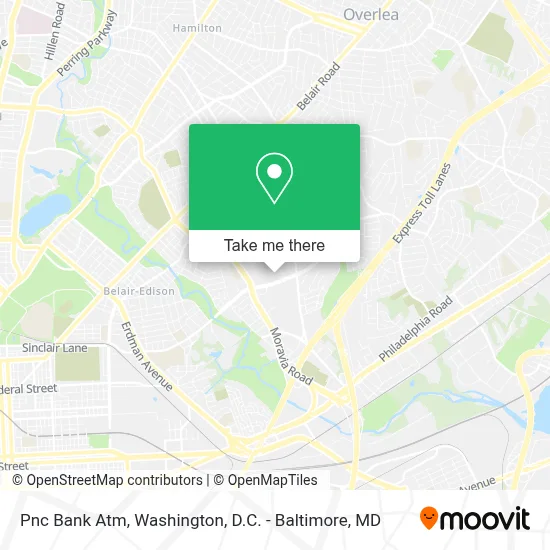
See Pnc Bank Atm, Baltimore, on the map
Public Transit to Pnc Bank Atm in Baltimore
Wondering how to get to Pnc Bank Atm in Baltimore? Moovit helps you find the best way to get to Pnc Bank Atm with step-by-step directions from the nearest public transit station.
Moovit provides free maps and live directions to help you navigate through your city. View schedules, routes, timetables, and find out how long does it take to get to Pnc Bank Atm in real time.
Looking for the nearest stop or station to Pnc Bank Atm? Check out this list of stops closest to your destination: Parkside Shopping Center; Sinclair Ln & Parkside Plaza MB Wb; Frankford Ave & Omaha Ave Nb; Moravia Rd & Sinclair Ln FS Wb.
Bus: 28, 30, CITYLINK PINK, 57, 59, 105, 63.
Want to see if there’s another route that gets you there at an earlier time? Moovit helps you find alternative routes or times. Get directions from and directions to Pnc Bank Atm easily from the Moovit App or Website.
We make riding to Pnc Bank Atm easy, which is why over 1.7 million users, including users in Baltimore, trust Moovit as the best app for public transit. You don’t need to download an individual bus app or train app, Moovit is your all-in-one transit app that helps you find the best bus time or train time available.
For information on prices of bus, costs and ride fares to Pnc Bank Atm, please check the Moovit app.
Use the app to navigate to popular places including to the airport, hospital, stadium, grocery store, mall, coffee shop, school, college, and university.
Pnc Bank Atm Address: 5150 Sinclair Ln street in Baltimore
- Moravia Rd (sinclair lane and moravia road),
- MTA Maryland 44 Bus,
- Parkside Gardens,
- Celestial Church of Christ,
- Garden Village Apartments & Townhouses,
- First Charity Baptist Church,
- Cedonia,
- Diddy’S Place Llc,
- Burgan Family Cemetery,
- 15 Security Square Mall,
- National Wesleyan Church,
- Small Breed Puppies For Rehoming In Baltimore, Md,
- Moravia Rd (belair road moravia road),
- New Global Kingdom Ministries,
- Sincere Motors Llc,
- MTA #15 Bus Stop-Belair n Moravia,
- Truth Lounge,
- Spoiled Rotten Kids Spa Party Bus,
- The New Greater New Life Cathedral Of Praise,
- Belair Belair Rd & Frankford Ave
Places Near Pnc Bank Atm (Baltimore)
- Amazon Hq2, Arlington County,
- Capital One Arena, Washington,
- M&T Bank Stadium, Baltimore,
- The Anthem, Washington,
- National Zoo, Washington,
- Marriott Marquis Washington, DC, Washington,
- Rock Creek Tennis Center, Washington,
- Museum Of The Bible, Washington,
- Westfield Montgomery Mall, Montgomery County,
- National Theatre, Washington,
- Pennsylvania Ave NW (3rd st and pennsylvania), Washington,
- Basilica of the National Shrine, Washington,
- National Museum of African American History and Culture, Washington,
- PG Mall, Prince George's County,
- Camden Yards, Baltimore,
- Warner Theatre, Washington,
- Washington National Cathedral, Washington,
- Sibley Memorial Hospital, Washington,
- Georgetown, Washington,
- Washington DC VA Medical Center, Washington
How to get to popular places in Washington, D.C. - Baltimore, MD with public transit
Get around Baltimore by public transit!
Traveling around Baltimore has never been so easy. See step by step directions as you travel to any attraction, street or major public transit station. View bus and train schedules, arrival times, service alerts and detailed routes on a map, so you know exactly how to get to anywhere in Baltimore.
When traveling to any destination around Baltimore use Moovit's Live Directions with Get Off Notifications to know exactly where and how far to walk, how long to wait for your line, and how many stops are left. Moovit will alert you when it's time to get off — no need to constantly re-check whether yours is the next stop.
Wondering how to use public transit in Baltimore or how to pay for public transit in Baltimore? Moovit public transit app can help you navigate your way with public transit easily, and at minimum cost. It includes public transit fees, ticket prices, and costs. Looking for a map of Baltimore public transit lines? Moovit public transit app shows all public transit maps in Baltimore with all Bus, Train, Metro, Light Rail and Ferry routes and stops on an interactive map.
Washington, D.C. - Baltimore, MD has 5 transit type(s), including: Bus, Train, Metro, Light Rail and Ferry, operated by several transit agencies, including WMATA, Montgomery County Ride On, Fairfax Connector, TheBus, PRTC, DASH - Alexandria, Arlington Transit (ART), RTA of Central Maryland, MDOT MTA, MDOT MTA Light RailLink, MDOT MTA Commuter Bus, MDOT MTA Local Bus, FXBGO!, Virginia Railway Express (VRE) and MARC