How to get to Pod Point by bus?
Click on the bus route to see step by step directions with maps, line arrival times and updated time schedules.
How to get to Pod Point by train?
Click on the train route to see step by step directions with maps, line arrival times and updated time schedules.
Bus stops near Pod Point in Trondheim
Train station near Pod Point in Trondheim
- Lerkendal Stasjon, 17 min walk,VIEW
Light Rail stations near Pod Point in Trondheim
- Breidablikk, 28 min walk,VIEW
Bus lines to Pod Point in Trondheim
- 1, Ranheim Via Tiller-Sentrum,VIEW
- 2, Lund Via Lade-Sentrum-Kolstad,VIEW
- 10, Fortuna/Sæterbakken Via Sentrum,VIEW
- 14, Strindheim Via Brundalen,VIEW
- 71, B Dora Via Ekra-Tillerterminalen,VIEW
- 72, Klæbu,VIEW
- 73, Klæbu Via Bostad,VIEW
- 74, Flatjord,VIEW
- 79, Nidarvoll Via Brattøra,VIEW
- 104, Heimdal Via Kolstad,VIEW
- 110, Brekkåsen Via Melhus,VIEW
- 111, Tiller,VIEW
- 135, Tynset,VIEW
- 310, Fannrem Stasjon Via Orkanger,VIEW
- 311, Stjørdal Stasjon,VIEW
- 340, Støren Stasjon,VIEW
- 410, Orkanger Via Fv. 800 Og Grønnøra,VIEW
- 420, Trondheim Via Fillan Og Orkanger,VIEW
- 440, Røros,VIEW
- 470, Kyrksæterøra,VIEW
What are the closest stations to Pod Point?
The closest stations to Pod Point are:
- Bratsbergvegen is 203 meters away, 3 min walk.
- Tempe is 265 meters away, 4 min walk.
- Siemens is 292 meters away, 4 min walk.
- Sorgenfri is 590 meters away, 8 min walk.
- Lerkendal Stasjon is 1286 meters away, 17 min walk.
- Breidablikk is 2167 meters away, 28 min walk.
Which bus lines stop near Pod Point?
These bus lines stop near Pod Point: 1, 13.
Which train line stops near Pod Point?
R70 (Lundamo)
What’s the nearest light rail station to Pod Point in Trondheim?
The nearest light rail station to Pod Point in Trondheim is Breidablikk. It’s a 28 min walk away.
What’s the nearest train station to Pod Point in Trondheim?
The nearest train station to Pod Point in Trondheim is Lerkendal Stasjon. It’s a 17 min walk away.
What’s the nearest bus station to Pod Point in Trondheim?
The nearest bus station to Pod Point in Trondheim is Bratsbergvegen. It’s a 3 min walk away.
What time is the first light rail to Pod Point in Trondheim?
The 9 is the first light rail that goes to Pod Point in Trondheim. It stops nearby at 3:24 AM.
What time is the last light rail to Pod Point in Trondheim?
The 9 is the last light rail that goes to Pod Point in Trondheim. It stops nearby at 12:28 AM.
What time is the first bus to Pod Point in Trondheim?
The 103 is the first bus that goes to Pod Point in Trondheim. It stops nearby at 3:05 AM.
What time is the last bus to Pod Point in Trondheim?
The 14 is the last bus that goes to Pod Point in Trondheim. It stops nearby at 12:47 AM.
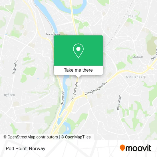
See Pod Point, Trondheim, on the map
Public Transit to Pod Point in Trondheim
Wondering how to get to Pod Point in Trondheim? Moovit helps you find the best way to get to Pod Point with step-by-step directions from the nearest public transit station.
Moovit provides free maps and live directions to help you navigate through your city. View schedules, routes, timetables, and find out how long does it take to get to Pod Point in real time.
Looking for the nearest stop or station to Pod Point? Check out this list of stops closest to your destination: Bratsbergvegen; Tempe; Siemens; Sorgenfri; Lerkendal Stasjon; Breidablikk.
Bus: 1, 13, 2, 10, 14, 71, 20, 109, 53, 54, 112, 18, 103.Train: R70.
Want to see if there’s another route that gets you there at an earlier time? Moovit helps you find alternative routes or times. Get directions from and directions to Pod Point easily from the Moovit App or Website.
We make riding to Pod Point easy, which is why over 1.5 million users, including users in Trondheim, trust Moovit as the best app for public transit. You don’t need to download an individual bus app or train app, Moovit is your all-in-one transit app that helps you find the best bus time or train time available.
For information on prices of bus and train, costs and ride fares to Pod Point, please check the Moovit app.
Use the app to navigate to popular places including to the airport, hospital, stadium, grocery store, mall, coffee shop, school, college, and university.
Pod Point Address: Holtermanns veg 7031 Trondheim street in Trondheim
- Tettpå! Bemanning,
- Sharapova Lash,
- Pumatec,
- Skin - Herbalife,
- Trd Nutrition AS,
- Sorgenfriveien 13,
- Kvalifiseringssenter For Innvandrere Tolketjenesten,
- Mester Grønn,
- Rema 1000,
- Reistad Buss,
- Trondheim Voksenopplæringssenter Videregående Skole,
- Trondheimsporten,
- Iss Facility Services AS Avd 460054 Trondheimsporten,
- Ahlsell Tempe,
- Sorgenfri,
- Trondheimsportrn P-Hus,
- Sorgenfri Fotte,
- Tempeveien 43,
- Sorgenfriveien 16 Parking,
- Hundesport & Fo
Places Near Pod Point (Trondheim)
- Ullevål Stadion (T), Oslo,
- Rikshospitalet (trikk), Oslo,
- Haukeland Universitetssjukehus, Bergen,
- Tyholttårnet, Trondheim,
- Color Line Terminal, Oslo,
- Drammen Sykehus, Drammen,
- Ikea Leangen, Trondheim,
- Jekta Storsenter, Tromsø,
- Vestby Outlet Store, Vestby,
- IKEA, Bergen,
- Bjerke Travbane, Oslo,
- Radiumhospitalet, Oslo,
- Quality Hotel Edvard Grieg, Bergen,
- Ulriken, Bergen,
- Oslo S spor 19 (Trelastgata), Oslo,
- IKEA, Oslo,
- DFDS Seaways, Oslo,
- Nylandsbrua, Oslo,
- Lovisenberg Diakonale Sykehus, Oslo,
- Voldsløkka, Oslo
How to get to popular places in Norway with public transit
Get around Trondheim by public transit!
Traveling around Trondheim has never been so easy. See step by step directions as you travel to any attraction, street or major public transit station. View bus and train schedules, arrival times, service alerts and detailed routes on a map, so you know exactly how to get to anywhere in Trondheim.
When traveling to any destination around Trondheim use Moovit's Live Directions with Get Off Notifications to know exactly where and how far to walk, how long to wait for your line, and how many stops are left. Moovit will alert you when it's time to get off — no need to constantly re-check whether yours is the next stop.
Wondering how to use public transit in Trondheim or how to pay for public transit in Trondheim? Moovit public transit app can help you navigate your way with public transit easily, and at minimum cost. It includes public transit fees, ticket prices, and costs. Looking for a map of Trondheim public transit lines? Moovit public transit app shows all public transit maps in Trondheim with all Bus, Train, Subway, Light Rail, Ferry and Cable Car routes and stops on an interactive map.
Norway has 6 transit type(s), including: Bus, Train, Subway, Light Rail, Ferry and Cable Car, operated by several transit agencies, including Ruter, Skyss, AtB, Flytoget, Vy Tåg, SJ, Go-Ahead Norge AS, SJ Nord, Vestfold Kollektivtrafikk as, Snelandia, Innlandstrafikk, FRAM, FlixBus, Kolumbus and Brakar