How to get to Point Chaud Supérette Rayan Staifi by bus?
Click on the bus route to see step by step directions with maps, line arrival times and updated time schedules.
From Rodilhan, Rodilhan
53 minFrom Base Avion De La Sécurité Civile Nîmes-Garons, Saint-Gilles
72 minFrom Cfa Cci Nîmes, Marguerittes
58 minFrom 30128, Garons
50 minFrom Super U, Marguerittes
54 minFrom Lycée Général Et Agricole Marie Durand, Rodilhan
46 minFrom Purple Campus Marguerittes, Marguerittes
57 minFrom D42, Saint-Gilles
76 minFrom Tables & Auberges de France, Garons
43 minFrom Cabinet Dentair, Garons
51 min
Bus stops near Point Chaud Supérette Rayan Staifi in Nimes
- Pissevin, 1 min walk,VIEW
Bus lines to Point Chaud Supérette Rayan Staifi in Nimes
What are the closest stations to Point Chaud Supérette Rayan Staifi?
The closest stations to Point Chaud Supérette Rayan Staifi are:
- Pissevin is 51 meters away, 1 min walk.
Which bus lines stop near Point Chaud Supérette Rayan Staifi?
These bus lines stop near Point Chaud Supérette Rayan Staifi: 8, T2.
What’s the nearest bus station to Point Chaud Supérette Rayan Staifi in Nimes?
The nearest bus station to Point Chaud Supérette Rayan Staifi in Nimes is Pissevin. It’s a 1 min walk away.
What time is the first bus to Point Chaud Supérette Rayan Staifi in Nimes?
The T2 is the first bus that goes to Point Chaud Supérette Rayan Staifi in Nimes. It stops nearby at 5:33 AM.
What time is the last bus to Point Chaud Supérette Rayan Staifi in Nimes?
The T2 is the last bus that goes to Point Chaud Supérette Rayan Staifi in Nimes. It stops nearby at 12:52 AM.
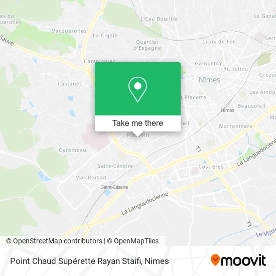
See Point Chaud Supérette Rayan Staifi, Nimes, on the map
Public Transit to Point Chaud Supérette Rayan Staifi in Nimes
Wondering how to get to Point Chaud Supérette Rayan Staifi in Nimes? Moovit helps you find the best way to get to Point Chaud Supérette Rayan Staifi with step-by-step directions from the nearest public transit station.
Moovit provides free maps and live directions to help you navigate through your city. View schedules, routes, timetables, and find out how long does it take to get to Point Chaud Supérette Rayan Staifi in real time.
Looking for the nearest stop or station to Point Chaud Supérette Rayan Staifi? Check out this list of stops closest to your destination: Pissevin.
Bus: 8, T2, 100, 101, 105, NMAR, 88.
Want to see if there’s another route that gets you there at an earlier time? Moovit helps you find alternative routes or times. Get directions from and directions to Point Chaud Supérette Rayan Staifi easily from the Moovit App or Website.
We make riding to Point Chaud Supérette Rayan Staifi easy, which is why over 1.5 million users, including users in Nimes, trust Moovit as the best app for public transit. You don’t need to download an individual bus app or train app, Moovit is your all-in-one transit app that helps you find the best bus time or train time available.
For information on prices of bus, costs and ride fares to Point Chaud Supérette Rayan Staifi, please check the Moovit app.
Use the app to navigate to popular places including to the airport, hospital, stadium, grocery store, mall, coffee shop, school, college, and university.
Point Chaud Supérette Rayan Staifi Address: 16 Place Claude Debussy 30900 Nîmes street in Nimes
- Fadhli Kheireddine,
- Avenue des Arts Parking,
- Solupropre,
- Boucherie Agadir,
- Place Roger Bastide 4,
- Rue Lulli 11,
- Chez Zamim,
- Place Jean Calvin,
- Accueil Municipal Valdegour,
- Brunot Jean-Pierre,
- Cacn - Centre d'Art Contemporain de Nîmes,
- 1557 Av. Kennedy Parking,
- Place Roger Bastide,
- Cio,
- Casa Burger,
- Rue Matisse,
- Cité Universitaire Matisse,
- B.M .Peinture,
- Maison de Santé Pluriprofessionnelle,
- Rue Weber 89
Places Near Point Chaud Supérette Rayan Staifi (Nimes)
- Carrefour Nîmes Sud,
- Clinique Franciscaine,
- La Galerie - Cap Costières,
- CHU de Nîmes - Hôpital universitaire Carémeau,
- Le Parnasse, Nîmes,
- VILLE ACTIVE, Nîmes,
- Hôpital Privé Les Franciscaines,
- Aire De Covoiturage Nîmes Ouest,
- Geant Casino,
- Polyclinique Du Grand Sud,
- Les 7 Collines,
- Centre hospitalier Caremeau,
- Rond-Point Kilomètre Delta, Nîmes,
- École Nationale De Police,
- Jardins de la Fontaine,
- Saint-Césaire,
- Parc Kennedy,
- Kinepolis,
- E.Leclerc,
- Rue Gilles Roberval 285
How to get to popular places in Nimes with public transit
Get around Nimes by public transit!
Traveling around Nimes has never been so easy. See step by step directions as you travel to any attraction, street or major public transit station. View bus and train schedules, arrival times, service alerts and detailed routes on a map, so you know exactly how to get to anywhere in Nimes.
When traveling to any destination around Nimes use Moovit's Live Directions with Get Off Notifications to know exactly where and how far to walk, how long to wait for your line, and how many stops are left. Moovit will alert you when it's time to get off — no need to constantly re-check whether yours is the next stop.
Wondering how to use public transit in Nimes or how to pay for public transit in Nimes? Moovit public transit app can help you navigate your way with public transit easily, and at minimum cost. It includes public transit fees, ticket prices, and costs. Looking for a map of Nimes public transit lines? Moovit public transit app shows all public transit maps in Nimes with all bus routes and stops on an interactive map.
Nimes has 1 transit type(s), including: bus, operated by several transit agencies, including TANGO