How to get to Point Five Lab by bus?
Click on the bus route to see step by step directions with maps, line arrival times and updated time schedules.
From Mountain Creek Waterpark, West Milford
39 minFrom Totowa, NJ, Totowa
65 minFrom Paterson, NJ, Paterson
74 minFrom Clifton, NJ, Clifton
85 minFrom Wayne, NJ, Wayne
40 minFrom MMNJ, Parsippany-Troy Hills
84 minFrom Lakeland Bus Stop, Parsippany-Troy Hills
85 minFrom Bergen Community College, Paramus
133 minFrom Parsippany, NJ, Parsippany-Troy Hills
141 min
Bus stops near Point Five Lab in Wanaque
Bus lines to Point Five Lab in Wanaque
What are the closest stations to Point Five Lab?
The closest stations to Point Five Lab are:
- Ringwood Ave at Carr St is 189 yards away, 3 min walk.
- Wanaque Ave at Ringwood Ave is 807 yards away, 10 min walk.
Which bus lines stop near Point Five Lab?
These bus lines stop near Point Five Lab: 194, 197.
What’s the nearest bus station to Point Five Lab in Wanaque?
The nearest bus station to Point Five Lab in Wanaque is Ringwood Ave at Carr St. It’s a 3 min walk away.
What time is the first bus to Point Five Lab in Wanaque?
The 197 is the first bus that goes to Point Five Lab in Wanaque. It stops nearby at 5:05 AM.
What time is the last bus to Point Five Lab in Wanaque?
The 197 is the last bus that goes to Point Five Lab in Wanaque. It stops nearby at 1:24 AM.
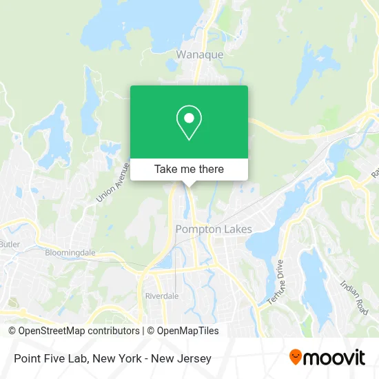
See Point Five Lab, Wanaque, on the map
Public Transit to Point Five Lab in Wanaque
Wondering how to get to Point Five Lab in Wanaque? Moovit helps you find the best way to get to Point Five Lab with step-by-step directions from the nearest public transit station.
Moovit provides free maps and live directions to help you navigate through your city. View schedules, routes, timetables, and find out how long does it take to get to Point Five Lab in real time.
Looking for the nearest stop or station to Point Five Lab? Check out this list of stops closest to your destination: Ringwood Ave at Carr St; Wanaque Ave at Ringwood Ave.
Bus: 194, 197, 748.
Want to see if there’s another route that gets you there at an earlier time? Moovit helps you find alternative routes or times. Get directions from and directions to Point Five Lab easily from the Moovit App or Website.
We make riding to Point Five Lab easy, which is why over 1.5 million users, including users in Wanaque, trust Moovit as the best app for public transit. You don’t need to download an individual bus app or train app, Moovit is your all-in-one transit app that helps you find the best bus time or train time available.
For information on prices of bus, costs and ride fares to Point Five Lab, please check the Moovit app.
Use the app to navigate to popular places including to the airport, hospital, stadium, grocery store, mall, coffee shop, school, college, and university.
Point Five Lab Address: 1458 Ringwood Ave street in Wanaque
- Tri Borough Plumbing Supply,
- Wanaque Lumber Landscaping & Garden Supplies,
- Children's Center at the Phoenix,
- Cris A Plus Cleaning Services Llc,
- The Journey Within Spiritualist Church,
- Safeguard Home Inspectors, Llc,
- Rt. 287 Exit 55,
- Twin Lakes Lower Dam,
- Gallo-Pacifico Park,
- Jersey Mike's,
- Domino Locksmith Corp,
- Buffalo Wild Wings,
- Libertyx Bitcoin Atm,
- Clearview Tree Service,
- Blue Rhino Propane Exchange,
- Western Union,
- Stop & Shop #860,
- Visology,
- Coinme,
- Thinkcleanlaundry
Places Near Point Five Lab (Wanaque)
- 911 Memorial, Manhattan,
- SoHo, Manhattan,
- Times Square, Manhattan,
- 376 Hudson Street, Manhattan,
- Katz's Deli, Manhattan,
- 66 John Street, Manhattan,
- 1 Police Plaza, Manhattan,
- 111 Centre New York City Supreme Court, Manhattan,
- qqqq, Manhattan,
- Hudson Yards, Manhattan,
- Rockefeller Center, Manhattan,
- 26 Federal Plaza, Manhattan,
- Bellevue Hospital, Manhattan,
- 3 Stone St, Manhattan,
- Chinatown, Manhattan,
- Pier 83, Manhattan,
- Mountainside Hospital, Glen Ridge,
- Queens Center Mall, Queens,
- Wall Street, Manhattan,
- San Gennaro Feast, Manhattan
How to get to popular places in New York - New Jersey with public transit
Get around Wanaque by public transit!
Traveling around Wanaque has never been so easy. See step by step directions as you travel to any attraction, street or major public transit station. View bus and train schedules, arrival times, service alerts and detailed routes on a map, so you know exactly how to get to anywhere in Wanaque.
When traveling to any destination around Wanaque use Moovit's Live Directions with Get Off Notifications to know exactly where and how far to walk, how long to wait for your line, and how many stops are left. Moovit will alert you when it's time to get off — no need to constantly re-check whether yours is the next stop.
Wondering how to use public transit in Wanaque or how to pay for public transit in Wanaque? Moovit public transit app can help you navigate your way with public transit easily, and at minimum cost. It includes public transit fees, ticket prices, and costs. Looking for a map of Wanaque public transit lines? Moovit public transit app shows all public transit maps in Wanaque with all Bus, Train, Subway, Light Rail, Ferry and Cable Car routes and stops on an interactive map.
New York - New Jersey has 6 transit type(s), including: Bus, Train, Subway, Light Rail, Ferry and Cable Car, operated by several transit agencies, including MTA Subway, Metro-North Railroad, LIRR, PATH, MTA New York City Transit - Express routes, MTA Bus, NJ Transit, NYC Ferry, NICE bus, Bee-Line Bus, NJ Transit Rail, Norwalk Transit District, Hartford Line, River Valley Transit and HART