Directions to Point Park (Baltimore) with public transportation
The following transit lines have routes that pass near Point Park
 Bus: CITYLINK NAVY, GREEN ROUTE, ORANGE ROUTE, 150, 71.
- Metro: METRO.
- Ferry: HC1.
How to get to Point Park by bus?
Click on the bus route to see step by step directions with maps, line arrival times and updated time schedules.
From Coppin State University, Baltimore
48 minFrom Baltimore Museum Of Art, Baltimore
44 minFrom Western High School, Baltimore
55 minFrom Social Security Administration (Robert M. Ball Building), Baltimore County
59 minFrom Saint Agnes Hospital, Baltimore
45 minFrom University Of Maryland Baltimore (Umbc), Baltimore County
53 minFrom Baltimore Penn Station, Baltimore
44 minFrom Guinness Open Gate Brewery & Barrel House, Baltimore County
79 minFrom NSA Friendship Annex (FANX), Anne Arundel County
101 minFrom Mva, Baltimore
70 min
How to get to Point Park by metro?
Click on the metro route to see step by step directions with maps, line arrival times and updated time schedules.
Bus stops near Point Park in Baltimore
Ferry stations near Point Park in Baltimore
Metro station near Point Park in Baltimore
- Shot Tower Metro, 34 min walk,VIEW
Bus lines to Point Park in Baltimore
What are the closest stations to Point Park?
The closest stations to Point Park are:
- Maritime Park (Eb) is 178 yards away, 3 min walk.
- Fleet St & Albemarle St Wb is 304 yards away, 4 min walk.
- Fleet & Exeter is 313 yards away, 4 min walk.
- Key Hwy & Cross St Ns Sb is 352 yards away, 5 min walk.
- Pierside Drive (Nb) is 388 yards away, 5 min walk.
- Maritime Park is 1145 yards away, 14 min walk.
- Pier Five is 1725 yards away, 21 min walk.
- Shot Tower Metro is 2802 yards away, 34 min walk.
Which bus lines stop near Point Park?
These bus lines stop near Point Park: CITYLINK NAVY, GREEN ROUTE, ORANGE ROUTE.
Which metro line stops near Point Park?
METRO (Towards John Hopkins)
What’s the nearest bus station to Point Park in Baltimore?
The nearest bus station to Point Park in Baltimore is Maritime Park (Eb). It’s a 3 min walk away.
What’s the nearest ferry station to Point Park in Baltimore?
The nearest ferry station to Point Park in Baltimore is Maritime Park. It’s a 14 min walk away.
What time is the first metro to Point Park in Baltimore?
The METRO is the first metro that goes to Point Park in Baltimore. It stops nearby at 5:07 AM.
What time is the last metro to Point Park in Baltimore?
The METRO is the last metro that goes to Point Park in Baltimore. It stops nearby at 12:27 AM.
What time is the first bus to Point Park in Baltimore?
The 71 is the first bus that goes to Point Park in Baltimore. It stops nearby at 5:08 AM.
What time is the last bus to Point Park in Baltimore?
The 71 is the last bus that goes to Point Park in Baltimore. It stops nearby at 2:03 AM.
What time is the first ferry to Point Park in Baltimore?
The HC3 is the first ferry that goes to Point Park in Baltimore. It stops nearby at 6:00 AM.
What time is the last ferry to Point Park in Baltimore?
The HC3 is the last ferry that goes to Point Park in Baltimore. It stops nearby at 8:07 PM.
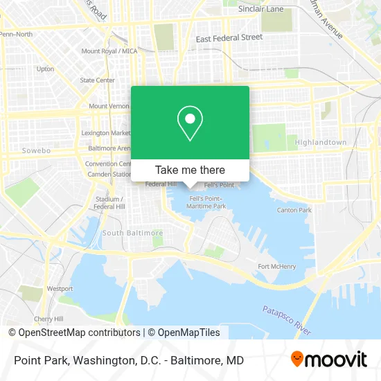
See Point Park, Baltimore, on the map
Public Transit to Point Park in Baltimore
Wondering how to get to Point Park in Baltimore? Moovit helps you find the best way to get to Point Park with step-by-step directions from the nearest public transit station.
Moovit provides free maps and live directions to help you navigate through your city. View schedules, routes, timetables, and find out how long does it take to get to Point Park in real time.
Looking for the nearest stop or station to Point Park? Check out this list of stops closest to your destination: Maritime Park (Eb); Fleet St & Albemarle St Wb; Fleet & Exeter; Key Hwy & Cross St Ns Sb; Pierside Drive (Nb); Maritime Park; Pier Five; Shot Tower Metro.
Bus: CITYLINK NAVY, GREEN ROUTE, ORANGE ROUTE, 150, 71.Metro: METRO.Ferry: HC1.
Want to see if there’s another route that gets you there at an earlier time? Moovit helps you find alternative routes or times. Get directions from and directions to Point Park easily from the Moovit App or Website.
We make riding to Point Park easy, which is why over 1.7 million users, including users in Baltimore, trust Moovit as the best app for public transit. You don’t need to download an individual bus app or train app, Moovit is your all-in-one transit app that helps you find the best bus time or train time available.
For information on prices of bus, metro and light rail, costs and ride fares to Point Park, please check the Moovit app.
Use the app to navigate to popular places including to the airport, hospital, stadium, grocery store, mall, coffee shop, school, college, and university.
Point Park Address: 1000 Wills St street in Baltimore
- Canopy by Hilton-Baltimore Harbor Point,
- Harbor Point,
- S Central Central Ave,
- Exelon,
- Attman's Delicatessen,
- Baltimore Water Taxi,
- Frederick Douglass-Isaac Myers Maritime Park,
- Blink Charging,
- Harbor Tandoor,
- Blink Charging,
- Legg Mason Building,
- Four Seasons Baltimore,
- Four Seasons-Baltimore ,
- Courtyard Baltimore Downtown / Inner Harbor,
- Bond Street Wharf,
- Marriott-Baltimore Waterfront,
- 1001 Fleet St,
- Baltimore Marriott Waterfront,
- Harbor East,
- Holly Winfield
Places Near Point Park (Baltimore)
- Georgetown, Washington,
- National Zoo, Washington,
- Museum Of The Bible, Washington,
- Amazon Hq2, Arlington County,
- Westfield Montgomery Mall, Montgomery County,
- M&T Bank Stadium, Baltimore,
- Warner Theatre, Washington,
- Rock Creek Tennis Center, Washington,
- Washington DC VA Medical Center, Washington,
- National Museum of African American History and Culture, Washington,
- Sibley Memorial Hospital, Washington,
- Camden Yards, Baltimore,
- Capital One Arena, Washington,
- The Anthem, Washington,
- Basilica of the National Shrine, Washington,
- Marriott Marquis Washington, DC, Washington,
- Washington National Cathedral, Washington,
- National Theatre, Washington,
- PG Mall, Prince George's County,
- Pennsylvania Ave NW (3rd st and pennsylvania), Washington
How to get to popular places in Washington, D.C. - Baltimore, MD with public transit
Get around Baltimore by public transit!
Traveling around Baltimore has never been so easy. See step by step directions as you travel to any attraction, street or major public transit station. View bus and train schedules, arrival times, service alerts and detailed routes on a map, so you know exactly how to get to anywhere in Baltimore.
When traveling to any destination around Baltimore use Moovit's Live Directions with Get Off Notifications to know exactly where and how far to walk, how long to wait for your line, and how many stops are left. Moovit will alert you when it's time to get off — no need to constantly re-check whether yours is the next stop.
Wondering how to use public transit in Baltimore or how to pay for public transit in Baltimore? Moovit public transit app can help you navigate your way with public transit easily, and at minimum cost. It includes public transit fees, ticket prices, and costs. Looking for a map of Baltimore public transit lines? Moovit public transit app shows all public transit maps in Baltimore with all Bus, Train, Metro, Light Rail and Ferry routes and stops on an interactive map.
Washington, D.C. - Baltimore, MD has 5 transit type(s), including: Bus, Train, Metro, Light Rail and Ferry, operated by several transit agencies, including WMATA, Montgomery County Ride On, Fairfax Connector, TheBus, PRTC, DASH - Alexandria, Arlington Transit (ART), RTA of Central Maryland, MDOT MTA, MDOT MTA Light RailLink, MDOT MTA Commuter Bus, MDOT MTA Local Bus, FXBGO!, Virginia Railway Express (VRE) and MARC