How to get to Point S by bus?
Click on the bus route to see step by step directions with maps, line arrival times and updated time schedules.
Bus stops near Point S in Nimes
Bus lines to Point S in Nimes
What are the closest stations to Point S?
The closest stations to Point S are:
- Rouquairol is 394 meters away, 6 min walk.
- Sacha Guitry is 419 meters away, 6 min walk.
- Perbos is 423 meters away, 6 min walk.
Which bus lines stop near Point S?
These bus lines stop near Point S: 11, 13, 15.
What’s the nearest bus station to Point S in Nimes?
The nearest bus stations to Point S in Nimes are Rouquairol, Sacha Guitry and Perbos. The closest one is a 6 min walk away.
What time is the first bus to Point S in Nimes?
The 13 is the first bus that goes to Point S in Nimes. It stops nearby at 6:03 AM.
What time is the last bus to Point S in Nimes?
The 15 is the last bus that goes to Point S in Nimes. It stops nearby at 8:45 PM.
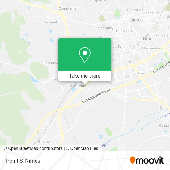
See Point S, Nimes, on the map
Public Transit to Point S in Nimes
Wondering how to get to Point S in Nimes? Moovit helps you find the best way to get to Point S with step-by-step directions from the nearest public transit station.
Moovit provides free maps and live directions to help you navigate through your city. View schedules, routes, timetables, and find out how long does it take to get to Point S in real time.
Looking for the nearest stop or station to Point S? Check out this list of stops closest to your destination: Rouquairol; Sacha Guitry; Perbos.
Bus: 11, 13, 15, 89, 100, 105.
Want to see if there’s another route that gets you there at an earlier time? Moovit helps you find alternative routes or times. Get directions from and directions to Point S easily from the Moovit App or Website.
We make riding to Point S easy, which is why over 1.5 million users, including users in Nimes, trust Moovit as the best app for public transit. You don’t need to download an individual bus app or train app, Moovit is your all-in-one transit app that helps you find the best bus time or train time available.
For information on prices of bus, costs and ride fares to Point S, please check the Moovit app.
Use the app to navigate to popular places including to the airport, hospital, stadium, grocery store, mall, coffee shop, school, college, and university.
Point S Address: 2290 Route de Montpellier 30900 Nîmes street in Nimes
- Bonjour,
- First Stop,
- Régis Loc 038,
- Dennis Café,
- Mission Locale Jeunes Nîmes Métropole,
- Chemin du Mas Coquillard 281,
- Outfit by Ef,
- Food Corner,
- Centre du Mas Roulan,
- Envie Nîmes,
- Würth Nîmes,
- Ostéopathe D.O Senin David,
- Freshmile,
- C.r.c.a.m. Du Gard - Caisse Régionale De Crédit Agricole Du Gard,
- Ape Marguerittes,
- Chemin du Mas de Cheylon 473,
- Tiff & Food,
- Sécuritest-Csfd-Controle Automobile,
- Z.A.C. Kilomètre Delta II,
- Sud Vo
Places Near Point S (Nimes)
- Jardins de la Fontaine,
- Kinepolis,
- École Nationale De Police,
- Rue Gilles Roberval 285,
- Carrefour Nîmes Sud,
- Rond-Point Kilomètre Delta, Nîmes,
- Geant Casino,
- Clinique Franciscaine,
- Saint-Césaire,
- CHU de Nîmes - Hôpital universitaire Carémeau,
- Parc Kennedy,
- La Galerie - Cap Costières,
- Polyclinique Du Grand Sud,
- VILLE ACTIVE, Nîmes,
- Les 7 Collines,
- Hôpital Privé Les Franciscaines,
- Centre hospitalier Caremeau,
- E.Leclerc,
- Aire De Covoiturage Nîmes Ouest,
- Le Parnasse, Nîmes
How to get to popular places in Nimes with public transit
Get around Nimes by public transit!
Traveling around Nimes has never been so easy. See step by step directions as you travel to any attraction, street or major public transit station. View bus and train schedules, arrival times, service alerts and detailed routes on a map, so you know exactly how to get to anywhere in Nimes.
When traveling to any destination around Nimes use Moovit's Live Directions with Get Off Notifications to know exactly where and how far to walk, how long to wait for your line, and how many stops are left. Moovit will alert you when it's time to get off — no need to constantly re-check whether yours is the next stop.
Wondering how to use public transit in Nimes or how to pay for public transit in Nimes? Moovit public transit app can help you navigate your way with public transit easily, and at minimum cost. It includes public transit fees, ticket prices, and costs. Looking for a map of Nimes public transit lines? Moovit public transit app shows all public transit maps in Nimes with all bus routes and stops on an interactive map.
Nimes has 1 transit type(s), including: bus, operated by several transit agencies, including TANGO