Directions to Point da Batata (Contenda) with public transportation
The following transit lines have routes that pass near Point da Batata
How to get to Point da Batata by bus?
Click on the bus route to see step by step directions with maps, line arrival times and updated time schedules.
From Copel Agência de Atendimento, Araucária
47 minFrom Bairro Costeira, Araucária
80 minFrom Campo Redondo, Araucária
48 minFrom Campina Da Barra, Araucária
64 minFrom Parque Cachoeira, Araucária
74 minFrom Terminal Central de Araucária, Araucária
40 minFrom Boqueirão/Araucária, Araucária
50 minFrom Araucária, Araucária
46 minFrom Rua Miguel Bertolino Pizzato, Araucária
72 minFrom Rua Francisco Dranka, Araucária
53 min
Bus stops near Point da Batata in Contenda
Bus lines to Point da Batata in Contenda
What are the closest stations to Point da Batata?
The closest stations to Point da Batata are:
- Av. São João, 743 is 28 meters away, 1 min walk.
- Rodovia Do Xisto (Br 476) - Contenda is 200 meters away, 3 min walk.
Which bus line stops near Point da Batata?
R11 CONTENDA / ARAUCÁRIA (Terminal Araucária ↺ Contenda (Circular))
What’s the nearest bus station to Point da Batata in Contenda?
The nearest bus station to Point da Batata in Contenda is Av. São João, 743. It’s a 1 min walk away.
What time is the first bus to Point da Batata in Contenda?
The R11 CONTENDA / ARAUCÁRIA is the first bus that goes to Point da Batata in Contenda. It stops nearby at 4:24 AM.
What time is the last bus to Point da Batata in Contenda?
The R11 CONTENDA / ARAUCÁRIA is the last bus that goes to Point da Batata in Contenda. It stops nearby at 1:10 AM.
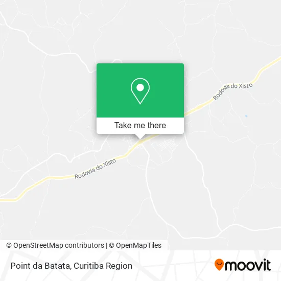
See Point da Batata, Contenda, on the map
Public Transit to Point da Batata in Contenda
Wondering how to get to Point da Batata in Contenda? Moovit helps you find the best way to get to Point da Batata with step-by-step directions from the nearest public transit station.
Moovit provides free maps and live directions to help you navigate through your city. View schedules, routes, timetables, and find out how long does it take to get to Point da Batata in real time.
Looking for the nearest stop or station to Point da Batata? Check out this list of stops closest to your destination: Av. São João; Rodovia Do Xisto (Br 476) - Contenda.
Bus: R11 CONTENDA / ARAUCÁRIA, R99 CONEXÃO CONTENDA, 1575-400 ARAUCÁRIA / LAPA.
Want to see if there’s another route that gets you there at an earlier time? Moovit helps you find alternative routes or times. Get directions from and directions to Point da Batata easily from the Moovit App or Website.
We make riding to Point da Batata easy, which is why over 1.5 million users, including users in Contenda, trust Moovit as the best app for public transit. You don’t need to download an individual bus app or train app, Moovit is your all-in-one transit app that helps you find the best bus time or train time available.
For information on prices of bus, costs and ride fares to Point da Batata, please check the Moovit app.
Use the app to navigate to popular places including to the airport, hospital, stadium, grocery store, mall, coffee shop, school, college, and university.
Point da Batata Address: Avenida São João, Contenda Contenda-PR 83730-000 street in Contenda
- Vidraçaria 3m,
- Nanico Moto Peças,
- La Bodega Frutas e Bebidas,
- Restaurante e Lanchonete Freitas,
- Praça da Independência,
- Facepp,
- Campina Gás,
- Sojapar Comércio de Cereais,
- Mundo Cell - Contenda,
- Mega Fibra,
- Terminal Contenda,
- Distribuidora Gotinha,
- Sorveteria Blue Ice,
- Dja Máquinas,
- Mercatal Supercados,
- Beneficiamento de Batatas Tri Legal,
- Agropecuaria Canto da Roca,
- Eliseu Cabeleireiro Contenda PR,
- Wk Tabacaria,
- Boutique do Gás
Places Near Point da Batata (Contenda)
- Hospital Nossa Senhora Das Graças, Mercês,
- Hospital do Rocio, Campo,
- Parque Barigui, Mercês,
- Hhhhh, Fazendinha,
- Jockey Plaza Shopping Center, Tarumã,
- Pontifícia Universidade Católica do Paraná (PUCPR), Prado Velho,
- Hospital Angelina Caron, Campina Grande Do Sul,
- Rua General Mário Tourinho, Campina Do Siqueira,
- Campo Largo, Campo,
- Hospital Universitário Evangélico de Curitiba, Bigorrilho,
- Hospital Da Cruz Vermelha, Batel,
- Hospital de Clínicas (HC - UFPR), Centro,
- Hospital Erasto Gaertner, Jardim Das Américas,
- Arena Da Baixada - Curitiba,
- Hospital Madalena Sofia, Bairro Alto,
- Jardim Botânico de Curitiba PR, Centro,
- Rua Martim Afonso 558, Mercês,
- Park Shopping Barigüi, Mossunguê,
- Shopping Palladium, Portão,
- Shopping Estação, Rebouças
How to get to popular places in Curitiba Region with public transit
Get around Contenda by public transit!
Traveling around Contenda has never been so easy. See step by step directions as you travel to any attraction, street or major public transit station. View bus and train schedules, arrival times, service alerts and detailed routes on a map, so you know exactly how to get to anywhere in Contenda.
When traveling to any destination around Contenda use Moovit's Live Directions with Get Off Notifications to know exactly where and how far to walk, how long to wait for your line, and how many stops are left. Moovit will alert you when it's time to get off — no need to constantly re-check whether yours is the next stop.
Wondering how to use public transit in Contenda or how to pay for public transit in Contenda? Moovit public transit app can help you navigate your way with public transit easily, and at minimum cost. It includes public transit fees, ticket prices, and costs. Looking for a map of Contenda public transit lines? Moovit public transit app shows all public transit maps in Contenda with all Bus and Cable Car routes and stops on an interactive map.
Curitiba Region has 2 transit type(s), including: Bus and Cable Car, operated by several transit agencies, including Sistema Integrado de Mobilidade (URBS), Sistema Integrado de Mobilidade (AMEP), URBS (Cartões bancários e Dinheiro), URBS (Cartões bancários / Cartão URBS), AMEP (Cartões bancários / Cartão MetroCard), AMEP (Cartões bancários / Cartão MetroCard / Dinheiro), Viação Colombo (Dinheiro), TRIAR (Cartão TRIAR / Dinheiro), Empresa Curitiba Cerro Azul (Dinheiro), Expresso Nossa Senhora da Penha (Dinheiro), Empresa Campo Alto Tijucas (Dinheiro), Auto Viação São José (Cartão VEM / Dinheiro), BRT S/A (Cartão VEM / Dinheiro), TransPiedade (Cartão Cidadão / Dinheiro) and Oceânica Sul (Cartão Transporte / Dinheiro)