How to get to Pointcode by bus?
Click on the bus route to see step by step directions with maps, line arrival times and updated time schedules.
From Leroy Merlin Vitry-Sur-Seine, Vitry-Sur-Seine
69 minFrom Thiais Village, Thiais
45 minFrom Hippodrome de Vincennes, Paris
98 minFrom Villejuif, Villejuif
91 minFrom Ormesson-Sur-Marne, Ormesson-Sur-Marne
93 minFrom Thiais, Thiais
43 minFrom Draveil, Draveil
51 minFrom IKEA, Thiais
47 minFrom Chennevières-Sur-Marne, Chennevières-Sur-Marne
103 minFrom Hôpital Privé d'Antony, Antony
81 min
Bus stops near Pointcode in Villeneuve-Le-Roi
RER stations near Pointcode in Villeneuve-Le-Roi
Bus lines to Pointcode in Villeneuve-Le-Roi
- 480, La Végétale (Câble C1),VIEW
- 483, Gare de Choisy-Le-Roi,VIEW
- 482, Belle Epine Sud,VIEW
- LICORNE, Gare de Villeneuve-Le-Roi,VIEW
- 4116, Gare De Villeneuve-Saint-Georges - Juvisy Gare Routière Seine,VIEW
- 4134, Pyramide - Pont De Choisy - Piscine,VIEW
- 4135, Gare De Brunoy - Gare De Villeneuve-Saint-Georges,VIEW
- N134, Gare de Combs-La-Ville - Quincy,VIEW
- N135, Gare de Corbeil-Essonnes,VIEW
- 4115, Gare de Villeneuve Place Semard,VIEW
- N72, Gare de Villeneuve-Saint-Georges - Place Sémard,VIEW
- 427, Les Graviers,VIEW
What are the closest stations to Pointcode?
The closest stations to Pointcode are:
- Pont de Villeneuve-Le-Roi is 145 meters away, 2 min walk.
- Raoul Delattre is 176 meters away, 3 min walk.
- Gare de Villeneuve-Saint-Georges is 686 meters away, 9 min walk.
- Gare de Villeneuve Place Semard is 778 meters away, 11 min walk.
- Villeneuve-Saint-Georges is 783 meters away, 11 min walk.
- Gare de Villeneuve-Saint-Georges - Place Sémard is 838 meters away, 11 min walk.
- Ablon is 1566 meters away, 20 min walk.
Which RER line stops near Pointcode?
D (Malesherbes/ Melun/ Corbeil-Essonnes /Juvisy)
Which bus lines stop near Pointcode?
These bus lines stop near Pointcode: 4116, 450, 480, 482, 483.
What’s the nearest bus station to Pointcode in Villeneuve-Le-Roi?
The nearest bus station to Pointcode in Villeneuve-Le-Roi is Pont de Villeneuve-Le-Roi. It’s a 2 min walk away.
What’s the nearest RER station to Pointcode in Villeneuve-Le-Roi?
The nearest RER station to Pointcode in Villeneuve-Le-Roi is Villeneuve-Saint-Georges. It’s a 11 min walk away.
What time is the first bus to Pointcode in Villeneuve-Le-Roi?
The N134 is the first bus that goes to Pointcode in Villeneuve-Le-Roi. It stops nearby at 3:03 AM.
What time is the last bus to Pointcode in Villeneuve-Le-Roi?
The N72 is the last bus that goes to Pointcode in Villeneuve-Le-Roi. It stops nearby at 3:27 AM.
What time is the first RER to Pointcode in Villeneuve-Le-Roi?
The D is the first RER that goes to Pointcode in Villeneuve-Le-Roi. It stops nearby at 4:53 AM.
What time is the last RER to Pointcode in Villeneuve-Le-Roi?
The D is the last RER that goes to Pointcode in Villeneuve-Le-Roi. It stops nearby at 1:20 AM.
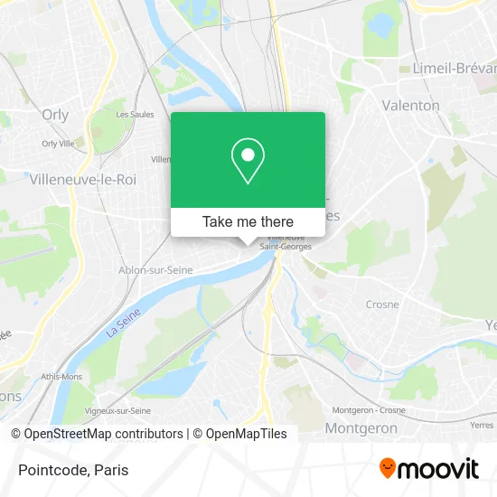
See Pointcode, Villeneuve-Le-Roi, on the map
Public Transit to Pointcode in Villeneuve-Le-Roi
Wondering how to get to Pointcode in Villeneuve-Le-Roi? Moovit helps you find the best way to get to Pointcode with step-by-step directions from the nearest public transit station.
Moovit provides free maps and live directions to help you navigate through your city. View schedules, routes, timetables, and find out how long does it take to get to Pointcode in real time.
Looking for the nearest stop or station to Pointcode? Check out this list of stops closest to your destination: Pont de Villeneuve-Le-Roi; Raoul Delattre; Gare de Villeneuve-Saint-Georges; Gare de Villeneuve Place Semard; Villeneuve-Saint-Georges; Gare de Villeneuve-Saint-Georges - Place Sémard; Ablon.
RER: D.Bus: 4116, 450, 480, 482, 483, LICORNE, 4134, 4135, N134, N135.
Want to see if there’s another route that gets you there at an earlier time? Moovit helps you find alternative routes or times. Get directions from and directions to Pointcode easily from the Moovit App or Website.
We make riding to Pointcode easy, which is why over 1.5 million users, including users in Villeneuve-Le-Roi, trust Moovit as the best app for public transit. You don’t need to download an individual bus app or train app, Moovit is your all-in-one transit app that helps you find the best bus time or train time available.
For information on prices of bus, RER, light rail and metro, costs and ride fares to Pointcode, please check the Moovit app.
Use the app to navigate to popular places including to the airport, hospital, stadium, grocery store, mall, coffee shop, school, college, and university.
Pointcode Address: 1 Rue Paul Bert 94290 Villeneuve-le-Roi street in Villeneuve-Le-Roi
- Objectifcode - Centre d'Examen du Code de la Route Villeneuve-le-Roi,
- Lycée Georges Brassens, Villeneuve le Roi,
- Agip,
- Atm Cordova,
- Apartment l'Aquarius,
- Lifting Color,
- Di Benedetto,
- 94290,
- Sc-Volailles Ma,
- Saindou Aboubacar,
- Muniyappa Alimentation,
- ZAC des Voeux St Georges,
- Eirl Guy Plomberie,
- Chabbar Assadi Hamza,
- 14 Rue la Fontaine,
- Fctp,
- IZIVIA Fast,
- Etap Hotel,
- 22 Rue Honoré Oursel,
- Pont de Villeneuve-le-Roi
Places Near Pointcode (Villeneuve-Le-Roi)
- Fondation Louis Vuitton, Paris,
- 29 Rue Manin, Paris,
- Marché Saint-Pierre, Paris,
- Beaugrenelle, Paris,
- Créteil Soleil, Creteil,
- Galeries Lafayette Haussmann, Paris,
- Centre Hospitalier des 15/20, Paris,
- Hopital Lariboisière, Paris,
- Hôpital Pitié Salpêtrière, Paris,
- Hôpital Saint-Joseph, Paris,
- Hôpital de la Pitié-Salpêtrière, Paris,
- Hôpital Beaujon, Clichy,
- Atelier Des Lumieres, Paris,
- Théâtre Mogador, Paris,
- Hôpital Henri Mondor, Creteil,
- Hopital Foch, Suresnes,
- Hôpital Necker, Paris,
- Gare Routière Flixbus, Paris,
- Hôpital Cochin, Paris,
- Galeries Lafayette, Paris
How to get to popular places in Paris with public transit
Get around Villeneuve-Le-Roi by public transit!
Traveling around Villeneuve-Le-Roi has never been so easy. See step by step directions as you travel to any attraction, street or major public transit station. View bus and train schedules, arrival times, service alerts and detailed routes on a map, so you know exactly how to get to anywhere in Villeneuve-Le-Roi.
When traveling to any destination around Villeneuve-Le-Roi use Moovit's Live Directions with Get Off Notifications to know exactly where and how far to walk, how long to wait for your line, and how many stops are left. Moovit will alert you when it's time to get off — no need to constantly re-check whether yours is the next stop.
Wondering how to use public transit in Villeneuve-Le-Roi or how to pay for public transit in Villeneuve-Le-Roi? Moovit public transit app can help you navigate your way with public transit easily, and at minimum cost. It includes public transit fees, ticket prices, and costs. Looking for a map of Villeneuve-Le-Roi public transit lines? Moovit public transit app shows all public transit maps in Villeneuve-Le-Roi with all Bus, Train, Metro, Light Rail, RER, Funicular and Gondola routes and stops on an interactive map.
Paris has 7 transit type(s), including: Bus, Train, Metro, Light Rail, RER, Funicular and Gondola, operated by several transit agencies, including RATP, RER, RER Bus de remplacement, Train, Train Bus de remplacement, Tramway Bus de remplacement, TER, ADP, Magical Shuttle, Argenteuil - Boucles de Seine, Autocars Dominique, Bièvre, Brie et 2 Morin, Le Bus - C.C. du Clermontois and Cœur d’Essonne