How to get to Pointex by bus?
Click on the bus route to see step by step directions with maps, line arrival times and updated time schedules.
From Le Piagge, Florence
77 minFrom Nuovo Pignone, Florence
75 minFrom San Bartolo a Cintoia Street 20/H2, Florence
101 minFrom Vergaio, Prato
65 minFrom Reginaldo Giuliani Street, Florence
87 minFrom Guidoni Parking, Florence
48 minFrom Wanny Palace, Florence
106 minFrom La Dogaia Prison, Prato
76 minFrom Firenze Food Kiosk, Sesto Fiorentino
44 minFrom Cascine Amphitheater, Florence
58 min
How to get to Pointex by train?
Click on the train route to see step by step directions with maps, line arrival times and updated time schedules.
Bus stops near Pointex in Prato
Train stations near Pointex in Prato
Bus lines to Pointex in Prato
What are the closest stations to Pointex?
The closest stations to Pointex are:
- Border 10 is 184 meters away, 3 min walk.
- Maiano Borders is 741 meters away, 10 min walk.
- Marconi 3 is 781 meters away, 10 min walk.
- Mezzana is 845 meters away, 11 min walk.
- Cervi Brothers 1 is 873 meters away, 12 min walk.
- Campi Bisenzio Galilei is 991 meters away, 13 min walk.
- Prato Porta Al Serraglio is 1026 meters away, 14 min walk.
- Prato Central is 2126 meters away, 28 min walk.
Which bus lines stop near Pointex?
These bus lines stop near Pointex: 212, 30, 4.
Which train line stops near Pointex?
R (Pistoia/Pisa)
What’s the nearest train station to Pointex in Prato?
The nearest train station to Pointex in Prato is Prato Porta Al Serraglio. It’s a 14 min walk away.
What’s the nearest bus station to Pointex in Prato?
The nearest bus station to Pointex in Prato is Border 10. It’s a 3 min walk away.
What time is the first train to Pointex in Prato?
The R is the first train that goes to Pointex in Prato. It stops nearby at 4:57 AM.
What time is the last train to Pointex in Prato?
The R is the last train that goes to Pointex in Prato. It stops nearby at 12:56 AM.
What time is the first bus to Pointex in Prato?
The 30 is the first bus that goes to Pointex in Prato. It stops nearby at 5:49 AM.
What time is the last bus to Pointex in Prato?
The 30 is the last bus that goes to Pointex in Prato. It stops nearby at 1:47 AM.
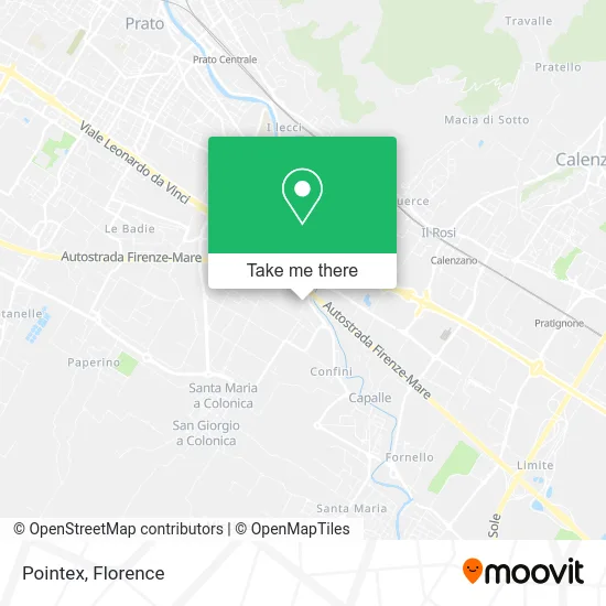
See Pointex, Prato, on the map
Public Transit to Pointex in Prato
Wondering how to get to Pointex in Prato? Moovit helps you find the best way to get to Pointex with step-by-step directions from the nearest public transit station.
Moovit provides free maps and live directions to help you navigate through your city. View schedules, routes, timetables, and find out how long does it take to get to Pointex in real time.
Looking for the nearest stop or station to Pointex? Check out this list of stops closest to your destination: Border 10; Maiano Borders; Marconi 3; Mezzana; Cervi Brothers 1; Campi Bisenzio Galilei; Prato Porta Al Serraglio; Prato Central.
Bus: 212, 30, 4, 206, 75, 301 A, 301 A.Train: R.
Want to see if there’s another route that gets you there at an earlier time? Moovit helps you find alternative routes or times. Get directions from and directions to Pointex easily from the Moovit App or Website.
We make riding to Pointex easy, which is why over 1.5 million users, including users in Prato, trust Moovit as the best app for public transit. You don’t need to download an individual bus app or train app, Moovit is your all-in-one transit app that helps you find the best bus time or train time available.
For information on prices of bus, train and light rail, costs and ride fares to Pointex, please check the Moovit app.
Use the app to navigate to popular places including to the airport, hospital, stadium, grocery store, mall, coffee shop, school, college, and university.
Pointex Address: Via dei Confini, 4 59100 Prato street in Prato
- Billions Prato,
- Iris Furniture,
- Elle Fashion Abbreviated Ell e Fashion,
- Arde Knitwear by Decio Massimo Romano and Co,
- Capalle,
- Youssef Butcher Shop,
- Mondo Convenienza,
- Social Cooperative Se,
- Fipili Sewage Cleaning,
- The Barber,
- Sottozero Gelato Shop,
- Germoglio Farm by Jiang Congcong,
- Pearl Haberdashery,
- Arno Spurghi,
- Mezzana Newsstand,
- Marina's World,
- Fantasy Clothing,
- Marco Holm Sailmaking,
- F. & M. Brachi Spinning Mill,
- 22 Boundaries Street
Places Near Pointex (Prato)
- Artemio Franchi Municipal Stadium, Florence,
- Michelangelo Square, Florence,
- Viola Park, Bagno a Ripoli,
- Nelson Mandela Forum, Florence,
- Tobacco Manufacture, Florence,
- Wanny Palace, Florence,
- I Gigli, Campi Bisenzio,
- Asmana, Campi Bisenzio,
- Michelangelo Square, Florence,
- Piero Palagi Hospital Facility-Florence, Florence,
- Field of Mars, Florence,
- OOO, Florence,
- Santa Maria Novella Station, Florence,
- IKEA Florence, Sesto Fiorentino,
- Santa Maria Nuova Hospital, Florence,
- Mandela Forum (Nelson Mandela Forum), Florence,
- Torregalli Hospital Scandicci *, Scandicci,
- Cascine Park, Florence,
- Verdi Theater, Florence,
- Campi Bisenzio, Campi Bisenzio
How to get to popular places in Florence with public transit
Get around Prato by public transit!
Traveling around Prato has never been so easy. See step by step directions as you travel to any attraction, street or major public transit station. View bus and train schedules, arrival times, service alerts and detailed routes on a map, so you know exactly how to get to anywhere in Prato.
When traveling to any destination around Prato use Moovit's Live Directions with Get Off Notifications to know exactly where and how far to walk, how long to wait for your line, and how many stops are left. Moovit will alert you when it's time to get off — no need to constantly re-check whether yours is the next stop.
Wondering how to use public transit in Prato or how to pay for public transit in Prato? Moovit public transit app can help you navigate your way with public transit easily, and at minimum cost. It includes public transit fees, ticket prices, and costs. Looking for a map of Prato public transit lines? Moovit public transit app shows all public transit maps in Prato with all Bus, Train, Light Rail, Ferry and Funicular routes and stops on an interactive map.
Florence has 5 transit type(s), including: Bus, Train, Light Rail, Ferry and Funicular, operated by several transit agencies, including Florence Urban - Tuscan Bus Lines, GEST, Livorno and Province - Tuscan Bus Lines, Arezzo, Florence and Provinces - Tuscan Bus Lines, Prato and Province - Tuscan Bus Lines, Lucca and Province - Tuscan Bus Lines, Massa, Carrara and Province - Tuscan Bus Lines, Pisa and Province - Tuscan Bus Lines, Grosseto, Siena and Provinces - Tuscan Bus Lines, Arezzo, Siena and Provinces - Tuscan Bus Lines, Florence and Province - Tuscan Bus Lines, Pistoia and Province - Tuscan Bus Lines, Siena and Province - Tuscan Bus Lines, Arezzo and Province - Tuscan Bus Lines and Trenitalia