Poliambulanza station - Monday schedule
| Line | Direction | Time |
|---|---|---|
| S12 | Cormano-Cusano | 05:08 |
| S12 | Cormano-Cusano | 05:18 |
| S12 | Melegnano | 05:21 |
| S12 | Cormano-Cusano | 05:28 |
| S12 | Melegnano | 05:31 |
| S12 | Cormano-Cusano | 05:38 |
| S12 | Melegnano | 05:41 |
| S12 | Cormano-Cusano | 05:48 |
| S12 | Melegnano | 05:51 |
| S12 | Cormano-Cusano | 05:58 |
| S12 | Melegnano | 06:01 |
| S12 | Cormano-Cusano | 06:08 |
| S12 | Melegnano | 06:11 |
| S12 | Cormano-Cusano | 06:16 |
| S12 | Melegnano | 06:21 |
| S12 | Cormano-Cusano | 06:24 |
| S12 | Melegnano | 06:29 |
| S12 | Cormano-Cusano | 06:32 |
| S12 | Melegnano | 06:37 |
| S12 | Cormano-Cusano | 06:40 |
| S12 | Melegnano | 06:45 |
| S12 | Cormano-Cusano | 06:48 |
| S12 | Melegnano | 06:53 |
| S12 | Cormano-Cusano | 06:56 |
| S12 | Melegnano | 07:01 |
Directions to Poliambulanza (Brescia) with public transportation
The following transit lines have routes that pass near Poliambulanza
How to get to Poliambulanza by bus?
Click on the bus route to see step by step directions with maps, line arrival times and updated time schedules.
How to get to Poliambulanza by train?
Click on the train route to see step by step directions with maps, line arrival times and updated time schedules.
How to get to Poliambulanza by metro?
Click on the metro route to see step by step directions with maps, line arrival times and updated time schedules.
Bus stations near Poliambulanza in Brescia
- Poliambulanza (Capolinea),6 min walk,
- Via Amendola Fr. 25,11 min walk,
- Viale Duca Degli Abruzzi 40,12 min walk,
- Brescia - Viale Duca Degli Abruzzi,12 min walk,
Metro stations near Poliambulanza in Brescia
- San Polo,15 min walk,
Bus lines to Poliambulanza in Brescia
- 13,Gussago,
- 14,Stazione F.S.,
- 16,Onzato,
- LS013,Cremona,
- LS014,Pralboino,
- LS016,Milzano,
- LS017,Brescia Autostazione,
- LS020,Isorella,
- LS031,Ghedi,
What are the closest stations to Poliambulanza?
The closest stations to Poliambulanza are:
- Poliambulanza (Capolinea) is 405 meters away, 6 min walk.
- Via Amendola Fr. 25 is 849 meters away, 11 min walk.
- Viale Duca Degli Abruzzi 40 is 861 meters away, 12 min walk.
- Brescia - Viale Duca Degli Abruzzi is 884 meters away, 12 min walk.
- San Polo is 1165 meters away, 15 min walk.
Which bus lines stop near Poliambulanza?
These bus lines stop near Poliambulanza: 13, 16.
Which train lines stop near Poliambulanza?
These train lines stop near Poliambulanza: R1, RE6.
Which metro line stops near Poliambulanza?
METROBS
What’s the nearest metro station to Poliambulanza in Brescia?
The nearest metro station to Poliambulanza in Brescia is San Polo. It’s a 15 min walk away.
What’s the nearest bus stop to Poliambulanza in Brescia?
The nearest bus stop to Poliambulanza in Brescia is Poliambulanza (Capolinea). It’s a 6 min walk away.
What time is the first metro to Poliambulanza in Brescia?
The METROBS is the first metro that goes to Poliambulanza in Brescia. It stops nearby at 5:04 AM.
What time is the last metro to Poliambulanza in Brescia?
The METROBS is the last metro that goes to Poliambulanza in Brescia. It stops nearby at 12:13 AM.
What time is the first bus to Poliambulanza in Brescia?
The 16 is the first bus that goes to Poliambulanza in Brescia. It stops nearby at 6:12 AM.
What time is the last bus to Poliambulanza in Brescia?
The 14 is the last bus that goes to Poliambulanza in Brescia. It stops nearby at 10:08 PM.
See Poliambulanza, Brescia, on the map
Public transit to Poliambulanza station in Brescia
Looking for directions to Poliambulanza in Brescia, Italy?
Download the Moovit App to find the current schedule and step-by-step directions for Bus, Metro or Train routes that pass through Poliambulanza.
Looking for the nearest stops closest to Poliambulanza ? Check out this list of closest stops to your destination: Poliambulanza (Capolinea); Via Amendola Fr. 25; Viale Duca Degli Abruzzi 40; Brescia - Viale Duca Degli Abruzzi; San Polo.
Bus:131614LS013LS014LS016LS017LS020Train:R1RE6Metro:METROBS
We make riding on public transit to Poliambulanza easy, which is why over 1.5 million users, including users in Brescia trust Moovit as the best app for public transit.
Use the app to navigate to popular places including to the airport, hospital, stadium, grocery store, mall, coffee shop, school, college, and university.
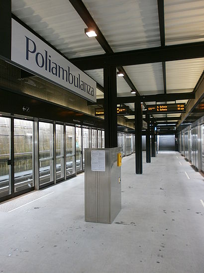
The station has the following entrances: Parcheggio and Parcheggio
The first line to this station is S12, at 05:08, and the last line is S12 at 00:11.
This station serves Trenord’s lines
Popular routes from Poliambulanza, Brescia
Bus stops near Poliambulanza
Poliambulanza (Capolinea),Via Amendola Fr. 25,Viale Duca Degli Abruzzi 40,Brescia - Viale Duca Degli AbruzziMetro station near Poliambulanza
San PoloPopular public transit stations in Brescia
Curno Fermi 56,Milano San Cristoforo,P.za Abbiategrasso,Via Toffetti,Cantù (Ospedale),Casalpusterlengo - Ospedale,Via Crema,Cassano D'Adda,Corridoni Fr.76,Via Garibaldi Via Brera (Cornaredo),Vigentino,C.na Gobba (San Raffaele),Via San Faustino 76 (Università),Via F.lli Bandiera Via Risorgimento (Sesto S. G.),Brescia Terminal A1/A2/A3,Via Calvairate V.le Molise,Clusone - Rotonda Ex Seminario,Borgosesia - Itis Agnona,Omegna - Stazione Ferroviaria,Via Giovanni XXIII Via Campestre (Bresso)Get around Brescia by public transit!
Traveling around Brescia has never been so easy. See step by step directions as you travel to any attraction, street or major public transit station. View bus and train schedules, arrival times, service alerts and detailed routes on a map, so you know exactly how to get to anywhere in Brescia.
When traveling to any destination around Brescia use Moovit's Live Directions with Get Off Notifications to know exactly where and how far to walk, how long to wait for your line, and how many stops are left. Moovit will alert you when it's time to get off — no need to constantly re-check whether yours is the next stop.
Wondering how to use public transit in Brescia or how to pay for public transit in Brescia? Moovit public transit app can help you navigate your way with public transit easily, and at minimum cost. It includes public transit fees, ticket prices, and costs. Looking for a map of Brescia public transit lines? Moovit public transit app shows all public transit maps in Brescia with all bus, metro or train routes and stops on an interactive map.
Brescia has 3 transit type(s), including: bus, metro or train, operated by several transit agencies, including ATM, ATM, ATM, Trenord, Trenitalia, Autoguidovie S.p.A., NET, Movibus, ATM, ASF Autolinee, Autostradale S.r.l., Terravision, AirPullman, TEB and ATB