How to get to Polytech Construction by bus?
Click on the bus route to see step by step directions with maps, line arrival times and updated time schedules.
From Albert Einstein High School, Montgomery County
41 minFrom Bethesda North Marriott Hotel & Conference Center, Montgomery County
31 minFrom I-270 Exit 10 (Clopper Rd. / West Diamond Ave.), Montgomery County
44 minFrom Suburban Hospital, Montgomery County
47 minFrom Brookside Gardens, Montgomery County
54 minFrom Montgomery Village, Maryland, Montgomery County
51 minFrom Astrazeneca HQ, Montgomery County
51 minFrom Olney MD USA, Montgomery County
40 minFrom Kaiser Permanente - Gaithersburg Medical Center, Montgomery County
48 minFrom RIO Washingtonian Center, Montgomery County
37 min
How to get to Polytech Construction by train?
Click on the train route to see step by step directions with maps, line arrival times and updated time schedules.
How to get to Polytech Construction by metro?
Click on the metro route to see step by step directions with maps, line arrival times and updated time schedules.
Bus stops near Polytech Construction in Montgomery County
Metro station near Polytech Construction in Montgomery County
- Rockville, 50 min walk,VIEW
Bus lines to Polytech Construction in Montgomery County
What are the closest stations to Polytech Construction?
The closest stations to Polytech Construction are:
- E Middle La & Monroe St is 46 yards away, 1 min walk.
- Rockville Station & Bay G is 153 yards away, 2 min walk.
- N Washington St & Middle Ln is 242 yards away, 3 min walk.
- E Jefferson St & Maryland Ave is 340 yards away, 5 min walk.
- Rockville is 4228 yards away, 50 min walk.
Which bus lines stop near Polytech Construction?
These bus lines stop near Polytech Construction: 101, 40, 47, 52, 54, 55, 56, 81.
Which train line stops near Polytech Construction?
MARC (Inbound - Brunswick)
Which metro line stops near Polytech Construction?
RED (Shady Grove)
What’s the nearest bus station to Polytech Construction in Montgomery County?
The nearest bus station to Polytech Construction in Montgomery County is E Middle La & Monroe St. It’s a 1 min walk away.
What time is the first metro to Polytech Construction in Montgomery County?
The RED is the first metro that goes to Polytech Construction in Montgomery County. It stops nearby at 5:04 AM.
What time is the last metro to Polytech Construction in Montgomery County?
The RED is the last metro that goes to Polytech Construction in Montgomery County. It stops nearby at 12:38 AM.
What time is the first train to Polytech Construction in Montgomery County?
The MARC is the first train that goes to Polytech Construction in Montgomery County. It stops nearby at 5:39 AM.
What time is the last train to Polytech Construction in Montgomery County?
The MARC is the last train that goes to Polytech Construction in Montgomery County. It stops nearby at 7:50 PM.
What time is the first bus to Polytech Construction in Montgomery County?
The 46 is the first bus that goes to Polytech Construction in Montgomery County. It stops nearby at 5:00 AM.
What time is the last bus to Polytech Construction in Montgomery County?
The 46 is the last bus that goes to Polytech Construction in Montgomery County. It stops nearby at 1:51 AM.
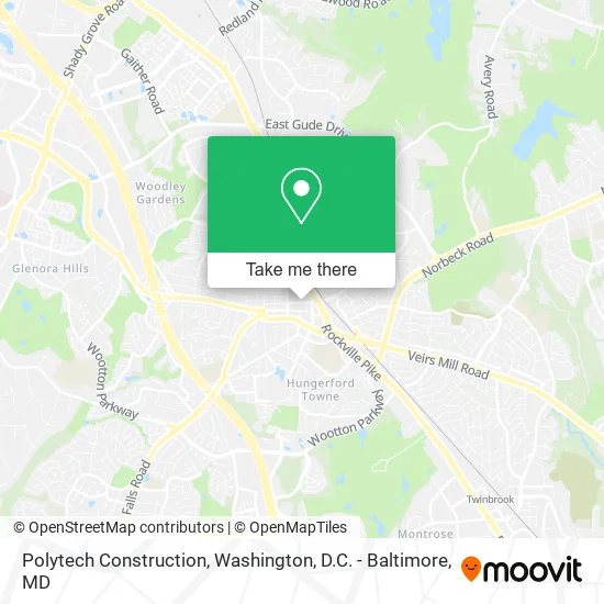
See Polytech Construction, Montgomery County, on the map
Public Transit to Polytech Construction in Montgomery County
Wondering how to get to Polytech Construction in Montgomery County? Moovit helps you find the best way to get to Polytech Construction with step-by-step directions from the nearest public transit station.
Moovit provides free maps and live directions to help you navigate through your city. View schedules, routes, timetables, and find out how long does it take to get to Polytech Construction in real time.
Looking for the nearest stop or station to Polytech Construction? Check out this list of stops closest to your destination: E Middle La & Monroe St; Rockville Station & Bay G; N Washington St & Middle Ln; E Jefferson St & Maryland Ave; Rockville.
Bus: 101, 40, 47, 52, 54, 55, 56, 81, 45, 301, M82, 46, 63.Train: MARC.Metro: RED.
Want to see if there’s another route that gets you there at an earlier time? Moovit helps you find alternative routes or times. Get directions from and directions to Polytech Construction easily from the Moovit App or Website.
We make riding to Polytech Construction easy, which is why over 1.5 million users, including users in Montgomery County, trust Moovit as the best app for public transit. You don’t need to download an individual bus app or train app, Moovit is your all-in-one transit app that helps you find the best bus time or train time available.
For information on prices of bus, metro and train, costs and ride fares to Polytech Construction, please check the Moovit app.
Use the app to navigate to popular places including to the airport, hospital, stadium, grocery store, mall, coffee shop, school, college, and university.
Polytech Construction Address: E Middle Ln Rockville, MD 20850 street in Montgomery County
- Properexpression,
- Air Duct Crew,
- Asterisk Web Design Services,
- Surety Home Inspection,
- Universal Painters,
- Jurgen Escobar,
- Air Duct & Chimney Services,
- Brown Lab Construction,
- Deep Cleaners DMV,
- Ahs Remodeling,
- Dmvfitclub,
- All Streetz Auto,
- Calvano's Garage Auto Repair,
- Wellness Detailing,
- Intex Auto Detail,
- Lash Happy,
- Silvia Costa Nails Designing,
- HKH Hvac,
- Right Pressure,
- Gas and Diesel Auto Repair
Places Near Polytech Construction (Montgomery County)
- Sibley Memorial Hospital, Washington,
- PG Mall, Prince George's County,
- Camden Yards, Baltimore,
- National Museum of African American History and Culture, Washington,
- Rock Creek Tennis Center, Washington,
- M&T Bank Stadium, Baltimore,
- The Anthem, Washington,
- Westfield Montgomery Mall, Montgomery County,
- Pennsylvania Ave NW (3rd st and pennsylvania), Washington,
- National Mall, Washington,
- Georgetown, Washington,
- Museum Of The Bible, Washington,
- National Zoo, Washington,
- Amazon Hq2, Arlington County,
- Washington National Cathedral, Washington,
- Capital One Arena, Washington,
- Warner Theatre, Washington,
- Marriott Marquis Washington, DC, Washington,
- Washington DC VA Medical Center, Washington,
- Basilica of the National Shrine, Washington
How to get to popular places in Washington, D.C. - Baltimore, MD with public transit
Get around Montgomery County by public transit!
Traveling around Montgomery County has never been so easy. See step by step directions as you travel to any attraction, street or major public transit station. View bus and train schedules, arrival times, service alerts and detailed routes on a map, so you know exactly how to get to anywhere in Montgomery County.
When traveling to any destination around Montgomery County use Moovit's Live Directions with Get Off Notifications to know exactly where and how far to walk, how long to wait for your line, and how many stops are left. Moovit will alert you when it's time to get off — no need to constantly re-check whether yours is the next stop.
Wondering how to use public transit in Montgomery County or how to pay for public transit in Montgomery County? Moovit public transit app can help you navigate your way with public transit easily, and at minimum cost. It includes public transit fees, ticket prices, and costs. Looking for a map of Montgomery County public transit lines? Moovit public transit app shows all public transit maps in Montgomery County with all Bus, Train, Metro, Light Rail and Ferry routes and stops on an interactive map.
Washington, D.C. - Baltimore, MD has 5 transit type(s), including: Bus, Train, Metro, Light Rail and Ferry, operated by several transit agencies, including WMATA, Montgomery County Ride On, Fairfax Connector, TheBus, PRTC, DASH - Alexandria, Arlington Transit (ART), RTA of Central Maryland, MDOT MTA, MDOT MTA Light RailLink, MDOT MTA Commuter Bus, MDOT MTA Local Bus, FXBGO!, Virginia Railway Express (VRE) and MARC