How to get to Pompano Beach Paving Contractor by bus?
Click on the bus route to see step by step directions with maps, line arrival times and updated time schedules.
Bus stops near Pompano Beach Paving Contractor
Train station near Pompano Beach Paving Contractor
- Pompano Beach Station, 6 min walk,VIEW
Bus lines to Pompano Beach Paving Contractor
What are the closest stations to Pompano Beach Paving Contractor?
The closest stations to Pompano Beach Paving Contractor are:
- Atlantic Boulevard/Andrews Avenue is 287 yards away, 4 min walk.
- Martin Luther King Jr Boulevard/Northwest 13th Avenue is 436 yards away, 6 min walk.
- Pompano Beach Station is 442 yards away, 6 min walk.
Which bus lines stop near Pompano Beach Paving Contractor?
These bus lines stop near Pompano Beach Paving Contractor: 42, 60.
What’s the nearest train station to Pompano Beach Paving Contractor?
The nearest train station to Pompano Beach Paving Contractor is Pompano Beach Station. It’s a 6 min walk away.
What’s the nearest bus station to Pompano Beach Paving Contractor?
The nearest bus station to Pompano Beach Paving Contractor is Atlantic Boulevard/Andrews Avenue. It’s a 4 min walk away.
What time is the first train to Pompano Beach Paving Contractor?
The TRIRAIL is the first train that goes to Pompano Beach Paving Contractor. It stops nearby at 4:38 AM.
What time is the last train to Pompano Beach Paving Contractor?
The TRIRAIL is the last train that goes to Pompano Beach Paving Contractor. It stops nearby at 10:50 PM.
What time is the first bus to Pompano Beach Paving Contractor?
The 60 is the first bus that goes to Pompano Beach Paving Contractor. It stops nearby at 5:31 AM.
What time is the last bus to Pompano Beach Paving Contractor?
The 60 is the last bus that goes to Pompano Beach Paving Contractor. It stops nearby at 11:51 PM.
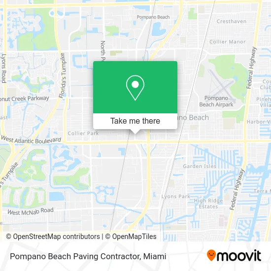
See Pompano Beach Paving Contractor on the map
Public Transportation to Pompano Beach Paving Contractor
Wondering how to get to Pompano Beach Paving Contractor? Moovit helps you find the best way to get to Pompano Beach Paving Contractor with step-by-step directions from the nearest public transit station.
Moovit provides free maps and live directions to help you navigate through your city. View schedules, routes, timetables, and find out how long does it take to get to Pompano Beach Paving Contractor in real time.
Looking for the nearest stop or station to Pompano Beach Paving Contractor? Check out this list of stops closest to your destination: Atlantic Boulevard/Andrews Avenue; Martin Luther King Jr Boulevard/Northwest 13th Avenue; Pompano Beach Station.
Bus: 42, 60.Train: TRIRAIL.
Want to see if there’s another route that gets you there at an earlier time? Moovit helps you find alternative routes or times. Get directions from and directions to Pompano Beach Paving Contractor easily from the Moovit App or Website.
We make riding to Pompano Beach Paving Contractor easy, which is why over 1.5 million users, including users in Pompano Beach, trust Moovit as the best app for public transit. You don’t need to download an individual bus app or train app, Moovit is your all-in-one transit app that helps you find the best bus time or train time available.
For information on prices of bus, costs and ride fares to Pompano Beach Paving Contractor, please check the Moovit app.
Use the app to navigate to popular places including to the airport, hospital, stadium, grocery store, mall, coffee shop, school, college, and university.
Pompano Beach Paving Contractor Address: 1287 W Atlantic Blvd Pompano Beach, FL 33069 street in Pompano Beach
- Tropical Isle Truck Service,
- Glorious Locksmith,
- Groves and Gifts,
- State of Florida Fruit & Vegetables Division,
- Business Law,
- NGR Trucking,
- Jocelyn Blaylock Real Estate Group,
- Wawa,
- City Hall - Utilities,
- Cypress Communications of South Florida,
- House of Wrapz Sou,
- Highline Motorsports,
- Declaration Defense L Gun Range Store Ammo,
- Map & Directions,
- Kennesaw Juice,
- America's Best Contacts & Eyeglasses,
- Foreign Auto Repair,
- Mommies Kitchen,
- RNG Produce,
- Acme Smoked Fish of Florida, L
Places Near Pompano Beach Paving Contractor
- Zoo Miami, Miami,
- Miami Freedom Park, Miami,
- Bayside Marketplace, Miami,
- Marlins Park, Miami,
- Wynwood, Miami,
- Miami Design District, Miami,
- Sawgrass mall ( FL ), Miami Beach,
- Little Havana, Miami,
- Miami-Dade County Courthouse, Miami,
- Dolphin Mall, Miami,
- Richard E. Gerstein Justice Building, Miami,
- Hard Rock Stadium, Miami Gardens,
- Keiser University Flagship Campus, West Palm Beach,
- Dolphin Mall Bus, Miami,
- Aventura Mall, Miami Beach,
- Miami VA Hospital, Miami,
- Brickell City Centre, Miami,
- Aventura Mall, Miami,
- Port of Miami Cruise Terminal, Miami,
- Sawgrass Mall, Miami
How to get to popular places in Miami with public transit
Get around Pompano Beach by public transit!
Traveling around Pompano Beach has never been so easy. See step by step directions as you travel to any attraction, street or major public transit station. View bus and train schedules, arrival times, service alerts and detailed routes on a map, so you know exactly how to get to anywhere in Pompano Beach.
When traveling to any destination around Pompano Beach use Moovit's Live Directions with Get Off Notifications to know exactly where and how far to walk, how long to wait for your line, and how many stops are left. Moovit will alert you when it's time to get off — no need to constantly re-check whether yours is the next stop.
Wondering how to use public transit in Pompano Beach or how to pay for public transit in Pompano Beach? Moovit public transit app can help you navigate your way with public transit easily, and at minimum cost. It includes public transit fees, ticket prices, and costs. Looking for a map of Pompano Beach public transit lines? Moovit public transit app shows all public transit maps in Pompano Beach with all Bus, Train, Light Rail and Ferry routes and stops on an interactive map.
Miami has 4 transit type(s), including: Bus, Train, Light Rail and Ferry, operated by several transit agencies, including Broward County Transit, Miami-Dade Transit, Metrorail, Palm Tran, Tri-Rail, Brightline, MARTY, City of Homestead Trolley, Key West Transit, Treasure Coast Connector, GoLine IRT, Amtrak, Greyhound-us, FlixBus-us and Aventura Express Shuttle Bus