Directions to Pont Au Double (Paris) with public transportation
The following transit lines have routes that pass near Pont Au Double
 Bus: 21, 47, 63, 72, 76.
- Metro: 10, 4, 1, 11.
- RER: B, C, 4.
How to get to Pont Au Double by bus?
Click on the bus route to see step by step directions with maps, line arrival times and updated time schedules.
How to get to Pont Au Double by metro?
Click on the metro route to see step by step directions with maps, line arrival times and updated time schedules.
Bus stops near Pont Au Double in Paris
- Lagrange, 1 min walk,
- Notre-Dame - Quai de Montebello, 3 min walk,
- Petit Pont, 3 min walk,
- Dante, 4 min walk,
- Saint-Michel - Saint-Germain, 5 min walk,
Metro stations near Pont Au Double in Paris
- Cluny - la Sorbonne, 4 min walk,
- Hôtel de Ville, 6 min walk,
RER station near Pont Au Double in Paris
- Saint-Michel Notre-Dame, 7 min walk,
Bus lines to Pont Au Double in Paris
- 47, Fort du Kremlin-Bicêtre,
- N15, Gabriel Péri - Métro,
- N22, Châtelet,
- 87, Invalides,
- 75, Porte de Pantin,
- 63, Gare de Lyon - Maison de la Ratp,
- 86, Demi Lune - Parc Zoologique,
- 21, Porte de Saint-Ouen - Hôpital Bichat,
- 38, Porte de la Chapelle,
- N12, Romainville - Carnot,
- N122, Châtelet,
- 27, Porte D'ivry - Gare Saint-Lazare,
- 96, Porte Des Lilas - Gare Montparnasse,
- N13, Bobigny - Pablo Picasso - Mairie D'issy,
- N14, La Croix De Berny Rer - Mairie De Saint-Ouen - République,
- N21, Châtelet - Hôpital De Longjumeau,
- N123, Gare D'arpajon - Châtelet,
What are the closest stations to Pont Au Double?
The closest stations to Pont Au Double are:
- Lagrange is 7 meters away, 1 min walk.
- Notre-Dame - Quai de Montebello is 153 meters away, 3 min walk.
- Petit Pont is 202 meters away, 3 min walk.
- Cluny - la Sorbonne is 244 meters away, 4 min walk.
- Dante is 245 meters away, 4 min walk.
- Saint-Michel - Saint-Germain is 349 meters away, 5 min walk.
- Hôtel de Ville is 400 meters away, 6 min walk.
- Saint-Michel Notre-Dame is 473 meters away, 7 min walk.
Which bus lines stop near Pont Au Double?
These bus lines stop near Pont Au Double: 21, 47, 63, 72, 76, 86.
Which metro lines stop near Pont Au Double?
These metro lines stop near Pont Au Double: 10, 4.
Which RER line stops near Pont Au Double?
B (Aéroport Charles-de-Gaulle 2 TGV / Mitry - Claye)
What’s the nearest metro station to Pont Au Double in Paris?
The nearest metro station to Pont Au Double in Paris is Cluny - la Sorbonne. It’s a 4 min walk away.
What’s the nearest bus station to Pont Au Double in Paris?
The nearest bus station to Pont Au Double in Paris is Lagrange. It’s a 1 min walk away.
What’s the nearest RER station to Pont Au Double in Paris?
The nearest RER station to Pont Au Double in Paris is Saint-Michel Notre-Dame. It’s a 7 min walk away.
What time is the first metro to Pont Au Double in Paris?
The 1 is the first metro that goes to Pont Au Double in Paris. It stops nearby at 5:30 AM.
What time is the last metro to Pont Au Double in Paris?
The 11 is the last metro that goes to Pont Au Double in Paris. It stops nearby at 1:14 AM.
What time is the first bus to Pont Au Double in Paris?
The N22 is the first bus that goes to Pont Au Double in Paris. It stops nearby at 3:00 AM.
What time is the last bus to Pont Au Double in Paris?
The N22 is the last bus that goes to Pont Au Double in Paris. It stops nearby at 4:02 AM.
What time is the first RER to Pont Au Double in Paris?
The C is the first RER that goes to Pont Au Double in Paris. It stops nearby at 5:18 AM.
What time is the last RER to Pont Au Double in Paris?
The B is the last RER that goes to Pont Au Double in Paris. It stops nearby at 12:52 AM.
See Pont Au Double, Paris, on the map
Public Transit to Pont Au Double in Paris
How to get to Pont Au Double in Paris, France?
It’s easy with Moovit. Type in your street address and Moovit’s route finder will locate the fastest way to get you there! Not sure where to get off on the street? Download the Moovit App to find live directions (including where to get off on Pont Au Double), see timetables and get the estimated arrival times for your favorite metro, bus, RER or light rail lines.
Looking for the nearest stop or station to Pont Au Double? Check out this list of closest stops available to your destination: Lagrange; Notre-Dame - Quai de Montebello; Petit Pont; Cluny - la Sorbonne; Dante; Saint-Michel - Saint-Germain; Hôtel de Ville; Saint-Michel Notre-Dame.
Bus: 21, 47, 63, 72, 76, 86, N15, N22, 87, 75.Metro: 10, 4, 1, 11.RER: B, C, 4.
Download the Moovit App to see the current schedule and routes available for Paris. No need to install a special bus app to check the bus time or a train app to get train time. Moovit is the only all-in-one transit app that helps you get where you need to go.
We make riding on public transit to Pont Au Double easy, which is why over 1.5 million users, including users in Paris trust Moovit as the best app for public transit.
Use the app to navigate to popular places including to the airport, hospital, stadium, grocery store, mall, coffee shop, school, college, and university.
Location: Paris
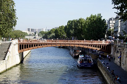
The Pont au Double is a bridge over the Seine in Paris, France.Wiki
- Quai de Montebello, Paris,
- Port de Montebello, Paris,
- Promenade Maurice Carême, Paris,
- Rue de L'Hôtel Colbert, Paris,
- Rue de la Bûcherie, Paris,
- Allée Amandine Giraud, Paris,
- Rue du Fouarre, Paris,
- Rue Saint-Julien Le Pauvre, Paris,
- Rue du Haut Pavé, Paris,
- Promenade Maurice Carème, Paris,
- Rue Galande, Paris,
- Place du Petit Pont, Paris,
- Petit-Pont, Paris,
- Rue du Petit Pont, Paris,
- Petit-Pont - Cardinal Lustiger, Paris,
- Rue Des Grands Degrés, Paris,
- Parvis Notre-Dame - Place Jean-Paul II, Paris,
- Accès Crypte Archéologique, Paris,
- Rue du Cloître Notre-Dame, Paris,
- Rue Lagrange, Paris
Streets near Pont Au Double, Paris
Get around Paris by public transit!
Traveling around Paris has never been so easy. See step by step directions as you travel to any attraction, street or major public transit station. View bus and train schedules, arrival times, service alerts and detailed routes on a map, so you know exactly how to get to anywhere in Paris.
When traveling to any destination around Paris use Moovit's Live Directions with Get Off Notifications to know exactly where and how far to walk, how long to wait for your line, and how many stops are left. Moovit will alert you when it's time to get off — no need to constantly re-check whether yours is the next stop.
Wondering how to use public transit in Paris or how to pay for public transit in Paris? Moovit public transit app can help you navigate your way with public transit easily, and at minimum cost. It includes public transit fees, ticket prices, and costs. Looking for a map of Paris public transit lines? Moovit public transit app shows all public transit maps in Paris with all Bus, Train, Metro, Light Rail, RER and Funicular routes and stops on an interactive map.
Paris has 6 transit type(s), including: Bus, Train, Metro, Light Rail, RER and Funicular, operated by several transit agencies, including RATP, RER, RER Bus de remplacement, Train, Train Bus de remplacement, TER, Tramway, ADP, Magical Shuttle, Argenteuil - Boucles de Seine, Autocars Dominique, Bièvre, Brie et 2 Morin, Le Bus - C.C. du Clermontois and Cœur d’Essonne