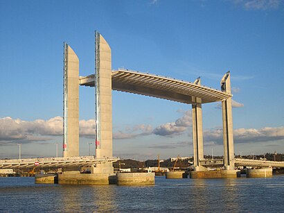
Directions to Pont Chaban-Delmas (Bordeaux) with public transportation
The following transit lines have routes that pass near Pont Chaban-Delmas
 Bus: 25, 462, 7, H1, H2.
- Train: F43.
- Light Rail: B.
- Ferry: 952.
How to get to Pont Chaban-Delmas by bus?
Click on the bus route to see step by step directions with maps, line arrival times and updated time schedules.
How to get to Pont Chaban-Delmas by train?
Click on the train route to see step by step directions with maps, line arrival times and updated time schedules.
Bus stops near Pont Chaban-Delmas in Bordeaux
- Les Hangars, 2 min walk,
- La Cité Du Vin, 8 min walk,
- Cité Du Vin, 8 min walk,
- Lajaunie, 16 min walk,
Light Rail stations near Pont Chaban-Delmas in Bordeaux
- Les Hangars, 9 min walk,
Ferry stations near Pont Chaban-Delmas in Bordeaux
- Les Hangars (Médoc), 14 min walk,
- La Cité Du Vin, 40 min walk,
Bus lines to Pont Chaban-Delmas in Bordeaux
- TBNIGHT, Campus Village 5,
- H1, Cenon Gare,
- 7, Ambares Parabelle,
- 25, Bouliac C.Cial,
- 27, Lormont Buttiniere,
- 53, Cracovie,
- 430, Express Blaye - Bordeaux,
- 432, Blaye - Bordeaux Les Aubiers,
- 462, Libourne - Bordeaux Les Aubiers,
- H2, Cenon Gare,
- 61, Ambes Escarraguel,
What are the closest stations to Pont Chaban-Delmas?
The closest stations to Pont Chaban-Delmas are:
- Les Hangars stop is 135 meters away, 2 min walk.
- La Cité Du Vin stop is 570 meters away, 8 min walk.
- Cité Du Vin stop is 599 meters away, 8 min walk.
- Les Hangars (Médoc) station is 1038 meters away, 14 min walk.
- Lajaunie stop is 1189 meters away, 16 min walk.
Which bus lines stop near Pont Chaban-Delmas?
These bus lines stop near Pont Chaban-Delmas: 25, 462, 7, H1, H2.
Which train line stops near Pont Chaban-Delmas?
F43 (Bordeaux Saint-Jean)
Which light rail line stops near Pont Chaban-Delmas?
B (Berges De La Garonne)
What’s the nearest light rail station to Pont Chaban-Delmas in Bordeaux?
The nearest light rail station to Pont Chaban-Delmas in Bordeaux is Les Hangars. It’s a 9 min walk away.
What’s the nearest bus station to Pont Chaban-Delmas in Bordeaux?
The nearest bus station to Pont Chaban-Delmas in Bordeaux is Les Hangars. It’s a 2 min walk away.
What’s the nearest ferry station to Pont Chaban-Delmas in Bordeaux?
The nearest ferry station to Pont Chaban-Delmas in Bordeaux is Les Hangars (Médoc). It’s a 14 min walk away.
What time is the first light rail to Pont Chaban-Delmas in Bordeaux?
The B is the first light rail that goes to Pont Chaban-Delmas in Bordeaux. It stops nearby at 4:21 AM.
What time is the last light rail to Pont Chaban-Delmas in Bordeaux?
The B is the last light rail that goes to Pont Chaban-Delmas in Bordeaux. It stops nearby at 1:29 AM.
What time is the first bus to Pont Chaban-Delmas in Bordeaux?
The TBNIGHT is the first bus that goes to Pont Chaban-Delmas in Bordeaux. It stops nearby at 3:01 AM.
What time is the last bus to Pont Chaban-Delmas in Bordeaux?
The TBNIGHT is the last bus that goes to Pont Chaban-Delmas in Bordeaux. It stops nearby at 3:34 AM.
What time is the first ferry to Pont Chaban-Delmas in Bordeaux?
The 952 is the first ferry that goes to Pont Chaban-Delmas in Bordeaux. It stops nearby at 8:53 AM.
What time is the last ferry to Pont Chaban-Delmas in Bordeaux?
The 952 is the last ferry that goes to Pont Chaban-Delmas in Bordeaux. It stops nearby at 9:27 PM.
See Pont Chaban-Delmas, Bordeaux, on the map
Public Transit to Pont Chaban-Delmas in Bordeaux
Wondering how to get to Pont Chaban-Delmas in Bordeaux? Moovit helps you find the best way to get to Pont Chaban-Delmas with step-by-step directions from the nearest public transit station.
Moovit provides free maps and live directions to help you navigate through your city. View schedules, routes, timetables, and find out how long does it take to get to Pont Chaban-Delmas in real time.
Looking for the nearest stop or station to Pont Chaban-Delmas? Check out this list of stops closest to your destination: Les Hangars; La Cité Du Vin; Cité Du Vin; Les Hangars (Médoc); Lajaunie.
Bus: 25, 462, 7, H1, H2, TBNIGHT, 27, 53, 430, 432, 61.Train: F43.Light Rail: B.Ferry: 952.
Want to see if there’s another route that gets you there at an earlier time? Moovit helps you find alternative routes or times. Get directions from and directions to Pont Chaban-Delmas easily from the Moovit App or Website.
We make riding to Pont Chaban-Delmas easy, which is why over 1.7 billion users, including users in Bordeaux, trust Moovit as the best app for public transit. You don’t need to download an individual bus app or train app, Moovit is your all-in-one transit app that helps you find the best bus time or train time available.
For information on prices of bus, light rail and train, costs and ride fares to Pont Chaban-Delmas, please check the Moovit app.
Use the app to navigate to popular places including to the airport, hospital, stadium, grocery store, mall, coffee shop, school, college, and university.
Pont Chaban-Delmas Address: Bacalan-Bastide street in Bordeaux
- Pont Jacques Chaban Delmas,
- Cap Sciences,
- Hangar 20,
- auditorium H20,
- 127° Cap Sciences,
- Cellule Numérique,
- Place Des Quinconces,
- 120 Quai de Bacalan,
- Station Bassins à Flot Ⓑ,
- Hangar G2,
- Cdiscount,
- Cdiscount Siège social,
- Inseec H19,
- Nike Factory Store,
- 5 Rue Lucien Faure,
- MONOPRIX,
- Hangar 18,
- Le Jardin Pêcheur,
- quay Hangar 16,
- Boutique Lindt
Places Near Pont Chaban-Delmas (Bordeaux)
- Hôpital Haut Lévêque, Pessac,
- Bordeaux Lac, Bordeaux,
- Clinique Du Sport, Merignac,
- Darwin, Bordeaux,
- La Cité du Vin, Bordeaux,
- Les Bassins des Lumières, Bordeaux,
- IKEA, Bordeaux,
- Clinique Bel-air, Bordeaux,
- clinique Saint Augustin, Bordeaux,
- Clinique Tivoli, Bordeaux,
- Clinique Saint Martin, Pessac,
- Polyclinique Bordeaux Nord, Bordeaux,
- Rives d'Arcins, Begles,
- Hôpital Saint-André, Bordeaux,
- Crématorium, Merignac,
- Parc Bordelais, Bordeaux,
- Rue Lecocq, Bordeaux,
- Hôpital Pellegrin CHU, Bordeaux,
- Institut Bergonié, Bordeaux,
- Parc des expositions, Bordeaux
How to get to popular places in Bordeaux with public transit
Get around Bordeaux by public transit!
Traveling around Bordeaux has never been so easy. See step by step directions as you travel to any attraction, street or major public transit station. View bus and train schedules, arrival times, service alerts and detailed routes on a map, so you know exactly how to get to anywhere in Bordeaux.
When traveling to any destination around Bordeaux use Moovit's Live Directions with Get Off Notifications to know exactly where and how far to walk, how long to wait for your line, and how many stops are left. Moovit will alert you when it's time to get off — no need to constantly re-check whether yours is the next stop.
Wondering how to use public transit in Bordeaux or how to pay for public transit in Bordeaux? Moovit public transit app can help you navigate your way with public transit easily, and at minimum cost. It includes public transit fees, ticket prices, and costs. Looking for a map of Bordeaux public transit lines? Moovit public transit app shows all public transit maps in Bordeaux with all Bus, Train, Light Rail and Ferry routes and stops on an interactive map.
Bordeaux has 4 transit type(s), including: Bus, Train, Light Rail and Ferry, operated by several transit agencies, including TBM, SNCF VOYAGEURS, OCEdefault, Cars Régionaux 33 - Gironde, Calibus and Baïa | Lignes Principales