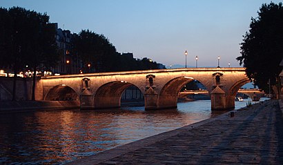
Directions to Pont Marie (Paris) with public transportation
The following transit lines have routes that pass near Pont Marie
 Bus: 38, 47, 67, 72, 86.
- Metro: 1, 7, 11.
- RER: B.
How to get to Pont Marie by bus?
Click on the bus route to see step by step directions with maps, line arrival times and updated time schedules.
How to get to Pont Marie by metro?
Click on the metro route to see step by step directions with maps, line arrival times and updated time schedules.
Metro stations near Pont Marie in Paris
- Hôtel de Ville, 3 min walk,
- Pont Marie (Cité Des Arts), 7 min walk,
Bus stops near Pont Marie in Paris
- Académie du Climat, 4 min walk,
- Pont Marie, 5 min walk,
- Pont de la Tournelle - Cardinal Lemoine, 5 min walk,
- Institut du Monde Arabe, 7 min walk,
- Saint-Germain - Cardinal Lemoine, 7 min walk,
- Pont Sully - Quai de Béthune, 7 min walk,
Bus lines to Pont Marie in Paris
- 69, Champ de Mars,
- 76, Montreuil - Hôpital,
- 96, Gare Montparnasse,
- N11, Pont de Neuilly-Métro,
- N16, Mairie de Montreuil,
- 67, Palais Royal - Musée du Louvre,
- 72, Gare de Lyon - Maison de la Ratp,
- 87, Invalides,
- 75, Porte de Pantin,
- 89, Porte de France,
- 63, Gare de Lyon - Maison de la Ratp,
- 86, Champ de Mars,
What are the closest stations to Pont Marie?
The closest stations to Pont Marie are:
- Hôtel de Ville is 156 meters away, 3 min walk.
- Académie du Climat is 298 meters away, 4 min walk.
- Pont Marie is 343 meters away, 5 min walk.
- Pont de la Tournelle - Cardinal Lemoine is 361 meters away, 5 min walk.
- Institut du Monde Arabe is 465 meters away, 7 min walk.
- Saint-Germain - Cardinal Lemoine is 469 meters away, 7 min walk.
- Pont Sully - Quai de Béthune is 513 meters away, 7 min walk.
- Pont Marie (Cité Des Arts) is 530 meters away, 7 min walk.
Which bus lines stop near Pont Marie?
These bus lines stop near Pont Marie: 38, 47, 67, 72, 86.
Which metro lines stop near Pont Marie?
These metro lines stop near Pont Marie: 1, 7.
Which RER line stops near Pont Marie?
B (Saint Rémy les Chèvreuses/ Massy Palaiseau/ Robinson)
What’s the nearest metro station to Pont Marie in Paris?
The nearest metro station to Pont Marie in Paris is Hôtel de Ville. It’s a 3 min walk away.
What’s the nearest bus station to Pont Marie in Paris?
The nearest bus station to Pont Marie in Paris is Académie du Climat. It’s a 4 min walk away.
What time is the first metro to Pont Marie in Paris?
The 1 is the first metro that goes to Pont Marie in Paris. It stops nearby at 5:30 AM.
What time is the last metro to Pont Marie in Paris?
The 11 is the last metro that goes to Pont Marie in Paris. It stops nearby at 1:14 AM.
What time is the first bus to Pont Marie in Paris?
The N16 is the first bus that goes to Pont Marie in Paris. It stops nearby at 3:05 AM.
What time is the last bus to Pont Marie in Paris?
The N16 is the last bus that goes to Pont Marie in Paris. It stops nearby at 3:28 AM.
See Pont Marie, Paris, on the map
Public Transit to Pont Marie in Paris
How to get to Pont Marie in Paris, France?
It’s easy with Moovit. Type in your street address and Moovit’s route finder will locate the fastest way to get you there! Not sure where to get off on the street? Download the Moovit App to find live directions (including where to get off on Pont Marie), see timetables and get the estimated arrival times for your favorite metro, bus, light rail, train or RER lines.
Looking for the nearest stop or station to Pont Marie? Check out this list of closest stops available to your destination: Hôtel de Ville; Académie du Climat; Pont Marie; Pont de la Tournelle - Cardinal Lemoine; Institut du Monde Arabe; Saint-Germain - Cardinal Lemoine; Pont Sully - Quai de Béthune; Pont Marie (Cité Des Arts).
Bus: 38, 47, 67, 72, 86, 69, 76, 96, N11, N16, 87, 63.Metro: 1, 7, 11.RER: B.
Download the Moovit App to see the current schedule and routes available for Paris. No need to install a special bus app to check the bus time or a train app to get train time. Moovit is the only all-in-one transit app that helps you get where you need to go.
We make riding on public transit to Pont Marie easy, which is why over 1.5 million users, including users in Paris trust Moovit as the best app for public transit.
Use the app to navigate to popular places including to the airport, hospital, stadium, grocery store, mall, coffee shop, school, college, and university.
Location: Paris
- Rue Des Deux Ponts, Paris,
- Rue Des Nonnains D'Hyères, Paris,
- Rue de L'Hôtel de Ville, Paris,
- Quai de Bourbon, Paris,
- Rue du Fauconnier, Paris,
- Rue Saint-Louis En L'Île, Paris,
- Rue Le Regrattier, Paris,
- Rue Budé, Paris,
- Rue Geoffroy L'Asnier, Paris,
- Rue du Figuier, Paris,
- Rue Poulletier, Paris,
- Rue de L'Avé Maria, Paris,
- Quai Des Célestins, Paris,
- Quai D'Orléans, Paris,
- Pont Louis Tomlinson, Paris,
- Rue Boutarel, Paris,
- Rue Saint-Paul, Paris,
- Pont Louis-Philippe, Paris,
- Rue du Pont Louis-Philippe, Paris,
- Rue de Bretonvilliers, Paris
Streets near Pont Marie, Paris
Get around Paris by public transit!
Traveling around Paris has never been so easy. See step by step directions as you travel to any attraction, street or major public transit station. View bus and train schedules, arrival times, service alerts and detailed routes on a map, so you know exactly how to get to anywhere in Paris.
When traveling to any destination around Paris use Moovit's Live Directions with Get Off Notifications to know exactly where and how far to walk, how long to wait for your line, and how many stops are left. Moovit will alert you when it's time to get off — no need to constantly re-check whether yours is the next stop.
Wondering how to use public transit in Paris or how to pay for public transit in Paris? Moovit public transit app can help you navigate your way with public transit easily, and at minimum cost. It includes public transit fees, ticket prices, and costs. Looking for a map of Paris public transit lines? Moovit public transit app shows all public transit maps in Paris with all Bus, Train, Metro, Light Rail, RER and Funicular routes and stops on an interactive map.
Paris has 6 transit type(s), including: Bus, Train, Metro, Light Rail, RER and Funicular, operated by several transit agencies, including RATP, RER, RER Bus de remplacement, Train, Train Bus de remplacement, TER, Tramway, ADP, Magical Shuttle, Argenteuil - Boucles de Seine, Autocars Dominique, Bièvre, Brie et 2 Morin, Le Bus - C.C. du Clermontois and Cœur d’Essonne