Directions to Pontcharra with public transportation
The following transit lines have routes that pass near Pontcharra
 Bus: G5, G50, G51, NVC, G60.
- Train: C31, K21, C1, K11.
How to get to Pontcharra by bus?
Click on the bus route to see step by step directions with maps, line arrival times and updated time schedules.
How to get to Pontcharra by train?
Click on the train route to see step by step directions with maps, line arrival times and updated time schedules.
Bus stops near Pontcharra
- Lycee Av De La Gare, 2 min walk,
- Piscine, 5 min walk,
- Lycee P. Du Terrail - Breda, 7 min walk,
- Residences Bayard, 9 min walk,
- College Marcel Chene - Quai, 10 min walk,
Train station near Pontcharra
- Pontcharra Sur Bréda, 61 min walk,
Bus lines to Pontcharra
- NVC, Bernin - Cloyeres,
- G5, Pontcharra - Mediatheque,
- G60, Allevard - Le David,
- SCO5G, Le Touvet - La Conche,
- G50, Pontcharra - Lycee P. Du Terrail - Parvis,
- G51, Chapareillan - Les Gaillons,
- SCO5H, St Vincent De Mercuze - St Vincent La Branchy,
- SCO5I, Pontcharra - Lycee P. Du Terrail - Parvis,
- SCO5J, St Pancrasse - La Mairie,
- SCO5F, Le Cheylas - Les Chaberts,
- SCO5E, Pontcharra - Ecole Cesar Terrier,
- SCO6K, Pontcharra - Lycee P. Du Terrail - Parvis,
What are the closest stations to Pontcharra?
The closest stations to Pontcharra are:
- Lycee Av De La Gare is 116 meters away, 2 min walk.
- Piscine is 361 meters away, 5 min walk.
- Lycee P. Du Terrail - Breda is 513 meters away, 7 min walk.
- Residences Bayard is 690 meters away, 9 min walk.
- College Marcel Chene - Quai is 724 meters away, 10 min walk.
- Pontcharra Sur Bréda is 4797 meters away, 61 min walk.
Which bus lines stop near Pontcharra?
These bus lines stop near Pontcharra: G5, G50, G51.
Which train lines stop near Pontcharra?
These train lines stop near Pontcharra: C31, K21.
What’s the nearest bus station to Pontcharra?
The nearest bus station to Pontcharra is Lycee Av De La Gare. It’s a 2 min walk away.
What time is the first train to Pontcharra?
The K11 is the first train that goes to Pontcharra. It stops nearby at 5:37 AM.
What time is the last train to Pontcharra?
The K21 is the last train that goes to Pontcharra. It stops nearby at 10:03 PM.
What time is the first bus to Pontcharra?
The NVC is the first bus that goes to Pontcharra. It stops nearby at 4:01 AM.
What time is the last bus to Pontcharra?
The NVC is the last bus that goes to Pontcharra. It stops nearby at 9:36 PM.
See Pontcharra on the map
Public Transportation to Pontcharra
Wondering how to get to Pontcharra? Moovit helps you find the best way to get to Pontcharra with step-by-step directions from the nearest public transit station.
Moovit provides free maps and live directions to help you navigate through your city. View schedules, routes, timetables, and find out how long does it take to get to Pontcharra in real time.
Looking for the nearest stop or station to Pontcharra? Check out this list of stops closest to your destination: Lycee Av De La Gare; Piscine; Lycee P. Du Terrail - Breda; Residences Bayard; College Marcel Chene - Quai; Pontcharra Sur Bréda.
Bus: G5, G50, G51, NVC, G60, SCO5G, SCO5H, SCO5I, SCO5J, SCO5F, SCO5E, SCO6K.Train: C31, K21, C1, K11.
Want to see if there’s another route that gets you there at an earlier time? Moovit helps you find alternative routes or times. Get directions from and directions to Pontcharra easily from the Moovit App or Website.
We make riding to Pontcharra easy, which is why over 1.5 million users, including users in Grenoble, trust Moovit as the best app for public transit. You don’t need to download an individual bus app or train app, Moovit is your all-in-one transit app that helps you find the best bus time or train time available.
For information on prices of bus and train, costs and ride fares to Pontcharra, please check the Moovit app.
Use the app to navigate to popular places including to the airport, hospital, stadium, grocery store, mall, coffee shop, school, college, and university.
Location: Grenoble
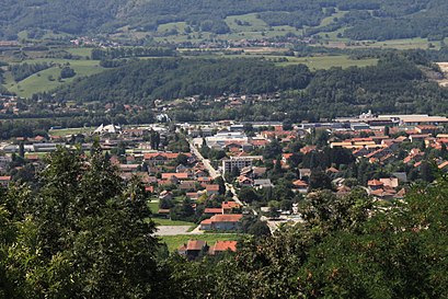
Pontcharra (French pronunciation: [pɔ̃ʃaʁa]; Arpitan: Pont-Charrâ) is a commune in the Isère department in southeastern France.Wiki
Popular routes to Pontcharra
Popular routes from Pontcharra
- Cinque Terre,
- 605 Av. de la Gare,
- Magasin Noz,
- Lycée Général Et Technologique Pierre Du Terrail,
- De la Mairie,
- LIDL,
- 999 Av. de la Gare,
- Le Domaine des Portes de Savoie,
- Kiddy Farm,
- Gare Sncf Pontcharra,
- 349 Rue du Bréda,
- 218 Rue du Port,
- Pontcharra sur Breda-Allevard Railway Station,
- Gare SNCF de Pontcharra-sur-Bréda,
- Château Bayard,
- Services Couverture,
- Mr.Scherrer,
- Station de recharge pour véhicules électriques,
- Super U Pontcharra,
- Espace culturel Coleo
Places Near Pontcharra
- Meylan, Meylan,
- Saint-Ismier, Saint-Ismier,
- Groupe Hospitalier Mutualiste De Grenoble, Grenoble,
- Saint-Hilaire-du-Touvet, Saint-Hilaire,
- Gare SNCF de Grenoble, Grenoble,
- Palais Des Sports, Grenoble,
- Passerelle Himalayenne du Drac, Mayres-Savel,
- Polyclinique des alpes du sud, Gap,
- CHU Grenoble, La Tronche,
- Centre Hospitalier De Voiron, Voiron,
- Clinique Des Cèdres, Échirolles,
- Clinique du Mail, Grenoble,
- IKEA, Grenoble,
- Ikea Grenoble Saint-Martin-D'Hères, Saint-Martin-D'Hères,
- Station Neyrpic-Belledonne ⒸⒹ, Saint-Martin-D'Hères,
- Espace Comboire, Échirolles,
- Crolles, Crolles,
- Hôpital Michallon, La Tronche,
- La Tronche, Grenoble,
- Lac de Monteynard, Monteynard
How to get to popular places in Grenoble with public transit
Get around Grenoble by public transit!
Traveling around Grenoble has never been so easy. See step by step directions as you travel to any attraction, street or major public transit station. View bus and train schedules, arrival times, service alerts and detailed routes on a map, so you know exactly how to get to anywhere in Grenoble.
When traveling to any destination around Grenoble use Moovit's Live Directions with Get Off Notifications to know exactly where and how far to walk, how long to wait for your line, and how many stops are left. Moovit will alert you when it's time to get off — no need to constantly re-check whether yours is the next stop.
Wondering how to use public transit in Grenoble or how to pay for public transit in Grenoble? Moovit public transit app can help you navigate your way with public transit easily, and at minimum cost. It includes public transit fees, ticket prices, and costs. Looking for a map of Grenoble public transit lines? Moovit public transit app shows all public transit maps in Grenoble with all Bus, Train and Light Rail routes and stops on an interactive map.
Grenoble has 3 transit type(s), including: Bus, Train and Light Rail, operated by several transit agencies, including TAG, Mobilités M - cars Région, Synchro Bus, Gresi, SNCF VOYAGEURS and capv